Category:Earth Observations

- Planet Citizens, Planet Scientists
- Our Time Is Now
- #Earth360 | #EarthImaging | #EarthMonitoring |
- #EarthObservations | #EarthScience
- #Earth360 | #EarthImaging | #EarthMonitoring |
- Planetary Awareness 🌎 www.planetaryawareness.org

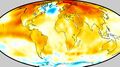
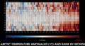
2023
Earth Science Research from Space

SJS / GreenPolicy360 Siterunner:
Planetary Awareness
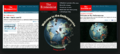
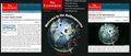
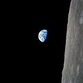
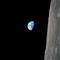
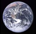
Beginning in December 1968 with Earthrise and continuing thru 1972 with the Apollo mission's last human-taken Whole Earth image, humanity's vision of our place in the universe as 'voyagers' in space has begun to shift our common understandings of who we are.
We are beginning to realize we are fellow travelers on Spaceship Earth, our Home Planet, and together we are reshaping the future of life on Earth, for good and bad. In many ways, we now facing existential questions that require 'new ways of seeing'. The Environmental movement is @ work today to improve our quality of life and to create a healthy, sustainable future for generations to come. Earth Observations are key to understanding our planet's changing, living systems, earth science and acting with wisdom as "Planet Citizens".
Explore Earth Right Now and follow Earth Science Research from Space...
GreenPolicy360 is envisioning New Definitions of National Security and, as Planet Citizens within a global green movement, we are communicating in a new era of information technology capable of reaching and engaging nearly all on Earth.
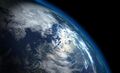
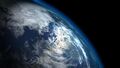
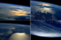
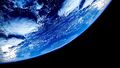
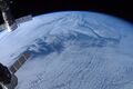
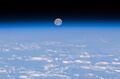
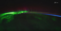
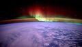
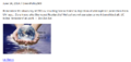
Look at how thin our atmosphere is

Protect & Secure "Thin Blue"
Ron Merkord / Caltech:
January 2021
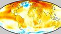
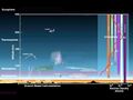
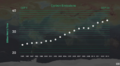
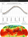
If you were to look at our planet with infrared eyes, rather than in the visible spectrum that we're used to, you'd see a darkening layer covering the planet, as the carbon dioxide levels in our atmosphere reach 50% higher than they should be.
It's kind of like putting ink in a pool. It doesn't take much to turn the whole pool dark. Our CO2 emissions from our burning of fossil fuels is turning our atmosphere dark to infrared light, causing the greenhouse effect that is warming our planet, and melting the ice.
🌎
British Met Office, recalling the beginning of the 'industrial revolution' and British history
In 2021, carbon dioxide in the atmosphere will reach levels 50% higher than before the industrial revolution, due to human-caused emissions, says a Met Office forecast.
○ ○ ○ ○ ○ ○ ○ ○ ○ ○ ○ ○ ○ ○ ○ ○
Planet Earth / Big Picture News
- • EarthPOV


NASA
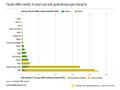
Above the Oil/Gas Producing Middle East

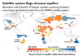
Climate crisis: Satellites to monitor air pollution
(May 2019) Air pollution monitoring revolutionised with the launch of a new satellite system
Tracking damaging greenhouse gas emissions coming from every large power station in the world in real time
• https://finance.yahoo.com/news/climate-crisis-satellites-monitor-air-155129758.html
“Emerging AI remote sensing techniques (intend) to hold every powerful polluter worldwide accountable ... better data ... puts most companies, governments, and environmentalists on the same side ... responsible, forward-thinking groups have started using advanced data to voluntarily slash emissions....”
The system promises far greater accuracy and detailed emissions data for each power station, effectively reducing barriers to insight into the impacts of power generation, ensure accurate emissions data and bring new opportunities to hold companies to account.
The satellite network will observe the power plants from space, while AI technology will use the image processing algorithms to detect signs of power plant emissions.
- ··············································································
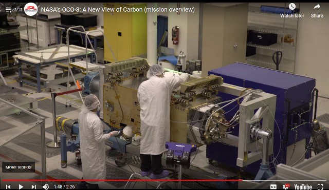
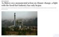
OCO-3 News Coverage Should Have Been of a Globally Important Event
OCO-3 arrives at the International Space Station to begin its earth science-space mission. There's little to find in Media coverage on its real-world importance whether on Google News, Bing Search, Yahoo, Duck Duck Go, pick your international news sources...
Yet, in fact and substance, the science of OCO-3 is critically important. Earth Science. Measuring CO2. JPL-Caltech/NASA, scientific inquiry at its best. Essential data and baseline information critical for informed policy and decision-making (yet President Donald Trump tried to kill the launch of OCO-3 and related US FY2018 missions to measure and monitor CO2).
A global security story... National security... Existential threats ...
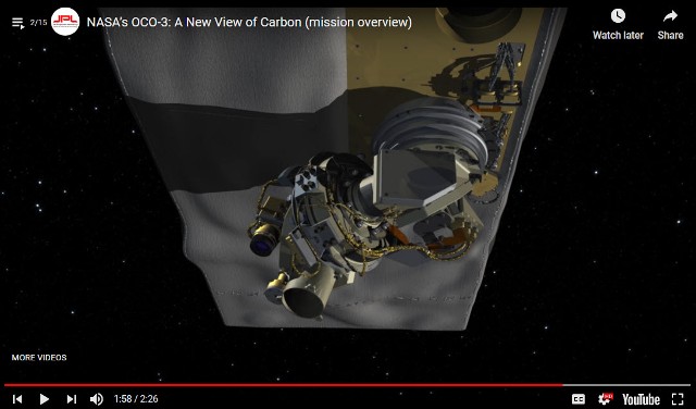
OCO-3 Arrives at the International Space Station
(Interview at JPL courtesy of the LA Times)
OCO-3 was built at the Jet Propulsion Laboratory in La Cañada Flintridge for less than $100 million, using parts left over from its predecessor, OCO-2. Once the carbon observatory gets to the ISS, a robotic arm will mount it on the underside of the space station so it can keep a close eye on the carbon dioxide in Earth’s atmosphere.
That will help scientists answer questions about how and why levels of the greenhouse gas fluctuate over days, months and years.
“Our goal is to get really good data so we can make informed decisions about how to manage carbon and carbon emissions in the future,” said Annmarie Eldering, the mission’s project scientist at JPL.
Carbon dioxide makes up a tiny fraction of the molecules in our atmosphere — roughly 400 parts per million. But seemingly small changes in the amount of carbon dioxide in the atmosphere have an outsized effect on the planet’s temperature.
“Carbon is really effective at trapping heat,” Eldering said. “Even changing the ratio from 300 parts per million to 400 parts per million makes a big difference.”
OCO-3 is so sensitive that it can detect changes as small as 1 part per million. So if CO2 levels go from 406 ppm one day to 407 ppm the next, the space-based observatory will record the increase.
- ···················································································
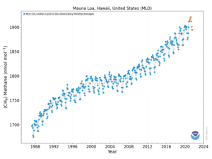
- Detecting methane from space
- "There has been quite a buzz around this unique advancement in space, and the valuable data it will provide on methane, a powerful greenhouse gas that accounts for a quarter of the warming our planet is experiencing today. Curbing anthropogenic methane emissions is one of the most efficient and economical options available to slow the rate of warming over the next few decades, while efforts continue to reduce CO2 emissions worldwide."
- The Environmental Defense Fund (EDF) is planning to be the first environmental group to send its own satellite into space.
- “We need good solid data so that we really can support global action on climate change, and we’ve got to do it fast,” says Steven Hamburg, the EDF’s chief scientist.
- The most detailed measurements currently available of atmospheric methane concentrations currently come from a sensor aboard the European Space Agency’s Sentinel-5P spacecraft, which launched in October 2017. The Tropospheric Monitoring Instrument provides global coverage at a resolution of nearly 50 square kilometres, but those measurements do not capture the dispersed sources of emissions from oil and gas fields.
- Commercial firms have developed high-resolution sensors that can be placed aboard 10-centimetre-sided CubeSats to measure emissions from individual wells or other facilities. Those data are proprietary, however, and the measurements cannot be scaled up to the level of an entire oil and gas field.
- The Environmental Defense Fund team is designing MethaneSAT to provide more-precise measurements, at a resolution of 1 square kilometre, with global coverage at least once a week.

- ······················································································
- On the 50th anniversary of the Apollo 8 launch
• https://www.greenpolicy360.net/w/File:Apollo.jpg
• http://www.bbc.com/future/story/20181220-the-nasa-mission-that-broadcast-to-a-billion-people
• https://qz.com/1501935/photos-apollo-8-brought-us-the-moon-as-never-seen-before/amp/
• https://petapixel.com/2018/12/20/how-nasas-iconic-earthrise-photo-was-shot/
🌎
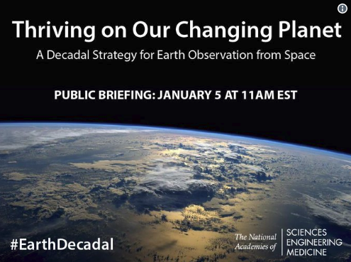
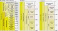
New Earth Science Decadel Survey Released
Thriving on Our Changing Planet (PDF)
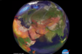
First Full Disk Image from GOES-17 / Click for Whole Earth View

"Vital Signs": Monitoring the Earth's Life Enabling Systems
Looking Back as We Turn from 2017 to a New Year
"This year has been an unequivocal disaster for the future of the planet. President Donald Trump has managed to take a wrecking ball to years' worth of hard work and painstaking negotiations. If not undone, our retreat from the Paris Climate Accords and the EPA's Clean Power Plan alone mean our planet's temperature will rise at a greater rate and our citizen's health will degrade. Other changes in environmental regulations on drilling and auto and appliance efficiency will only make matters worse."
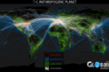
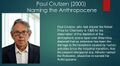
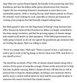
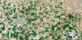
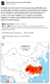
Perhaps the thing that worries me the most is the massive deforestation underway in areas like Asia and Latin America. Countless trees and millions of square miles of jungle and forest have been removed to accommodate our desires for more -- more wood, more farmland, more pasture, more meat.
When I first looked down upon the Amazon rainforest in 2001, I saw vast areas of jungle and a wide and winding copper colored river that went on and on and on. A river that was impossible to miss and like no other on the planet. By 2011, however, the part that was most noticeable wasn't the river or the jungle but the large swaths of empty land.
From space, it looks empty because we are far away. We don't see the crops or the cattle but we do see the loss. We see the loss of an incredibly diverse ecosystem that once held endless possibilities for new medicines and other discoveries.
We see the loss of a home for so many species that will now have to learn to adapt and survive somewhere else -- or not. And we see the loss of a large amount of carbon, sequestered in a living and breathing ecosystem which created massive amounts of oxygen for all of us.
That carbon, once the giver of life to millions of species all over our planet, now has a new role: greenhouse gas. It will sit in our atmosphere as CO and CO2 for millennia, but in this case as an invisible blanket, warming our planet, changing our climate and creating a cataclysmic mess for future generations.
-- By Mark Kelly / Updated 4:20 PM ET, Wed December 27, 2017
························································································


How Satellite Imagery Is Transforming Earth Science, Regional, National & Global Security
"Planetary Health": New methods, new analytical approaches to data collected from earth-facing observation platforms
“High-resolution earth imagery sources, beyond historic US/NASA/NOAA/ESA research from space, represent rich new troves of information...” says David Johnston of Duke University’s Nicholas School of the Environment. Johnson and his co-authors embrace satellite imagery “as a legitimate data source that can supplement and even supplant traditional methods.”
The rapidly growing abundance and sophistication of satellite imagery and remote sensing data is about to change (the scientific fields of earth science)... thanks to a profusion of startup companies, including Planet, DigitalGlobe, Skybox Imaging (later purchased by Google and renamed Terra Bella), Urthecast, and LAND INFO Worldwide Mapping.
New Space | Planet API |
Democratization of Space
NASA Challenges the Public to Join In
GreenPolicy360 / Virtual Earth Mapping
The technology will prove useful for monitoring commitments made by nations under REDD (the program to reduce emissions from deforestation and forest degradation) as well as under the Paris climate accord and the Convention on Biological Diversity...
• https://www.greenpolicy360.net/w/Category:INDC
• https://www.greenpolicy360.net/w/Category:Environmental_Security
○ ○ ○ ○ ○ ○ ○ ○ ○ ○ ○ ○ ○ ○ ○ ○ ○
Rising Threats to National and Global Security
US Retreats from Global Stage, Moves Backwards Under Current White House
The 'Trump Doctrine', a Legacy in the Making
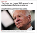
Time to Act as the US President says No to the Global Community and No to the International Climate Agreement

Better Climate Observation Needed
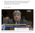
Former NOAA Chief Scientist Warns of Threats to Science
Scientists Fear Climate Data Gap as Trump Aims at Satellites
18 NASA Earth Science Missions in Space

2017 / Updates
Via Scientific American
Ageing Satellites Put Crucial Sea Ice Climate Record at Risk
Track Earth Science Missions, the Politics of Earth Science from Space, and Global/National Security
US Politics and Earth Science Research from Space
Trump Administration Budget Undercuts "Earth Science" at NASA
- Vital Security Programs Cut / OCO-3 Mission to Study CO2 in Atmosphere Eliminated
The proposed NASA budget targets the agency’s work on environmental science, cutting funding for Earth science research grants. The cuts would go further by eliminating several missions that are in development, including PACE (Plankton, Aerosol, Cloud, ocean Ecosystem), which is intended to monitor and provide baseline data of the Earth’s ocean and their health; the Orbiting Carbon Observatory 3, or OCO-3, an instrument to precisely monitor the carbon dioxide in our atmosphere, continuing the unique work of OCO-2; and the Climate Absolute Radiance and Refractivity Observatory, or CLARREO, pathfinder, which is to use a solar spectrometer to produce highly accurate climate projections.
Protecting "The Commons", the "Thin Blue Layer", the Global Atmosphere
Look at how thin our atmosphere is...
Baseline Data and the Damage of Interruptions in Baseline Data
- ○ ○ ○ ○ ○ ○ ○ ○ ○ ○ ○ ○ ○ ○ ○ ○ ○
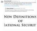
New Definitions of National Security
"New Definitions of National Security"
- A Project of GreenPolicy360 and Strategic Demands

○ ○ ○ ○ ○ ○ ○ ○ ○ ○ ○ ○ ○ ○ ○ ○ ○ ○
Space 'Macroscope', Earth Science
Yale Environment 360 / by Richard Conniff / June 2017
Google, Earth Observations, Earth Science
○ ○ ○ ○ ○ ○ ○ ○ ○ ○ ○ ○ ○ ○ ○ ○ ○ ○ ○ ○ ○ ○ ○ ○
*The Critical Importance of "EarthScience360" from Space
GreenPolicy360: The election of Donald Trump as US president delivers immediate crisis and a turning point. The president-elect's statements that climate change is a 'hoax' and environmental policies and programs, including NASA 'Earth Sciences', are impediments that need to be ended now assures tumult and a new level of threat to national and global security. Announced administration appointees, as of November 2016, and recent Congressional threats to deeply cut environmental protection and NASA 'Earth Science' budgets are warning signs of coming showdowns over the direction of the nation and the nation's priorities.
NASA scientists responsible for vital programs have been reluctant to speak publicly since the election but one anonymous NASA scientist is among the first to write online about the value of earth science research from space.
Anon: "We are the largest combined organization of scientists and engineers in the world dedicated to space-based observations of Earth, the Solar System, and the Universe. A huge part of our mission is to design and fabricate Earth-viewing satellites that track long-term changes in topography and climate. These satellites ensure that we have the most complete set of data available to not only predict how humanity's impacts will affect the Earth, but also understand how we can prepare and protect those most vulnerable to climate change and rising sea levels. As an example of our impact on the daily lives of people around the world, one of the satellites I previously worked on, Global Precipitation Measurement, is currently in Earth orbit tracking extreme weather events. Its data allows meteorologists to improve their forecasts of where hurricanes will strike and how intense they will be, as well as to identify the areas that are most prone to floods and landslides, so that we can give advanced warnings to those affected. This is just one of dozens of major Earth-observing satellites that NASA manages everyday.
"Today, we were shocked to hear of Trump's plan to scrap NASA's climate change research as part of a crack down on "politicized science". Among the scientific community, climate change is no more "politicized science" than the theory of gravity is. While his crackdown would mean that thousands of scientists and engineers at NASA Goddard would lose their livelihoods, it represents an even greater loss for the world. Without data continuity in our Earth observations, we will be blind to the ravages of climate change: to the deluges and droughts that might devastate crops, to the extreme weather events that destroy communities as the Earth continues to warm. We will not be able to develop the solutions that can prevent Earth's temperatures from rising to catastrophic levels. I urge you to implore your Congressional Representatives to not allow Trump's plan to happen. We cannot sit on the sidelines over the next four years: our future on this planet is at stake."
Follow the Action (of anti-science forces) as the US Congress Looks to Block Earth Science

Under Trump, Will NASA’s Space Science Include Planet Earth?
- -- By Andrew C. Revkin / November 28, 2016 / Dot Earth

December 14, 2016
Speaking directly to threats to the value of earth science and earth science research from space, Governor Brown addressed the American Geophysical Union (AGU) Fall Meeting in California. The AGU annual gathering is the largest Earth and space science meeting in the world.
The AGU is an international scientific society that describes itself as "dedicated to promoting discovery in Earth and space science for the benefit of humanity."
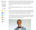
Jerry Brown:
"We got the scientists. We got the lawyers. And we're ready to fight. We're ready to defend. And California is no stranger to this fight...
"California is the future. We are pioneering space...
"Now some people say they're going to turn off the satellites that are monitoring the climate... low-earth phenomena, the LANDSAT and all the various measuring satellites that we have...
"Well, I remember back in 1978 I proposed a LANDSAT satellite for California. They called me 'Governor Moonbeam' because of that. I didn't get that moniker for nothing.
"And if Trump turns off the satellites, California will launch its own (d-mn) satellites!"
○ ○ ○ ○ ○ ○ ○ ○ ○ ○ ○ ○ ○ ○ ○ ○ ○ ○
Satellites Launched to Monitor Planet Change
- NASA Earth Science Missions - https://eospso.gsfc.nasa.gov/current-missions

- ○ ○ ○ ○ ○ ○ ○ ○ ○ ○ ○ ○ ○
Earth Science, Ocean Science
- Studying Sea-Level Rise from Space
- Jason-3 Successfully Launched into Orbit --- Follow Jason Online
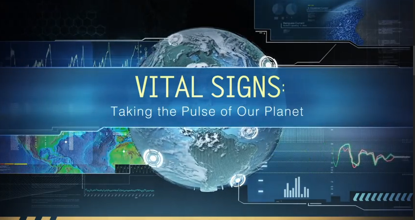
- Vital Signs


I am OCO-2 -- 'Reporting Home'
Visit the Orbiting Carbon Observatory
Climate deniers blame global warming on nature. NASA data begs to differ

Visit NASA's Earth Science News
"Vital Signs of the Planet"
Critical Missions to Monitor Earth's Systems from Space -- http://climate.nasa.gov/
- https://www.greenpolicy360.net/w/Climate_News | Climate News
- https://www.greenpolicy360.net/w/Category:Earth_Observations | Earth Observations
- https://www.greenpolicy360.net/w/Category:Environmental_Security | Environmental Security
- Democratization of Space | https://www.greenpolicy360.net/w/Democratization_of_Space
- Earth Imaging-New Space | https://www.greenpolicy360.net/w/Earth_Imaging-New_Space
- Earth Right Now | https://www.greenpolicy360.net/w/Earth_Right_Now
Earth Science Research from Space
- Earth Science Vital Signs | https://www.greenpolicy360.net/w/Earth_Science_Vital_Signs
- Landsat Data Users Handbook | https://www.greenpolicy360.net/w/Landsat_data_users_handbook
- Micro-satellites | https://www.greenpolicy360.net/w/Micro-satellites
"New Definitions of National Security"
- New Space | https://www.greenpolicy360.net/w/New_Space
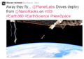
- Planet Labs Doves Fly | https://www.greenpolicy360.net/w/Planet_Labs_Doves_Fly
- Thin Blue Layer | http://www.thinbluelayer.com
- Earth Observations - https://www.greenpolicy360.net/w/Category:Earth_Observations
- Earth Science - https://www.greenpolicy360.net/w/Category:Earth_Science
- Climate Change - https://www.greenpolicy360.net/w/Category:Climate_Change
- Global Security - https://www.greenpolicy360.net/w/Category:Global_Security

|
|
- ○ ○ ○ ○ ○ ○ ○ ○ ○ ○ ○ ○ ○
NASA/NOAA Earth Observing Satellite Updates
How satellites are used to monitor climate change
Satellites in operation (2016) that are adding to scientists’ understanding of climate change
https://www.carbonbrief.org/interactive-satellites-used-monitor-climate-change

○ ○ ○ ○ ○ ○ ○ ○ ○ ○ ○ ○ ○ ○ ○ ○
Jason-3 Mission -- Jason-3 -- Launched Jan 17, 2016
Ocean circulation patterns, global and regional changes in sea level, and climate implications of a warming world
○ ○ ○ ○ ○ ○ ○ ○ ○ ○ ○ ○ ○ ○ ○ ○
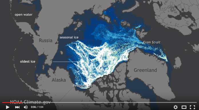
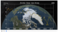
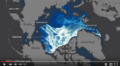
"Watch 25 years of Arctic Sea Ice disappear"
○ ○ ○ ○ ○ ○ ○ ○ ○ ○
https://www.pinterest.com/stratdem/
https://strategicdemands.com/another-view-of-thin-blue/

○ ○ ○ ○ ○ ○ ○ ○ ○ ○ ○ ○ ○ ○ ○ ○ ○ ○
https://www.greenpolicy360.net/w/New_Definitions_of_National_Security
https://www.greenpolicy360.net/w/Category:Environmental_Security
○
Latest from the Atmospheric Science Data Center (ASDC) at NASA Langley Research Center
NASA Earth science data in the areas of radiation budget, clouds, aerosols, and tropospheric chemistry
https://eosweb.larc.nasa.gov/ --- https://eosweb.larc.nasa.gov/projects-supported
April 2015
A Successful Era in Climate Science
Calipso - Ten Years in Space (and Flying with the 'A-Train')
Since its launch in 2006, CALIPSO has orbited the Earth tirelessly, using its lasers to take more than 5.7 billion lidar (light detection and ranging) measurements probing the vertical structure and properties of clouds and other particles — such as dust, sea salt, ash and soot — in the air.
For atmospheric scientists, the ability to regularly and accurately examine clouds and particles at different heights was something new. Gathering that data over such a long time period has contributed to a scientific bonanza.
Also, scientists are able to combine CALIPSO’s measurements with those of other Earth-observing satellites circling the globe in a cooperative path called the A-Train constellation. CALIPSO and CloudSat, a satellite containing a cloud-profiling radar, launched together on a Delta II rocket, now fly in formation with satellites named Aqua, Aura, Global Change Observation Mission-Water (GCOM-W) and Orbiting Carbon Observatory (OCO)-2.
Combining measurements from these A-Train satellites offers a clearer view of what’s happening in the atmosphere.
“CALIPSO, in complement with the other instruments flying in the A-Train, has provided observations in areas that had never been observed before,” said Pierre Tabary, program manager for atmosphere, meteorology and climate for CNES, the French space agency.
He said scientists have gained knowledge about clouds, and their impact on incoming solar radiation, as well as on infrared radiation coming from the Earth’s surface, known as the greenhouse effect.
“There were no other instruments providing such observations before,” Tabary said. “All those data have been used to improve our understanding of how climate works.”
More than 1,600 scientific and technical reports and published research papers have used CALIPSO data. The data are widely cited in reports from the Intergovernmental Panel on Climate Change", Tabary said, "a clear demonstration of what CALIPSO has brought to climate science."
Read More about the 'A-Train'
A convoy of "A-Train" satellites has emerged as one of the most powerful tools scientists have for understanding our planet's changing climate...
https://www.nasa.gov/mission_pages/a-train/a-train.html
https://www.nasa.gov/content/a-train
○
From Above We See Our Planet High Definition Video, from NASA
March 2015
One of the many critical NASA earth science missions from space reports:
https://www.nature.com/ngeo/journal/vaop/ncurrent/full/ngeo2388.html
https://www.ig.utexas.edu/research/projects/icecap/
https://www.nasa.gov/mission_pages/icebridge/
○
Sneak Peek at the DSCOVR Mission: Earth pix daily from a million miles
- DSCOVR is launched and on its way!
February 12, 2015 The DSCOVR satellite with its EPIC cam, PlasMag & NISTAR instrument package is on the way... a million mile journey, scheduled to light up, be tested and begin delivering data to Earth in August, including near-real-time imaging of Earth provided online – We will be delivering a stream of amazing imagery of our planet as NASA/NOAA begin uploading EPICs pictures of us!
○
It's been some time since December 7, 1972 when the only picture ever snapped by a human of the whole earth was captured -- our iconic "Blue Marble" -- Engineers that they are, NASA named the image -- AS17-148-22727
As we have been recalling the history, we haven't had returned to us a 'whole earth' image since 1972. Today, Feb 10, the Associated Press reports Sen. Bill Nelson, D-Florida, pointing out from Washington that there hasn't been a full, sunlit picture of the Earth since Apollo 17 in 1972 - NASA's last manned moon-landing mission. Subsequent images have been stitched together, the Senator explained, for composite shots. The Senator has an exceptional point of view as he was an astronaut -- In January 1986, Nelson spent six days orbiting Earth as a payload specialist aboard space shuttle Columbia. His NASA bio adds "The experience gave him a new perspective on the Earth’s fragile environment and a greater appreciation of the importance of our nation’s space exploration program."
The DSCOVR satellite launches into deep orbit with multiple missions -- to monitor space weather and, due to the satellite's orbital distance from Earth (1 mil miles), DSCOVR will be sending back daily images of the 'whole earth' via its EPIC image-taking system and via its NISTAR system measuring earth's earth's temperature, our "radiation balance" ("albedo").
○ ○ ○ ○
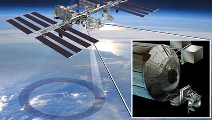
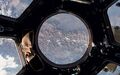
- ISS mission to monitor #planethome
[[
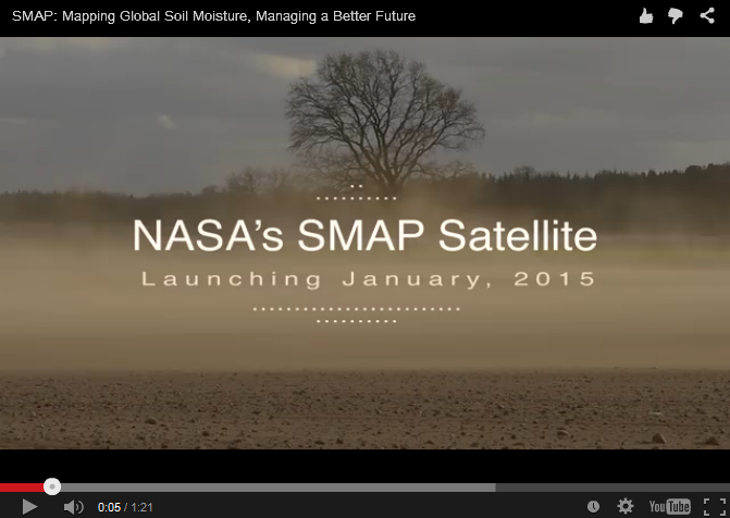
- Time to measure earth soil moisture content -- SMAP
January 2015
Launching Jan 29, 2015 to "measure the moisture in Earth's soils with unprecedented accuracy and resolution.
○ ○ ○ ○
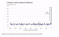
- Existential -- Monitoring "vital signs", scientific observations over time, a baseline of planet Earth
NASA OCO Satellite Sends Back Most Detailed CO2 View Ever
Initial round of CO2 data is released...
First full set of CO2 data made available in March 2015 for scientists and public to download and explore.
More on the history-making OCO-2 / Orbiting Carbon Observatory
According to JPL scientists: "Where OCO-2 really excels is the sheer amount of data being collected within a day, about one million measurements across a narrow swath... For fluorescence, this enables us, for the first time, to look at features on the five- to 10-kilometer scale on a daily basis." SIF can be measured even through moderately thick clouds, so it will be especially useful in understanding regions like the Amazon where cloud cover thwarts most spaceborne observations."
The changes in atmospheric carbon dioxide that OCO-2 seeks to measure are so small that the mission must take unusual precautions to ensure the instrument is free of errors. For that reason, the spacecraft was designed so that it can make an extra maneuver. In addition to gathering a straight line of data like a lawnmower swath, the instrument can point at a single target on the ground for a total of seven minutes as it passes overhead. That requires the spacecraft to turn sideways and make a half cartwheel to keep the target in its sights.
The targets OCO-2 uses are stations in the Total Carbon Column Observing Network (TCCON), a collaborative effort of multiple international institutions. TCCON has been collecting carbon dioxide data for about five years, and its measurements are fully calibrated and extremely accurate. At the same time that OCO-2 targets a TCCON site, a ground-based instrument at the site makes the same measurement. The extent to which the two measurements agree indicates how well calibrated the OCO-2 sensors are.
Additional maps released recently showed the results of these targeting maneuvers over two TCCON sites in California and one in Australia. "Early results are very promising," said Paul Wennberg, a professor at Caltech and head of the TCCON network. "Over the next few months, the team will refine the OCO-2 data, and we anticipate that these comparisons will continue to improve."
More about the OCO-2 mission, making history as it reveals the extent of atmospheric CO2
○ ○ ○ ○
- Tracking ocean currents, 'best-ever data
November 2014
Scientists produce "the most accurate space view yet of global ocean currents and the speed they move..."
https://www.greenpolicy360.net/mw/images/Ocean_currents_from_GOCE_20141125-jpg.jpg
○ ○ ○ ○
New NASA ERA
Sept 08, 2014 - NASA opens a new era in its exploration of our home planet with the launch of the first in a series of Earth science instruments to the International Space Station, Earth-observing instruments to be mounted on the exterior of the #ISS. ISS-RapidScat will monitor ocean winds for climate research, weather predictions and hurricane monitoring. The second instrument is the Cloud-Aerosol Transport System (CATS), a laser instrument that will measure clouds and the location and distribution of pollution, dust, smoke, and other particulates in the atmosphere. Look closer at the array of instruments #RapidScat #EarthRightNow
○ ○ ○ ○ ○ ○ ○ ○ ○ ○ ○ ○ ○ ○ ○ ○ ○ ○ ○ ○ ○ ○ ○ ○
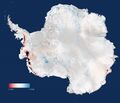
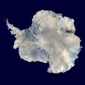
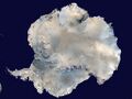
Ice impacts of Climate Change -- Arctic/Antarctic
The Antarctic: Big Melt Accelerates

The Antarctic: Big Melt Accelerates - Cryosat - Greenland
Antarctica's Flowing Ice - Antarctica
○
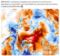
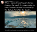
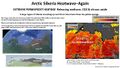
The Arctic Ice Is Melting: Why?
https://pbs.twimg.com/media/C4Lj3gcWIAE6dqF.jpg
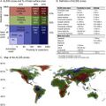
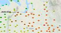
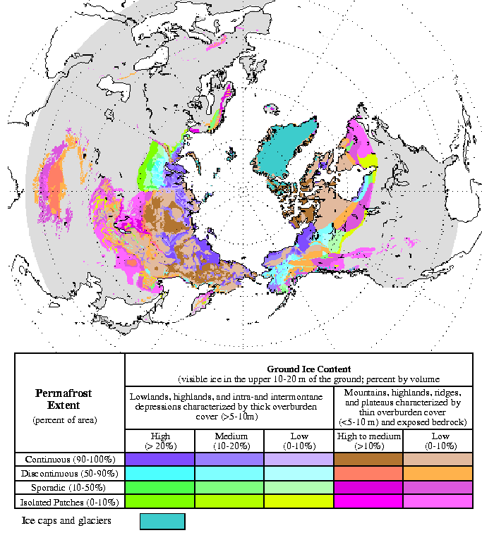
Permafrost Loss, Potential Impacts, Time to Measure
2016
https://nsidc.org/sites/nsidc.org/files/images/cryosphere/fig1.gif
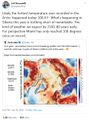
Scientists estimate that five times as much carbon might be stored in frozen Arctic soils — permafrost — as has been emitted by all human activities since 1850. This worries people who study global warming. While emissions from permafrost currently account for less than 1 percent of global methane emissions, some researchers think this could change in dramatic ways as the world warms and that carbon-rich frozen soil breaks down.

The map above, based on data provided by the National Snow and Ice Data Center, shows the extent of Arctic permafrost. Any rock or soil remaining at or below 0 degrees Celsius (32 degrees Fahrenheit) for two or more years is considered permafrost.
Continuous permafrost, which occurs in the coldest areas, refers to areas where frozen soil underlies more than 90 percent of the surface. Discontinuous permafrost occurs in slightly warmer areas, where frozen soils underlie 50 to 90 percent of the surface, while certain features such as rivers and south-facing slopes may be ice-free. In areas with sporadic permafrost, frozen soils underlie 10 to 50 percent of the surface. In areas with isolated permafrost, frozen soils underlie less than 10 percent of the surface, usually only occurring in depressions or north-facing slopes.
https://earthobservatory.nasa.gov/IOTD/view.php?id=87794&eocn=home&eoci=iotd_title
○ ○ ○ ○ ○ ○ ○ ○ ○ ○ ○ ○ ○ ○ ○ ○ ○
November 2015
As Earth Warms, NASA Targets 'Other Half' of Carbon, Climate Equation

Permafrost Threatened
https://www.usgs.gov/newsroom/article.asp?ID=4400
Using statistically modeled maps drawn from satellite data and other sources, U.S. Geological Survey scientists have projected that the near-surface permafrost that presently underlies 38 percent of boreal and arctic Alaska would be reduced by 16 to 24 percent by the end of the 21st century under widely accepted climate scenarios. Permafrost declines are more likely in central Alaska than northern Alaska.
Northern latitude tundra and boreal forests are experiencing an accelerated warming trend that is greater than in other parts of the world. This warming trend degrades permafrost, defined as ground that stays below freezing for at least two consecutive years. Some of the adverse impacts of melting permafrost are changing pathways of ground and surface water, interruptions of regional transportation, and the release to the atmosphere of previously stored carbon.
“A warming climate is affecting the Arctic in the most complex ways,” said Virginia Burkett, USGS Associate Director for Climate and Land Use Change. “Understanding the current distribution of permafrost and estimating where it is likely to disappear are key factors in predicting the future responses of northern ecosystems to climate change.”
○ ○ ○ ○ ○ ○ ○ ○ ○ ○ ○ ○ ○ ○
https://en.wikipedia.org/wiki/Tundra
A severe threat to tundra is global warming, which causes permafrost to melt. The melting of the permafrost in a given area on human time scales (decades or centuries) could radically change which species can survive there.
Another concern is that about one third of the world's soil-bound carbon is in taiga and tundra areas. When the permafrost melts, it releases carbon in the form of carbon dioxide and methane, both of which are greenhouse gases. The effect has been observed in Alaska. In the 1970s the tundra was a carbon sink, but today, it is a carbon source. Methane is produced when vegetation decays in lakes and wetlands.
The amount of greenhouse gases which will be released under projected scenarios for global warming have not been reliably quantified by scientific studies, although a few studies were reported to be underway in 2011. It is uncertain whether the impact of increased greenhouse gases from this source will be minimal or massive.
https://en.wikipedia.org/wiki/Methanogenesis -- https://en.wikipedia.org/wiki/Greenhouse_gas
○ ○ ○ ○ ○ ○ ○ ○ ○ ○ ○ ○ ○ ○ ○
A self-reinforcing positive feedback loop is akin to a "vicious circle": It accelerates the impacts of anthropogenic climate disruption (ACD). An example would be methane releases in the Arctic. Massive amounts of methane are currently locked in the permafrost, which is now melting rapidly. As the permafrost melts, methane - a greenhouse gas 100 times more potent than carbon dioxide on a short timescale - is released into the atmosphere, warming it further, which in turn causes more permafrost to melt, and so on...
○ ○ ○ ○ ○ ○ ○ ○ ○ ○ ○ ○ ○ ○ ○ ○ ○
Predicted rate of temperature change in Arctic
Arctic temperatures are expected to increase at roughly twice the global rate. The Intergovernmental Panel on Climate Change (IPCC) will in their fifth report establish scenarios for the future, where the temperature in the Arctic will rise between 1.5 and 2.5°C by 2040 and with 2 to 7.5°C by 2100. Estimates vary on how many tons of greenhouse gases are emitted from thawed permafrost soils. One estimate suggests that 110-231 billion tons of CO2 equivalents (about half from carbon dioxide and the other half from methane) will be emitted by 2040, and 850-1400 billion tons by 2100. This corresponds to an average annual emission rate of 4-8 billion tons of CO2 equivalents in the period 2011-2040 and annually 10-16 billion tons of CO2 equivalents in the period 2011-2100 as a result of thawing permafrost. For comparison, the anthropogenic emission of all greenhouse gases in 2010 is approximately 48 billion tons of CO2 equivalents. Release of greenhouse gases from thawed permafrost to the atmosphere may increase global warming.
https://en.wikipedia.org/wiki/Permafrost#Carbon_cycle_in_permafrost
○ ○ ○ ○ ○ ○ ○ ○ ○ ○ ○ ○ ○ ○ ○ ○ ○ ○
Additional References re: Permafrost Science
Oct 2015 / Via Berkeley Lab -- A Simpler Way to Estimate the Feedback Between Permafrost Carbon and Climate
Simplified, data-constrained approach to estimate the permafrost carbon–climate feedback
Via University of Cambridge -- Analysis of the effects of melting permafrost in the Arctic points to $43 trillion in extra economic damage by the end of the next century, on top of the more than the $300 trillion economic damage already predicted
Alaska's Stirring Permafrost -- https://landsat.gsfc.nasa.gov/pdf_archive/cape_halkett_4web.pdf
○
○
Much Ado About Methane (2012 / RealClimate.org ... methane-climate background and projections)
https://www.realclimate.org/index.php/archives/2012/01/much-ado-about-methane/
··································
Watching the Ice Melt
Doubling-of-antarctic-ice-loss-revealed-by-european-satellite
Melting / New assessments of impacts of global warming come from Europe's Cryosat spacecraft.
The CryoSat is part of the Living Planet Programme [1] / [2] [3] / [4] of the European Space Agency / ESA
Cooperative earth monitoring science between US-Europe ...
More data re ice melt-GRACE/US-NASA / [5] GRACE
··································································
Earth Observing System satellites -- ESA Earth monitoring from Space
Earth-observing satellites for earth system monitoring include:
The European Space Agency (ESA) "Living Planet Programme" managed by Earth Observation Programmes - [6]
- GOCE – Gravity Field and Steady-State Ocean Circulation Explorer - launched on March 17, 2009 - [7]
- SMOS – Soil Moisture and Ocean Salinity satellite - studying ocean salinity and soil moisture; launched in 2 November 2009 - [8]
- CryoSat is designed to map the Earth's ice cover. CryoSat-1 was lost in 2005. CryoSat-2 was launched 8 April 2010 - [9]
- Swarm – is a trio of satellites to map the Earth's magnetism. The SWARM constellation was launched successfully on 22 November 2013 - [10]
- Aeolus – Atmospheric Dynamics Mission will use an innovative laser to measure winds. Due for launch in 2015 - [11]
- EarthCARE – Earth Clouds Aerosols and Radiation Explorer will examine the formation and effects of clouds. Due for launch in 2016 - [12]
- BIOMASS is designed to calculate the amount of carbon stored in the world's forests, and to monitor for any changes over the course of its five-year mission. Due to launch in 2020 - [13]
··································································
The European Space Agency's mission:
To benefit citizens "asking for a better quality of life on earth... for greater security and economic wealth... to pursue dreams, to increase knowledge... for younger people to be attracted to the pursuit of science and technology... ESA's purpose shall be to provide for, and to promote, for exclusively peaceful purposes, cooperation in space research and technology and space applications, with a view to their being used for scientific purposes..."
··································································
New Space, "democratization of space", start-up ventures, #EarthScience #MicroSats #OpenSource Data
○ ○ ○ ○ ○ ○ ○ ○ ○ ○ ○ ○ ○ ○ ○ ○ ○ ○

- ○ ○ ○ ○ ○ ○ ○ ○ ○ ○ ○ ○ ○ ○ ○ ○ ○ ○ ○ ○ ○ ○ ○ ○ ○
"It's All Connected": Small to Large"
- The Oceans, 70% of the Earth's Surface

Ocean Food Chain -- Ocean Ecosystems / #OceanScience
Phytoplankton... Diatoms... Oxygen Creators, CO2 Digesters... Zooplankton, Food-of-the-Seas


Plankton Swirl -- Climate Dance

Phytoplankton Oxygen Factories in the Southern Ocean

NASA Earth Observatory
Phytoplankton are essential ecosystems of the seas. They are floating, drifting, plant-like organisms that harness the energy of the Sun, mix it with carbon dioxide that they take up from the atmosphere, and turn it into carbohydrates and oxygen.
Scientific estimates speak of approximately half the oxygen in the Earth's atmosphere being the result of plankton photosynthesis and phytoplankton are critical to the marine food web, being the primary producers of food in the oceans, from phytoplankton to zooplankton to fish and shellfish to whales.
Like plants and trees on land, "phytoplankton give us a lot more than food". Whether the current science estimates that 50 or 80 percent of the oxygen in our atmosphere has been produced by phytoplankton, the health of the blue-green ocean life is essential for sustainable ocean ecosystems.
The tiniest of living organisms exert an outsized influence on the planet.
○ ○ ○ ○ ○ ○ ○ ○ ○ ○ ○ ○ ○ ○ ○ ○ ○ ○
Phytoplankton rapidly disappearing
Loss of mini marine plants at base of food web threatens sea’s ecology
A rapid loss of phytoplankton threatens to turn the western Indian Ocean into an “ecological desert,” a new study warns. The research reveals that phytoplankton populations in the region fell an alarming 30 percent over the last 16 years.
A decline in ocean mixing due to warming surface waters is to blame for that phytoplankton plummet, researchers propose online January 19 in Geophysical Research Letters. The mixing of the ocean’s layers ferries phytoplankton nutrients from the ocean’s dark depths up into the sunlit layers that the mini plants inhabit.
The loss of these microbes, which form the foundation of the ocean food web, may undermine the region’s ecosystem, warns study coauthor Raghu Murtugudde, an oceanographer at the University of Maryland in College Park.
“If you reduce the bottom of the food chain, it’s going to cascade...”
Blue-Green in the Oceans & Connection to Life on Earth
- "A single kind of blue-green algae in the ocean produces the oxygen in one of every five breaths we take"
- ~ from "The World Is Blue: How Our Fate and the Ocean’s Are One" by Sylvia Earle / National Geographic
- ○ ○ ○ ○ ○ ○ ○ ○ ○ ○ ○ ○
- New Ways of Seeing Our World

- Earth Observations... Observe!

○
Subcategories
This category has the following 13 subcategories, out of 13 total.
A
E
F
G
N
P
S
W
Pages in category "Earth Observations"
The following 167 pages are in this category, out of 167 total.
3
A
C
- C40 Cities Climate Leadership Group
- Carbon Brief
- Citizen Science
- Clearcutting
- Climate Change - Global Warming Keyword-Terms
- Climate Change Denier Talking Points -- and Rebuttals
- Climate Change Summit Paris
- Climate Conference - Paris 2015
- Climate Desk
- Climate Law Blog @Columbia Law School
- Climate migration
- Climate News
- Climate News Events Archive ... 1970 to Today
- Climate Plans Enforcement - Resources
- Climate Problems, Climate Solutions
- Copernicus EU
- Creatively Green
D
E
- Each of us can make a positive difference
- Earth
- Earth and Space, Politics
- Earth Day 2020
- Earth Day Memories on the 50th Anniversary
- Earth Day Summit - April 22 2021
- Earth from NASA
- Earth Imaging-New Space
- Earth Observation Portal
- Earth Right Now
- Earth Science
- Earth Science Eco-Fields
- Earth Science Research from Space
- Earth Science Vital Signs
- EarthPOV
- Earthrise
- EarthTime
- Earthviews
- Earthviews from Astronauts
- Eco-nomics
- Ecolivia
- Environmental full-cost accounting
- Environmental Rules Rolled Back
- Environmental Security Organizations
- EOS eco Operating System
- ESA Living Planet Announcement - May 2022
- Ethics and Climate Change
- European Union Green Deal - Fit for 55
- Extinction
- ExxonMobil and US House Science Committee v US Attorneys General and Environmental Groups
G
- Generation Green
- Geoengineering
- George E. Brown Jr
- Glasgow Climate Summit - Pledges, Promises, Declarations - What's Next Up
- Global Citizen
- Global Climate Action Summit
- Global Fishing Watch
- Global Forest Watch
- Global Risks Report
- Going Green: Texas v. Pennsylvania
- Google Earth
- Google Earth Timelapse
- GP360 NewPages
- Green Bank in Maryland - and More
- Green Quotes
- Green Stories of the Day
- Green Stories of the Day - GreenPolicy360 Archive
- Greening Our Blue Planet
- GreenPolicy360 Archive Highlights 2013
- GreenPolicy360 Archive Highlights 2014
- GreenPolicy360 Archive Highlights 2015
- GreenPolicy360 Archive Highlights 2016
- GreenPolicy360 Archive Highlights 2017
- GreenPolicy360 Archive Highlights 2018
- GreenPolicy360 Archive Highlights 2019
- GreenPolicy360 Archive Highlights 2020
- GreenPolicy360 Archive Highlights 2023
- GreenPolicy360 Highlights
- Ground Truth
I
L
N
O
P
- Pale blue dot
- Paris climate change conference, Dec12, 2015 report from Rebecca Solnit
- PeoplesClimateMarch
- Permaculture Green Practices
- Permafrost
- Pictures from ISS
- Planet API
- Planet Citizen Action
- Planet Citizen Vision of Living Earth
- Planet Citizens
- Planet Citizens, Planet Scientists
- Planet Labs Doves Fly
- Planet of the Humans, a documentary film
- Planetary.org
- PlanetCitizen
S
T
U
W
Media in category "Earth Observations"
The following 200 files are in this category, out of 1,342 total.
(previous page) (next page) 'Most beautiful from space' the Bahamas by Scott Kelly Apr 26, 2015.png 800 × 511; 767 KB
 'Thin Blue Layer' of Earth's Atmosphere 2.jpg 800 × 486; 46 KB
 'Thin Blue Layer' of Earth's Atmosphere l.jpg 853 × 486; 46 KB
 'Thin Blue Layer' of Earth's Atmosphere xl.jpg 1,152 × 648; 79 KB
 -HelloEarth.png 579 × 381; 0 bytes
 03-Scott-Kelly-NASA.jpg 800 × 500; 113 KB
 1977 from the Office of Science and Technology Policy.jpg 661 × 711; 177 KB
 2001 pic3.jpeg 800 × 450; 65 KB
 2015 Hottest year a.pdf ; 316 KB
- 2015 Hottest year b.pdf ; 308 KB
 2015 temp-report s.jpg 399 × 224; 35 KB
 2015 temp-report.jpg 950 × 534; 119 KB
 2020 record temperatures.png 800 × 502; 358 KB
 3-15-2016 10-49-38 AM.png 702 × 862; 396 KB
 3-15-2016 12-29-07 PM.png 538 × 701; 201 KB
 3840 × 2160.jpg 3,840 × 2,160; 1.11 MB
 5 19 14 andrew antarcticaelevationchanges-640x547.jpg 640 × 547; 59 KB
 7-20-2020 GreenPolicy360 RT No.2.jpg 591 × 510; 125 KB
 A Fierce Green Fire.jpg 208 × 314; 13 KB
 A Flash of Green by John D. MacDonald.jpg 400 × 400; 55 KB
 A Planet Citizen View.png 799 × 1,241; 1.64 MB
 A root and its mycorrhizal fungus surroundings.PNG 315 × 382; 236 KB
 A scorching year, what about the 360 warming data.jpg 600 × 706; 106 KB
 A View of the Earth and Moon from Mars.jpg 720 × 890; 3 KB
 A window view.jpg 620 × 412; 22 KB
 About Baselines and Change.png 592 × 312; 33 KB
 About website of The Invading Sea.png 800 × 343; 126 KB
 Above Earth .jpg 2,000 × 1,500; 278 KB
 Above Florida green.jpg 1,091 × 726; 171 KB
 Above.png 500 × 375; 173 KB
 Acceptance on behalf of the United States of America.png 448 × 306; 62 KB
 Act now for a livable future.png 501 × 275; 272 KB
 Acting on Climate Change.png 402 × 139; 109 KB
 Acting to make a positive difference - in St Petersburg Florida.png 600 × 723; 645 KB
 Ag production and GHG emissions.jpg 680 × 510; 33 KB
 Against the Tide - Cover - by Cornelia Dean.jpg 308 × 475; 57 KB
 Air pollution moves globally.png 620 × 412; 256 KB
 Alaska Willow - March 12 2023.png 576 × 230; 99 KB
 Alaska Willow News-March 12 2023.png 576 × 625; 235 KB
 Aldis zone blog.jpg 500 × 498; 67 KB
 Algae release -nikon-small-world-competition-2017-winners.jpg 640 × 576; 89 KB
 All Alone In the Night.png 831 × 426; 275 KB
 All species day with homo sapien in Santa Fe .jpg 640 × 369; 98 KB
 Amazon fires burn across the rainforest.jpg 800 × 504; 76 KB
 Amazon-rainforest (2).jpg 600 × 338; 68 KB
 Amazon-rainforest (3).jpg 300 × 225; 57 KB
 Amazon-rainforest.jpg 814 × 459; 142 KB
 Andrew Wheeler confirmed to head EPA.jpg 753 × 600; 85 KB
 Another year, another record.png 800 × 294; 251 KB
 Antarctica from Blue Marble wiki.jpg 768 × 768; 133 KB
 Antarctica ice shelf-glaciers 2012.png 956 × 714; 805 KB
 Antarctica Larsen B Ice Shelf.png 983 × 575; 1.13 MB
 Antarctica NASA 1024x768.jpg 1,024 × 768; 250 KB
 Antarctica-2018.jpg 768 × 1,024; 82 KB
 Anthro-transport via globaia.org.jpg 800 × 450; 444 KB
 Anthropocene bks016.png 800 × 248; 227 KB
 Anthropocene Economist.png 775 × 349; 369 KB
 Anthropocene-550x360.png 550 × 360; 335 KB
 Anthropocene-crutzen.jpg 628 × 347; 79 KB
 Anthropocene-economist cover.jpg 750 × 320; 223 KB
 Anthropocene-nature March2015.jpg 747 × 407; 103 KB
 Anthropocene-the-geology-of-humanity.jpg 628 × 347; 79 KB
 Anti science, anti open data - EPA April 2017.png 429 × 616; 198 KB
 AOC re climate task force - july 8 2020.jpg 585 × 203; 38 KB
 Apollo 8, Life Jan10,1969.png 480 × 635; 515 KB
 Apollo Earth 350x350.jpg 350 × 350; 32 KB
 Apollo.jpg 715 × 715; 102 KB
 Aquifers earthsciencefromspace Grace CA3.png 772 × 652; 559 KB
 Aquifers globalstudy 2015.png 668 × 451; 299 KB
 Aquifers June2015 past the tipping point.png 533 × 615; 195 KB
 Arctic - Antarctic - Breaking.png 639 × 600; 903 KB
 Arctic - Kolbert - 2023.png 553 × 476; 274 KB
 Arctic 30.1 C at 62.5 N.jpg 800 × 432; 80 KB
 Arctic drilling ban Dec 21, 2016.png 692 × 536; 119 KB
 Arctic heat in Russia-Siberia 2020.gif 784 × 408; 3.6 MB
 Arctic Melt - 1950-2020.png 640 × 349; 287 KB
 Arctic Sea Ice 2015.png 1,008 × 756; 542 KB
 Arctic Sea Ice Area graphic thru 2016.png 640 × 355; 382 KB
 Arctic sea ice National Geo.jpg 506 × 380; 87 KB
 Arctic sea ice watch 25 yrs of ice cover change.png 697 × 386; 314 KB
 Arctic Sea Ice.png 525 × 103; 97 KB
 Arctic Siberia Heatwave - Again - June 2021.jpg 640 × 360; 83 KB
 Arctic-March30,2019.jpg 797 × 600; 126 KB
 Arctic-Siberia-6-20-2020.jpg 478 × 644; 148 KB
- Arctic-swipa-spm.pdf ; 4.58 MB
 As Earth Warms, NASA Targets 'Other Half' of Carbon, Climate Equation.jpg 1,504 × 846; 242 KB
 AskNatureAvatar s.png 200 × 200; 14 KB
 Asteroid Watch JPL.jpg 779 × 312; 113 KB
 Astro POV - Mike Massimino - PlanetCitizen.png 800 × 466; 792 KB
 Astro Sam w new espresso machine's first cuppa java May2015.png 585 × 377; 375 KB
 Astro Samantha ISS Nov27.jpg 614 × 648; 89 KB
 Astro Samantha.png 448 × 266; 78 KB
 Astronaut Photography of Earth ISS Cupola 2014 1152x467.png 1,152 × 467; 882 KB
 Astronaut Photography of Earth ISS Cupola 2014.png 1,598 × 628; 1.13 MB
 Astronaut Samantha June 10 2015.png 620 × 624; 294 KB
 Astronaut-chris-hadfield-earth-photo.jpg 960 × 638; 105 KB
 At st peters endangered species.png 717 × 431; 242 KB
 Atmosphere layers ISS sunset 768x432.jpg 768 × 432; 52 KB
 Atmosphere Science.jpg 800 × 600; 45 KB
 Atmospheric Experiment of Humanity.jpg 519 × 574; 201 KB
 AtmosphericMoon.jpg 653 × 432; 77 KB
 AU Too Hot.png 640 × 413; 286 KB
 Audubon - Photo by Shari McCollough.jpg 795 × 559; 76 KB
 Aurora at night from the ISS 768x432.jpg 768 × 432; 192 KB
 Aurora Backyard Heden.jpg 1,000 × 884; 284 KB
 Aurora from the ISS 2016.png 844 × 434; 150 KB
 Aurora Green 2022.png 600 × 638; 330 KB
 Auroras-ISS OlegArtemyev Sept2014.jpg 768 × 432; 74 KB
 Away fly the Doves March4,2015.png 582 × 409; 167 KB
 Backbone of Night - The Milky Way by Andrew McCarthy 2023.png 796 × 1,722; 2.3 MB
 Banking - finance - climate - Mann-1.jpg 452 × 640; 162 KB
 Banking - finance - climate - Mann-2.jpg 452 × 640; 164 KB
 Barrier island hubris 6-29-2021.jpg 490 × 635; 111 KB
 Battle for Democracy.jpg 640 × 123; 24 KB
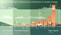 Be a planet citizen, make a choice, act to reduce climate change.jpg 1,024 × 595; 60 KB
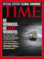 Be Worried, Be Very Worried.jpg 400 × 533; 211 KB
 Ben Santer to Pruitt March 2017.png 506 × 420; 0 bytes
 Bernie Sanders, Senate 2.PNG 800 × 517; 379 KB
 Bernie Sanders, Senate Aug 3.PNG 800 × 518; 388 KB
 Biden - clean energy ambitions.JPG 640 × 334; 31 KB
 Biden announces EV policies - Aug 2021.jpg 600 × 604; 112 KB
 Biden introduces leadership team - Nov 24 2020.jpg 800 × 644; 173 KB
 Biden re Earth Day 2023.png 640 × 400; 155 KB
 Biden selects Kerry as special climate envoy.jpg 592 × 505; 87 KB
 Biden urged to act - Oct 18 2021 - The Guardian.png 663 × 600; 497 KB
 Biden's assembled an all-star climate team 4-21-2021.jpg 682 × 732; 309 KB
 Biden-January 27 2021-Environment Day 1-News headlines.jpg 800 × 673; 122 KB
 Biden-January 27 2021-Environment Day 1.jpg 800 × 500; 80 KB
 Biden-Sanders Unity Task Force on Climate.jpg 701 × 780; 139 KB
 Big Oil Rocked by News May 27 2021.jpg 639 × 600; 84 KB
 Big Wobble 2020.jpg 507 × 342; 79 KB
 Bill McKibben switches gears-Sept 2021.jpg 518 × 265; 78 KB
 Bill McKibben to next generations.JPG 700 × 700; 203 KB
 Bill Nelson on Global Temp Rise and Climate Change.png 640 × 353; 100 KB
 Bill Nye explains.jpg 543 × 508; 88 KB
 Bill Nye The Planet's on Fire.jpg 800 × 675; 106 KB
 Bioluminescent phytoplankton Maldives.jpg 842 × 526; 76 KB
 Bloomberg Carbon Clock 10-26-2021 8-47-05 AM EST.png 800 × 195; 356 KB
 Bloomberg Live Climate Data Dashboard.jpg 640 × 756; 156 KB
 Blue atmosphere from Astro Wheelock.jpg 800 × 532; 16 KB
 Blue earth at night... and auras.jpg 366 × 211; 13 KB
 Blue fragile edge thin blue line.jpg 1,200 × 798; 26 KB
 Blue Horizon Sept21,2015 by Astro Scott Kelly.jpg 1,023 × 681; 11 KB
 Blue Marble memories in 2022.png 768 × 969; 727 KB
 Blue Marble photo - Apollo 17.jpg 642 × 605; 129 KB
 Blue Marble photo taken by the crew of Apollo 17 (1972).jpg 642 × 605; 129 KB
 Blue Marble updated-August 2015.jpg 1,024 × 341; 109 KB
 Blue n white.jpg 1,024 × 683; 104 KB
 Blue-Green & Planet Citizens, Planet Scientists.png 549 × 844; 94 KB
 Blue-green phyto swirling 2015.png 357 × 605; 409 KB
 Bluemarble 2014-M.jpg 800 × 600; 107 KB
 Bluemarble 2014.jpg 2,400 × 1,800; 511 KB
 Brazil INDC 2015.png 592 × 366; 301 KB
 Breakpoint - Reckoning with America's Environmental Crisis.jpg 329 × 500; 49 KB
 Bridenstine talks.png 1,485 × 911; 223 KB
 Brief History of Carbon Emissions as of 2016.png 770 × 425; 342 KB
 Burst of climate denial as Trump presidency ends.jpg 632 × 604; 92 KB
 CAIT Map 1.png 800 × 415; 123 KB
 California's Central Valley Earth View June 2015.png 1,571 × 767; 0 bytes
 California's kelp forests and coastal biodiversity diminished.png 532 × 754; 307 KB
 Canary - 1.jpg 448 × 901; 144 KB
 Canary - 2.png 446 × 531; 264 KB
 Car heating and cooling.png 465 × 635; 261 KB
 Carbon Brief - Greenhouse gas levels 2021.png 640 × 436; 292 KB
 Carbon Clock March 23, 2017.png 800 × 194; 44 KB
 Carbon Footprint - BP-McKibben-Solnit-Aug2021.jpg 516 × 264; 66 KB
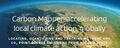 Carbon Mapper - Launch - April 2021.jpg 800 × 323; 92 KB
 Carbon-footprint small or large.jpg 149 × 258; 0 bytes
 Carbon-footprint.jpg 297 × 516; 59 KB
 Cardinal directions m.png 250 × 250; 20 KB
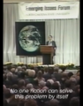 Carl Sagan at the Emerging Issues Forum - 1990.png 360 × 460; 192 KB
 Carl Sagan at the Emerging Issues Forum.png 747 × 600; 600 KB
 Carl Sagan, 1985.PNG 480 × 566; 331 KB
 Carl Sagan, the atmosphere unifies and connects all of our world.png 360 × 390; 229 KB
 CCI-June29,2016.png 760 × 902; 201 KB
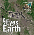 Celebrating 50 Years of Landsat.png 600 × 610; 909 KB
 Celebrating Earth's Beauty 2015.png 1,150 × 716; 1.53 MB
 CFCs then HFCs.png 800 × 382; 169 KB
 CFSV2 world temp July 3, 2023.png 600 × 800; 513 KB
 CH4 graph - 1980-2020.JPG 640 × 446; 22 KB
 Changes in carbon dioxide per 1000 years - via Climate Central.jpg 682 × 424; 34 KB
 Charles Bolden.jpg 575 × 449; 153 KB
 ChatGPT talks of fighting climate denialism.png 707 × 747; 239 KB
 China Record Heat - August 2022.png 800 × 1,343; 812 KB
 Christina Korp Earth Day and Apollo 8.jpg 519 × 264; 80 KB
 Citizens Climate Lobby - Save Our Future Act 2021.jpg 518 × 262; 77 KB
 Citizens Climate Lobby - Tampa Bay.jpg 586 × 515; 125 KB
 Climate Action 25th conf in Madrid.jpg 680 × 510; 22 KB
 Climate activist - Steven Schmidt - 1978 on.png 600 × 480; 174 KB
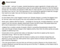
 Climate Books - 2020.jpg 800 × 450; 69 KB
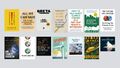
 Climate cases on the rise - Nature, Sept 2021.png 800 × 562; 181 KB
 Climate Change Agr Nov 4, 2016.png 800 × 523; 296 KB


.jpg)
.jpg)


.jpg)


- Aquifers
- Atmosphere
- Biodiversity
- Biosphere
- Citizen Science
- Climate Change
- Climate Policy
- Earth360
- EarthPOV
- Earth Imaging
- Earth Law
- Earth Science
- Earth Science from Space
- Ecology Studies
- Education
- Environmental Full-cost Accounting
- Environmental Protection
- Environmental Security
- Environmental Security, National Security
- Externalities
- Forests
- Fossil Fuels
- Global Security
- Global Warming
- Land Ethic
- Maps
- New Definitions of National Security
- New Space
- Oceans
- Peace
- Planet API
- Planet Citizen
- Planet Citizens
- Planet Scientist
- Planet Citizens, Planet Scientists
- Planetary Science
- Rainforest
- Resilience
- Sea-level Rise
- Sea-Level Rise & Mitigation
- Sustainability
- Sustainability Policies
- ThinBlueLayer
- Virtual Earth
- Virtual Planet
- Water
- Whole Earth
- Atmospheric Science
- Biogeosciences
- Cryosphere
- Geology
- Geophysics
- Geophysics and Geochemistry
- Hydrology
- Mineralogy
- Natural Resources
- Ocean Science
- Space Science and Space Physics
- Topic