File:MethaneSat - 3.PNG
MethaneSat_-_3.PNG (448 × 303 pixels, file size: 248 KB, MIME type: image/png)
2024
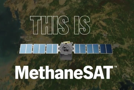
The first satellite developed by an environmental non-profit will see methane emissions others can’t, paving the way for heightened accountability and faster reductions
On March 4, 2024, MethaneSAT effectively detached from the SpaceX Transporter-10 rocket that carried the emissions-monitor into space. The groundbreaking satellite is designed to help protect the Earth’s climate by accelerating reductions of a powerful greenhouse pollutant, focusing first on oil and gas operations, a major source of methane.
Data will be available for download in the Google Earth Engine database, followed by satellite data after launch
![]()
Climate Action Plans 360
We will be distributing the data!
GRN360: Climate Plans Enforcement Initiative
GRN3360: Methods to Enforce Climate Plan Pledges


MethaneSAT ... (January 2024, Developing story) .... Goal, launch "the most advanced methane-tracking satellite in space, measuring methane emissions virtually anywhere on Earth. Cutting methane emissions from the oil and gas is the single fastest, most impactful thing we can do to slow the rate of warming today"
🌎
File history
Click on a date/time to view the file as it appeared at that time.
| Date/Time | Thumbnail | Dimensions | User | Comment | |
|---|---|---|---|---|---|
| current | 21:25, 28 February 2024 | | 448 × 303 (248 KB) | Siterunner (talk | contribs) |
You cannot overwrite this file.
File usage
- About Us
- Air Quality
- Air Pollution
- Agriculture
- Alternative Agriculture
- Antarctica
- Anthropocene
- Arctic
- Atmospheric Science
- Bioneers
- California
- Citizen Science
- City Governments
- Climate Change
- Climate Migration
- Climate Policy
- Countries
- County Governments
- Democracy
- Desertification
- Digital Citizen
- Earth Imaging
- Earth Observations
- Earth360
- Earth Science
- Earth Science from Space
- Earth System Science
- Ecology Studies
- Eco-nomics
- Economic Justice
- Education
- Energy
- Environmental Laws
- Environmental Protection
- Environmental Security
- Environmental Security, National Security
- ESA
- European Union
- Externalities
- Extinction
- Food
- Forests
- Fossil Fuels
- Greenland
- Global Security
- Global Warming
- Green Graphics
- GreenPolicy360
- Green Networking
- Green Best Practices
- Green Politics
- Health
- INDC
- Maps
- Money in Politics
- NASA
- NOAA
- Natural Resources
- Networking
- New Definitions of National Security
- New Economy
- New Space
- Oceans
- Ocean Science
- Online Education
- Planet Citizen
- Planet Citizens
- Planet Citizens, Planet Scientists
- Pollution
- Rainforest
- Renewable Energy
- Resilience
- Sea-level Rise
- Sea-Level Rise & Mitigation
- Seventh Generation Sustainability
- Social Justice
- Soil
- Solar Energy
- Strategic Demands
- Sustainability Policies
- Threat Multiplier
- Transportation
- United Nations
- US
- US Environmental Protection Agency
- Water Quality
- Whole Earth
- Wind Energy
- World Bank
- World Wide Web
- Youth