Planet API: Difference between revisions
Siterunner (talk | contribs) |
Siterunner (talk | contribs) |
||
| Line 17: | Line 17: | ||
[http://www.planetcitizen.org '''''Planet Citizens, Planet Scientists'''''] | [http://www.planetcitizen.org '''''Planet Citizens, Planet Scientists'''''] | ||
: | : What happens when young NASA scientists 'grow up and up' and launch their own ventures... | ||
Revision as of 19:54, 14 May 2023

New Ways to See & Experience Planet Earth
Planet Citizens, Planet Scientists
- What happens when young NASA scientists 'grow up and up' and launch their own ventures...

Will Marshall
Planet
SkySat
(as of May 2023)
SkySat, operated by Planet, is a high resolution constellation of 21 satellites, able to image revisit any location on Earth up to 10x daily (a daily collection capacity of 400 thousand km²/day). SkySat images are approximately 50 centimeters per pixel resolution.
Constellation & Sensor Overview
The SkySat satellite constellation consists of multiple launches of our SkySat-C generation satellites, first launched in 2016.
Each satellite is 3-axis stabilized and agile enough to slew between different targets of interest. Each satellite has four thrusters for orbital control, along with four reaction wheels and three magnetic torquers for attitude control.
All SkySats contain Cassegrain telescopes with a focal length of 3.6m, with three 5.5 megapixel CMOS imaging detectors making up the focal plane.
SkySat Imagery Products
SkySat Products are available for search and download via Planet’s APIs, User Interfaces, and Integrations, in the form of Scene, Collect, and Video products, which are encoded in our platform as a set of Item Types and Asset Types.
A SkySat Scene Product is an individual framed scene within a strip, captured by the satellite in its line-scan of the Earth. SkySat Satellites have three cameras per satellite, which capture three overlapping strips. Each of these strips contain overlapping scenes, not organized to any particular tiling grid system.
SkySat Scene products are approximately 1 x 2.5 square kilometers in size. They are represented in the Planet Platform as the SkySatScene item type.
A SkySat Collect Product is created by composing roughly 60 SkySat Scenes along an imaging strip into an orthorectified segment, approximately 20 x 5.9 square kilometers in size. They are represented in the Planet Platform as the SkySatCollect item type. This product may be easier to handle, if you're looking at larger areas of interest with SkySat imagery. Due to the image rectification process involved in creating this product, Collect is generally recommended over the Scene product when the AOI spans multiple scenes, particularly if a mosaic or composite image of the individual scenes is required. Collect performs necessary rectification steps automatically. This is especially useful for users who don't feel comfortable doing orthorectification manually.


Planet.com
- Monitoring the pulse of our planet
- Pioneering projects with earth science, mapping, environmental activism, resilience & sustainability
Young NASA Scientists 'Spin Off' the Home Ship and Launch a New Venture: Planet.com

- 2019
- Planet's launched numbers reach 150+ satellites across three 'constellations' – Dove, SkySat, and RapidEye...
- 2018
- Partnerships with public interest groups grow globally... Google Earth Outreach and more...

Planet Citizen, Bioneers and environmental activist Leonardo DiCaprio joins w/ Planet to launch an amazing ocean imaging, earth science project. Join in the action!
Visit Bioneers.org for many more planet citizen eco-ideas and -apps for resiliwnce and sustainability. #GreenBestPractices
- Reefscape
The Reefscape project aims to improve our understanding of the condition of coral reefs worldwide, while simultaneously developing spectral libraries needed to advance the development of a new satellite mission.
To gather a more comprehensive understanding of the condition of global reef ecosystems, we need a way to assess and monitor them on a large geographic scale. New satellites, such as those from Planet (formerly Planet Labs), are, as of 2017, able to capture near-daily imagery of coral reefs worldwide. Planet’s high-resolution imagery of reef location provides us with an at-your-fingertips understanding of the extent of shallow, horizontally oriented reefs.
To lay the groundwork for a new satellite mission, it is important to develop a baseline understanding of current reef extent, and to pair that information with field-based assessments of reef condition. In addition, improved spectral libraries of corals are required to drive the new satellite design and approach for global monitoring. GreenBestPractices
Join in the API work. Make a positive difference.
··································································
2017

2016
- Planet Labs is now Planet @planet.com -- https://www.planet.com/
2015
- "New Space" / Your Earth Science from Above
Generation 1.0, an era of Micro-satellites and #EarthImaging
2014
- Planet Labs, Will Marshall... "These are our Doves"
- In short, we want to democratize access to information about our planet.
Planet Labs' API @the Open Source Conference

About Planet Labs Documentation Intro Planet Labs at GitHub
- July 2015 - 'Planet Labs Acquires Blackbridge/RapidEye
- February 2015 - Private Spending on Space Is Headed for a New Record - Space Race 2.0
- #NewSpace - Planet Labs has raised more than $160 million and launched 73 global imaging satellites... Three years ago co-founder Will Marshall built the first of the miniature satellites nicknamed “doves” in a Silicon Valley garage.
- “A lot of people were very skeptical, and what we were trying to do seemed ludicrous,” says Marshall, a former engineer at NASA Ames Research Center in Mountain View, California. “But we have assets in orbit, and customers who are very interested in the data. Every time we take a picture, we can see how the world is changing.”
Connect
Planet Labs/NYT Planet Labs, newly #ISS deployed Doves 'Smartphone' components in space
Launch of Flock of Dove Satellites to Continuously Image and Study Earth
Planet Labs 'Dove' micro-satellites
- New York Times / "Rapid cadence imagery, like Planet Labs is developing, helps us become better, more sustainable stewards of Earth."
- Planet Lab Doves "Planet Earth imaging possibilities never before offered"
Citizens of the Planet -- #PlanetCitizens
PlanetCitizen | PlanetCitizen.org
Planet Citizens | PlanetCitizens.org
Planet Citizens, Planet Scientists

Google Earth Outreach

Google Earth Engine & Outreach
Under the forward-looking initiative and leadership of Planet Citizen and Bioneers Rebecca Moore who set in motion Google Earth Outreach, Google Earth Engine is an online environment monitoring platform that makes available to the entire world a dynamic digital model of our planet that is updated daily.
The Google Earth Outreach Engine stores petabytes of satellite data and allows high-performance tools to analyze and interpret this information that can then be visualized on a map...
Communities of #PlanetCitizens observing, networking, sharing information, protecting #PlanetEarth...
- ·················································································
Join in ! Become a Planet Citizen and Make a Difference in Y/Our World
Recent Earth Outreach green networking include --
Global Fishing Watch and Forest Watch
Planet Citizens, Use the Earth Science Data to Join In & Get with the Action
○
Global Forest Watch launches - 2014
Google Outreach continues its impact
World Resources Institute Forest Watch
Monitoring the Planet's Forests
Thank you Rebecca, #PlanetCitizen
····································································
Upping the Game with Planet API
February 2017 / News re: Google & Planet
December 2014 / News re: Google Earth's API
Google promises expansion of Google Earth to other 3D mapping products after Dec 2015. As to what, and when, we'll wait and see...

Visit Virtual Earth for More on Mapping Earth
Earth Mapping Developments & Updates
····································································
More APIs for the Planet & Connected Planet Citizens
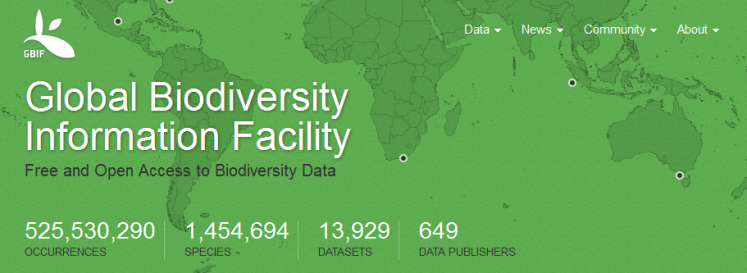
Global Biodiversity Information, free and open access to biodiversity data - Global Biodiversity / Terms
○ ○ ○ ○
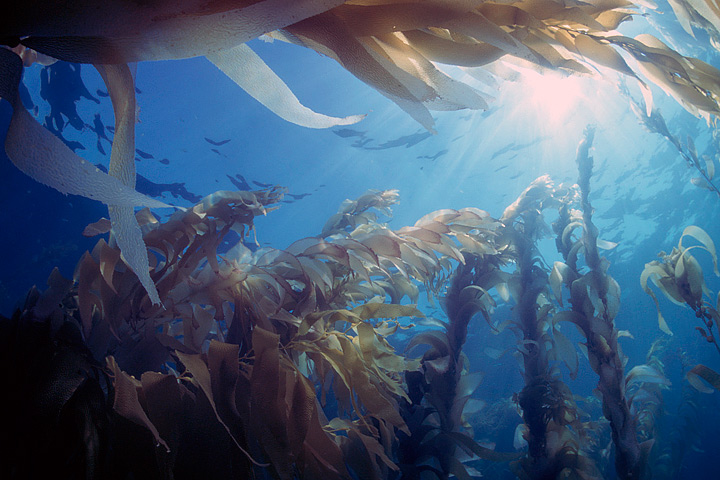

- Floating Forests
Help with the Kelp, Join in -- be a Be a Planet Citizen, Planet Scientist -- http://www.floatingforests.org/
Floating Forests - Earth Observatory/NASA-Landsat
Origin of Floating Forests Project
Planet Citizen, Planet Scientist
Kyle Cavanaugh had an idea. “These forests change so rapidly and on a variety of different time scales—months to years to decades—so we needed a long record with consistent, repeated observations,” Cavanaugh said. He devised a method to use Landsat satellite data to monitor kelp forests.
A few things made Landsat an obvious resource. Since the 1970s, the satellites have had a regular collection schedule (twice monthly). Their data and images are managed by the U.S. Geological Survey and are reliably stored in an archive that dates back more than forty years. And Landsat’s images are calibrated, or standardized, across different generations of satellites, making it possible to compare data collected across several decades...
Landsat measures the energy reflected and emitted from Earth at many different wavelengths. By knowing how features on Earth reflect or absorb energy at certain wavelengths, scientists can map and measure changes to the surface. The most important feature for the kelp researchers is Landsat’s near-infrared band, which measures wavelengths of light that are just outside our visual range. Healthy vegetation strongly reflects near-infrared energy, so this band is often used in plant studies. Also, water absorbs a lot of near-infrared energy and reflects little, making the band particularly good for mapping boundaries between land and water.
“The near-infrared is key for identifying kelp from surrounding water,” Cavanaugh explained. “Like other types of photosynthesizing vegetation, giant kelp have high reflectance in the near infrared. This makes the kelp canopy really stand out from the surrounding water.”
○
After a recent meeting on kelp forests and climate change, researchers Byrnes, Cavanaugh, and other colleagues set out to consolidate all of the available kelp forest data from around the world. They wanted to take a step toward understanding how climate change is affecting kelp globally, but they quickly discovered they had a sparse patchwork of information.
Byrnes was struck with a thought. They had used Landsat to expand their studies across time, so why not use Landsat to expand their studies around the world? Could Landsat be used to establish global trends in kelp forest extent? The answer was yes, but the problem was eyeballs.
Unlike research on terrestrial vegetation — which uses Landsat data and powerful computer processing arrays to make worldwide calculations — distinguishing kelp forests requires manual interpretation. While kelp forests pop out to the human eye in near-infrared imagery, computers looking at the data numerically can confuse kelp patches with land vegetation. Programs and coded logic that separate aquatic vegetation from land vegetation can be confounded by things like clouds, sunglint, and sea foam...
"Automated classification methods just don’t produce acceptable levels of accuracy..."
Byrnes and Cavanaugh put together a science team and joined with Zooniverse, a group that connects professional scientists with citizen scientists in order to help analyze large amounts of data. The result was the Floating Forests project.
https://www.zooniverse.org/#climate
https://www.zooniverse.org/#nature
The Floating Forest concept is all about getting more eyeballs on Landsat imagery. Citizen scientists—recruited via the Internet—are instructed in how to hunt for giant kelp in satellite imagery. They are then given Landsat images and asked to outline any giant kelp patches that they find. Their findings are crosschecked with those from other citizen scientists and then passed to the science team for verification. The size and location of these forests are catalogued and used to study global kelp trends.
Join in!
○ ○ ○ ○
- Citizen Science
Citizen Science by Planet Citizens
○ ○ ○ ○
Planet API | #PlanetAPI | Planet Citizen | #PlanetCitizen
GreenPolicy360 | #Earth360 | #EarthImaging | #EarthMonitoring
GP360 | #EarthObservations | #EarthScience | #NewSpace
www.planetcitizen.org | www.earthpov.com
○ ○ ○ ○
- Your Mission if You Choose to Go
Democratising access to information about Planet Earth... Planet Labs brings home the data
Be one of the first ever on our voyage over time to show you're an Earth-wise #PlanetCitizen
○
- Country
- Maps
- About Us
- Additional Website Resources - Linked Data - Green Best Practices
- Air Quality
- Air Pollution
- Aquifers
- Anthropocene
- Atmospheric Science
- Biodiversity
- Bioneers
- Citizen Science
- Clean Air
- Climate Change
- Climate Policy
- Democratization of Space
- Desertification
- Digital Citizen
- Earth360
- EarthPOV
- Earth Imaging
- Earth Observations
- Earth Law
- Earth Science
- Earth Science from Space
- Earth System Science
- Ecology Studies
- Eco-nomics
- Education
- Environmental Full-cost Accounting
- Environmental Protection
- Environmental Security
- Environmental Security, National Security
- EOS eco Operating System
- ESA
- Externalities
- Forest
- Forests
- Green Best Practices
- GreenPolicy360
- Green Politics
- Health
- Internet
- Land Ethic
- NASA
- Natural Resources
- New Definitions of National Security
- New Space
- NOAA
- Oceans
- Online Education
- Permaculture
- Planet API
- Planet Citizens
- Planet Scientist
- Planet Citizens, Planet Scientists
- PlanetLabs
- Planetary Science
- Population
- Rainforest
- Strategic Demands
- Sustainability
- Sustainability Policies
- ThinBlueLayer
- Virtual Earth
- Virtual Planet
- Water
- Whole Earth
- World Wide Web
- Youth
- Biogeosciences
- Cryosphere
- Geology
- Geophysics
- Geophysics and Geochemistry
- Hydrology
- Mineralogy
- Ocean Science
- Space Science and Space Physics