Democratization of Space: Difference between revisions
Siterunner (talk | contribs) No edit summary |
Siterunner (talk | contribs) No edit summary |
||
| (56 intermediate revisions by the same user not shown) | |||
| Line 1: | Line 1: | ||
[[File:Planet Labs | [[File:You can manage only what you can measure Dr David Crisp, OCO-2, June 2014 m.jpg]] | ||
<big><big>'''[[Planet API]]'''</big></big> | |||
* https://content.planet.com/c/queryable-earth-comb?x=VNDhA2 | |||
<big>'''[[Planet Citizens, Planet Scientists]]'''</big> | |||
* https://content.planet.com/c/planet-solutionsover-6?x=VNDhA2 | |||
🌎 | |||
<big>'''The 2024 Launch of MethaneSat'''</big> | |||
MethaneSAT, a subsidiary of the nonprofit Environmental Defense Fund, selected Blue Canyon Technologies in 2020 to supply its donor-funded satellite. | |||
:: [[File:MethaneSat - 1.jpg]] | |||
:: [[File:MethaneSat - 2.PNG]] | |||
:: [[File:MethaneSat - 3.PNG]] | |||
:: * https://twitter.com/MethaneSAT/status/1748388037719904318 | |||
🌎 | |||
[http://www.greenpolicy360.net/w/Category:Democratization_of_Space <big><big>'''Democratizing #NewSpace'''</big></big>] | |||
: [https://www.greenpolicy360.net/w/Micro-satellites '''Micro-satellites'''] | |||
:: [https://www.greenpolicy360.net/w/Category:Earth_Observations '''Earth Observations'''] | |||
::: [https://www.greenpolicy360.net/w/Earth_Science_Research_from_Space '''Earth Science Research from Space'''] | |||
:::: [https://www.greenpolicy360.net/w/Earth_Imaging-New_Space '''Earth Imaging / New Space'''] | |||
🌎 | |||
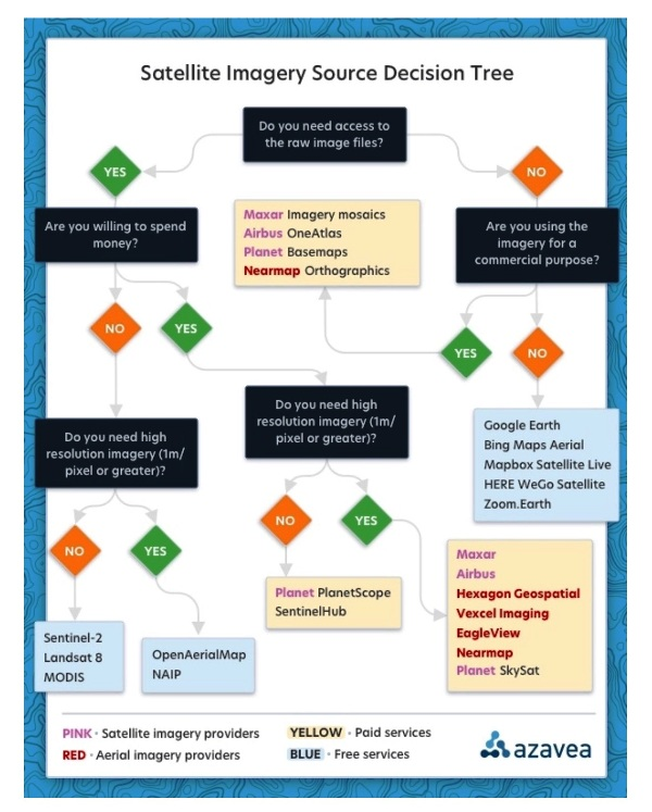
[[File:Recent Satellite Imagery of Earth - via Azavea.png]] | |||
: Via Azavea 2023 | |||
'''Google Earth''' | |||
* https://earth.google.com/web/ | |||
'''Bing Maps Aerial''' | |||
* https://www.arcgis.com/home/webmap/viewer.html?webmap=8651e4d585654f6b955564efe44d04e5#! | |||
'''Mapbox Satellite Live''' | |||
* https://www.mapbox.com/maps/satellite | |||
* https://www.mapbox.com/imagery | |||
'''HERE WeGo - Map View / Satellite''' | |||
* https://www.here.com/ - https://wego.here.com | |||
'''Zoom Earth''' | |||
* https://zoom.earth/ | |||
~ | |||
'''Airbus''' | |||
* https://www.airbus.com/en | |||
'''Blue Canyon Technologies''' | |||
* https://bluecanyontech.com/ | |||
'''Capella''' | |||
* https://www.capellaspace.com/ | |||
'''EagleView''' | |||
* https://www.eagleview.com/ | |||
'''Hexagon Geospatial''' | |||
* https://hexagon.com/solutions/geospatial-content | |||
'''ICEYE (US) | |||
* https://www.iceye.com/en-us/ | |||
* https://www.iceye.com/satellites | |||
'''LeoLabs''' | |||
* https://leolabs.space/ | |||
'''Maxxar''' | |||
* https://www.maxar.com/ | |||
'''Nearmap''' | |||
* https://www.nearmap.com/us/en | |||
'''Planet''' | '''[[Planet API]]''' | |||
* https://www.planet.com/ | |||
* https://developers.planet.com/docs/data/skysat/ | |||
* https://earth.esa.int/eogateway/missions/skysat | |||
'''SpaceX - Rideshare''' | |||
* https://www.spacex.com/rideshare/ | |||
'''Spire''' | |||
* https://spire.com/ | |||
* https://spire.com/about-us/ | |||
* https://spire.com/our-purpose/ | |||
'''Vexcel Imaging''' | |||
* https://www.vexcel-imaging.com/ | |||
🌎 | |||
<big><big>''''New Space' | Democratization of Space'''</big></big> | |||
* https://www.greenpolicy360.net/w/Democratization_of_Space | |||
* https://www.greenpolicy360.net/w/Category:Democratization_of_Space | |||
Space private sector Q2 2022 reports via @thesheetztweetz: | |||
* https://www.cnbc.com/2022/09/10/space-sector-q2-results-mixed-performance-with-progress-and-delays.html | |||
CNBC breaks down the most recent quarterly reports for Aerojet Rocketdyne, AST SpaceMobile, Astra, BlackSky, Iridium, Maxar, Momentus, Mynaric, Redwire, Rocket Lab, Satellogic, Spire Global, Telesat, Terran Orbital, ViaSat, Virgin Galactic and Virgin Orbit. | |||
and Planet | https://www.cnbc.com/quotes/PL | |||
* https://www.greenpolicy360.net/w/Planet_API | |||
Planet Labs PBC, formerly dMY Technology Group, Inc. IV, is a provider of global, daily satellite imagery and geospatial solutions. The Company designs, builds, and operates the Earth observation fleet of imaging satellites, capturing, and compiling data from over three million images per day. The Company’s automated, cloud-native platform processes and manages data catalogue and extracts information. The Company’s platform includes imagery, insights, and machine learning that enables companies, governments, and communities around the world to make decisions about evolving world. Its platform and analytics products include Planet Application Programming Interfaces (APIs), Planet Applications, Planet Basemaps, Planet Fusion, and Planet Analytics Feeds. The Company provides mission-critical data, advanced insights, and software solutions, across agriculture, forestry, intelligence, education and finance companies and government agencies, enabling users to derive satellite imagery. | |||
$AJRD | $ASTS | $ASTR | $BKSY | $IRDM | $MAXR | $MNTS | $MYNA | $RDW | |||
$RKLB | $SATL | $SPIR | $TSAT | $LLAP | $VSAT | $SPCE | $VORB | |||
🌎 | |||
<big><big>'''Earth Science Research from Space: Methane emissions'''</big></big> | |||
''Extremely large emitters — releasing more than 25 tons per hour — can be seen and tracked from near-earth orbit'' | |||
''Earth imaging data from a sensor aboard a European satellite, Sentinel 5'' | |||
* https://sentinel.esa.int/web/sentinel/missions/sentinel-5 | |||
''Using data from 2019 and 2020, (scientists) located about 1,200 of these ultra emitters, a large portion of them from Russia, Turkmenistan, the United States, the Middle East and Algeria.'' | |||
''Total emissions from these sites were estimated at about 9 million tons per year. In terms of its potential to warm the planet, that much methane is equivalent to about 275 million tons of carbon dioxide, which is the total carbon footprint of 40 million people, based on the global average per capita.'' | |||
'''''Seen From Space: Huge Methane Leaks''''' | |||
* https://www.nytimes.com/2022/02/04/climate/methane-leaks-satellites.html | |||
* https://www.washingtonpost.com/climate-environment/2022/02/03/cracking-down-methane-ultra-emitters-is-quick-way-combat-climate-change-researchers-find/ | |||
* https://www.greenpolicy360.net/w/Earth_Science_Research_from_Space | |||
:<big>'''[[Copernicus EU]]'''</big> | |||
:[[File:Copernicus EU logo.jpg|link=https://www.greenpolicy360.net/w/Copernicus_EU]] | |||
:<big>'''''Methane, We're Watching'''''</big> | |||
:: * https://www.greenpolicy360.net/w/Copernicus_EU | |||
::: * https://hsat.space/satellites-sentinel-5/ | |||
:: '''''Detecting methane from space''''' | |||
::''"There has been quite a buzz around this unique advancement in space, and the valuable data it will provide on methane, a powerful greenhouse gas that accounts for a quarter of the warming our planet is experiencing today. Curbing anthropogenic methane emissions is one of the most efficient and economical options available to slow the rate of warming over the next few decades, while efforts continue to reduce CO2 emissions worldwide."'' | |||
::············································································································ | |||
::<big><big><big><big>[[New Space]]</big></big></big></big> | |||
::[[File:Geosciences satellite fields b.jpg]] | |||
::············································································································· | |||
<big><big>'''''[[Planet API]]'''''</big></big> | |||
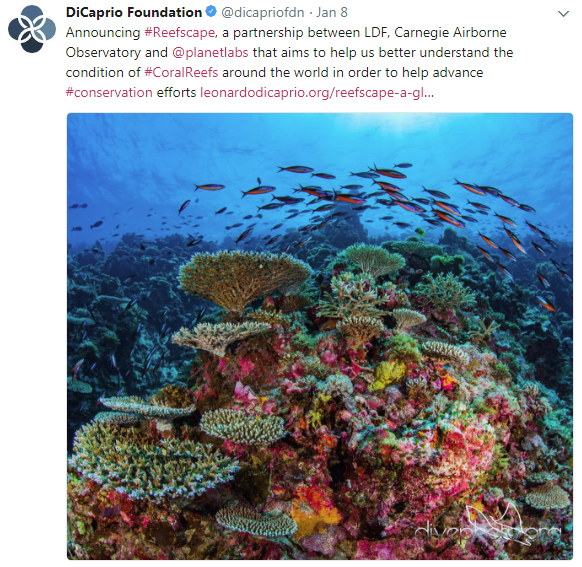
<big>'''''Planet & [https://www.greenpolicy360.net/w/Bioneers Bioneer] Leonardo DiCaprio [https://www.greenpolicy360.net/w/File:Reefscape.png join up] with #Earth Vision'''''</big> | |||
: ''Reefscape, Another New Way to View, Watch Over & Care for Our Common Home'' | |||
::<big>''[[The Commons]]''</big> | |||
[[File:Reefscape.png]] | |||
·········································································································································· | |||
[https://www.nature.com/articles/d41586-018-04478-6 <big><big>'''''US environmental group wins millions to develop methane-monitoring satellite'''''</big></big>] | |||
'''''The Environmental Defense Fund (EDF) is planning to be the first environmental group to send its own satellite into space''''' | |||
:''“We need good solid data so that we really can support global action on climate change, and we’ve got to do it fast,” says Steven Hamburg, the EDF’s chief scientist.'' | |||
:''The most detailed measurements currently available of atmospheric methane concentrations come from a sensor aboard the European Space Agency’s [https://www.greenpolicy360.net/w/Copernicus_EU '''Sentinel-5P spacecraft'''], which launched in '''October 2017'''. The Tropospheric Monitoring Instrument provides global coverage at a '''resolution of nearly 50 square kilometres''', but those measurements at this time do not capture the dispersed sources of emissions from oil and gas fields.'' | |||
:''Commercial firms have developed high-resolution sensors that can be placed aboard 10-centimetre-sided [https://www.nature.com/news/mini-satellites-prove-their-scientific-power-1.15051 '''CubeSats'''] to measure emissions from individual wells or other facilities. Those data are proprietary, however, and the measurements currently cannot be scaled up to the level of an entire oil and gas field.'' | |||
:''The Environmental Defense Fund team is designing '''MethaneSAT''' to provide more-precise measurements, at a '''resolution of 1 square kilometre''', with global coverage at least once a week.'' | |||
○ | |||
'''As the Trump administration attempts to cut and eliminate the EPA and climate-related government programs, [https://www.greenpolicy360.net/w/Global_Climate_Action_Summit ''California sends a message'']...''' | |||
<big>'''''California & [https://www.greenpolicy360.net/mw/index.php?title=Special%3ASearch&profile=default&search=planet+labs&fulltext=Search Planet Labs] Plan Satellite-Based Technologies to Track and Attack Climate Pollutants'''''</big> | |||
* Video @ https://twitter.com/JerryBrownGov/status/1040729207850950656 | |||
* Global Climate Action / news @ https://www.greenpolicy360.net/w/Global_Climate_Action_Summit | |||
○ | |||
<big>'''''SpaceX, NASA & Beginnings of 'New Space' '''''</big> | |||
* https://arstechnica.com/science/2018/09/inside-the-eight-desperate-weeks-that-saved-spacex-from-ruin/ | |||
''The first successful flight of the Falcon 1 (in 2008) served as a catalyst for the commercial space industry. The privately financed development of new rockets and spacecraft, as well as commercial businesses in space beyond telecommunications, had seen ups and downs over the years but never sustained success. SpaceX’s second successful launch of the Falcon 1 rocket in 2009, when it delivered a commercial satellite into orbit, sealed the deal. | |||
“The impact that their first successful commercial launch had on the space industry cannot be overstated,” said Chad Anderson, who runs an investment group, [https://www.spaceangels.com/team Space Angels], that closely tracks public and private investment in spaceflight. | |||
''This initial success helped land a multibillion dollar contract from NASA to deliver cargo to the space station and ignited a furious decade in which SpaceX has gone from a single engine rocket, to one with nine engines, to one with 27 engines. The company has also developed two spacecraft, the Dragon 1 and 2, and landed dozens of first stages.'' | |||
''Before SpaceX began flying the Falcon 1 rocket, there were a few dozen privately funded companies, globally, engaged in spaceflight activities. Today (as of 2018), there are 350, and they have raised $15 billion in private capital...'' | |||
○ | |||
[http://www.greenpolicy360.net/w/Category:PlanetLabs ''Planet Labs @ GreenPolicy360''] | [http://www.greenpolicy360.net/w/Category:PlanetLabs ''Planet Labs @ GreenPolicy360''] | ||
| Line 9: | Line 284: | ||
○ | ○ | ||
| Line 18: | Line 293: | ||
[[File:PlanetLabs homepage2016.png]] | :[[File:PlanetLabs homepage2016.png]] | ||
○ | ○ | ||
'''Will Marshall, [https://youtu.be/UHkEbemburs November 2014 / Video]:''' I'm going to show you what our satellite looks like: This is our satellite. This is not a scale model, this is the real size. It's 10 by 10 by 30 centimeters, it weighs four kilograms, and we've stuffed the latest and greatest electronics and sensor systems into this little package so that even though this is really small, this can take pictures 10 times the resolution of the big satellite here, even though it weighs one thousandth of the mass. And we call this satellite "Dove"... | '''Will Marshall, [https://youtu.be/UHkEbemburs November 2014 / Video]:''' I'm going to show you what our satellite looks like: This is our satellite. This is not a scale model, this is the real size. It's 10 by 10 by 30 centimeters, it weighs four kilograms, and we've stuffed the latest and greatest electronics and sensor systems into this little package so that even though this is really small, this can take pictures 10 times the resolution of the big satellite here, even though it weighs one thousandth of the mass. And we call this satellite "Dove"... | ||
We've launched 28 [as of today]... It's the largest constellation of Earth-imaging satellites in human history, and it's going to provide a completely radical new data set about our changing planet. But that's just the beginning. You see, we're going to launch more than 100 of these satellites like these over the course of the next year. It's going to be the largest constellation of satellites in human history. And this is what it's going to do: Acting in a single-orbit plane that stays fixed with respect to the sun, the Earth rotates underneath. They're all cameras pointed down, and they slowly scan across as the Earth rotates underneath. The Earth rotates every 24 hours, so we scan every point on the planet every 24 hours. It's a line scanner for the planet. We don't take a picture of anywhere on the planet every day, we take a picture of every single place on the planet every day. Even though we launched these just a couple of weeks ago, we've already got some initial imagery from the satellites and I'm going to show it publicly for the first time right now. This is the very first picture taken by our satellite. It happened to be over UC-Davis' campus in California when we turned the camera on. | We've launched 28 [as of today]... It's the largest constellation of Earth-imaging satellites in human history, and it's going to provide a completely radical new data set about our changing planet. But that's just the beginning. You see, we're going to launch more than 100 of these satellites like these over the course of the next year. It's going to be the largest constellation of satellites in human history. And this is what it's going to do: Acting in a single-orbit plane that stays fixed with respect to the sun, the Earth rotates underneath. They're all cameras pointed down, and they slowly scan across as the Earth rotates underneath. The Earth rotates every 24 hours, so we scan every point on the planet every 24 hours. It's a line scanner for the planet. We don't take a picture of anywhere on the planet every day, we take a picture of every single place on the planet every day. Even though we launched these just a couple of weeks ago, we've already got some initial imagery from the satellites and I'm going to show it publicly for the first time right now. This is the very first picture taken by our satellite. It happened to be over UC-Davis' campus in California when we turned the camera on. | ||
[[File:Planet Labs Dove-sat-01.jpg]] | [[File:Planet Labs Dove-sat-01.jpg]] | ||
[W]e will be able to track urban growth as it happens around the whole world in all cities, every day. | [W]e will be able to track urban growth as it happens around the whole world in all cities, every day. | ||
We'll be able to see the extent of all water bodies around the whole world every day and help water security. From water security to food security. We'll see crops as they grow in all the fields in every farmer's field around the planet every day. and help them to improve crop yield. This is a beautiful image that was taken just a few hours ago when the satellite was flying over Argentina. The general point is there are probably hundreds and thousands of applications of this data, I've mentioned a few, but there's others: deforestation, the ice caps melting. We can track all of these things, every tree on the planet every day. If you took the difference between today's image and yesterday's image, you'd see much of the world news — you'd see floods and fires and earthquakes. And we have decided, therefore, that the best thing that we could do with our data is to ensure universal access to it. We want to ensure everyone can see it. Thank you. (Applause) We want to empower NGOs and companies and scientists and journalists to be able to answer the questions that they have about the planet. We want to enable the developer community to run their apps on our data. In short, we want to democratize access to information about our planet. | We'll be able to see the extent of all water bodies around the whole world every day and help water security. From water security to food security. We'll see crops as they grow in all the fields in every farmer's field around the planet every day. and help them to improve crop yield. This is a beautiful image that was taken just a few hours ago when the satellite was flying over Argentina. The general point is there are probably hundreds and thousands of applications of this data, I've mentioned a few, but there's others: deforestation, the ice caps melting. We can track all of these things, every tree on the planet every day. If you took the difference between today's image and yesterday's image, you'd see much of the world news — you'd see floods and fires and earthquakes. And we have decided, therefore, that the best thing that we could do with our data is to ensure universal access to it. We want to ensure everyone can see it. Thank you. (Applause) We want to empower NGOs and companies and scientists and journalists to be able to answer the questions that they have about the planet. We want to enable the developer community to run their apps on our data. In short, we want to democratize access to information about our planet. | ||
○ | ○ | ||
[http://www.wired.co.uk/news/archive/2014-10/31/planet-labs ''Wired: To image the entire Earth every day, Planet Labs has worked out that it needs 150 satellites in orbit concurrently...''] | [http://www.wired.co.uk/news/archive/2014-10/31/planet-labs ''Wired: To image the entire Earth every day, Planet Labs has worked out that it needs 150 satellites in orbit concurrently...''] | ||
| Line 43: | Line 323: | ||
''The paper never materialized, but an unusual friendship and mentoring relationship did. When Worden became director of the NASA Ames Research Center in Silicon Valley four years later, he recruited the group of Houston 20-somethings, along with a handful of their friends. Included were Schingler and Chris Kemp, then 28, who would become Ames’s director of business development and later its chief technology officer.'' | ''The paper never materialized, but an unusual friendship and mentoring relationship did. When Worden became director of the NASA Ames Research Center in Silicon Valley four years later, he recruited the group of Houston 20-somethings, along with a handful of their friends. Included were Schingler and Chris Kemp, then 28, who would become Ames’s director of business development and later its chief technology officer.'' | ||
○ | |||
○ | |||
[http://blogs.wsj.com/digits/2012/05/14/how-nasa-led-tech-to-the-cloud/ ''How NASA led tech to the Cloud / WSJ - May 2012''] | [http://blogs.wsj.com/digits/2012/05/14/how-nasa-led-tech-to-the-cloud/ ''How NASA led tech to the Cloud / WSJ - May 2012''] | ||
| Line 55: | Line 337: | ||
[http://techport.nasa.gov/home ''The Technology Portfolio System, TechPort, is NASA’s first comprehensive resource for locating information about NASA-funded technology development activities. This beta system enables the public to explore NASA’s technology portfolio...''] | [http://techport.nasa.gov/home ''The Technology Portfolio System, TechPort, is NASA’s first comprehensive resource for locating information about NASA-funded technology development activities. This beta system enables the public to explore NASA’s technology portfolio...''] | ||
○ | |||
○ | |||
[http://spacenews.com/pete-worden-leaving-nasa-to-pursue-private-sector-dreams/ ''Pete Worden - NASA Ames departure - SpaceNews - Feb 2015 / It would be a profound shift to see the Strategic Defense Initiative-SDI guy, who helped launch 'new space' (and Planet Labs) continue his move from maverick military to earth/biology... so to speak''] | [http://spacenews.com/pete-worden-leaving-nasa-to-pursue-private-sector-dreams/ ''Pete Worden - NASA Ames departure - SpaceNews - Feb 2015 / It would be a profound shift to see the Strategic Defense Initiative-SDI guy, who helped launch 'new space' (and Planet Labs) continue his move from maverick military to earth/biology... so to speak''] | ||
| Line 63: | Line 347: | ||
''“In the last nine years we have launched dozens of small, low-cost satellites – and helped ignite a major new industry in this area. Ames people have revitalized space biology and begun to apply the new field of synthetic biology,” Worden said via email Feb. 26. “Ames has provided entry technology for the emerging commercial space launch sector. We have helped launch small satellites working with a number of nations. And we’ve hosted and inspired thousands of students.”'' | ''“In the last nine years we have launched dozens of small, low-cost satellites – and helped ignite a major new industry in this area. Ames people have revitalized space biology and begun to apply the new field of synthetic biology,” Worden said via email Feb. 26. “Ames has provided entry technology for the emerging commercial space launch sector. We have helped launch small satellites working with a number of nations. And we’ve hosted and inspired thousands of students.”'' | ||
The future of NASA and SDI are a separate topic for others to address. Here at GreenPolicy we are tracking the utilization of technology that has moved from 'first generation' military purposes to first generation "New Space" 'open' uses. The democratization of space envisions moving from military-dependency to civilian/educational/environmental/scientific/engineering/resource monitoring and management -- a full spectrum of #EarthScience that, hopefully, brings a future of environmental-national-global security. Our position is that the application and re-purposing of initial space-borne military systems can be and should be applied to earth resource monitoring and management as legislative *technology transfer* has codified over the past two decades. The successful restructuring of the old Cold War systems is a challenge, without question, yet the example of Pete Worden and Planet Labs bring both hope and a direction that is worth pursuing in the face of rising security challenges that are global and threats to security within and across borders. | [GreenPolicy Siterunner: from early Cold War 'spin offs' of military R&D and defense spending came [http://en.wikipedia.org/wiki/ARPANET ARAPANET] from DARPA, the genesis of today's Internet] | ||
The future of NASA and SDI are a separate topic for others to address. Here at GreenPolicy we are tracking the utilization of technology that has moved from 'first generation' military purposes to first generation "New Space" 'open' uses. The democratization of space envisions moving from military-dependency to civilian / educational / environmental / scientific / engineering / resource monitoring and management -- a full spectrum of #EarthScience that, hopefully, brings a future of environmental-national-global security. Our position is that the application and re-purposing of initial space-borne military systems can be and should be applied to earth resource monitoring and management as legislative *technology transfer* has codified over the past two decades. The successful restructuring of the old Cold War systems is a challenge, without question, yet the example of Pete Worden and Planet Labs bring both hope and a direction that is worth pursuing in the face of rising security challenges that are global and threats to security within and across borders. | |||
-=-=-=-=-=-=-=-=-=-=- | -=-=-=-=-=-=-=-=-=-=- | ||
'''OpenStack strategy''' | '''OpenStack strategy''' | ||
| Line 80: | Line 368: | ||
[http://en.wikipedia.org/wiki/Miniaturized_satellite#Microsatellite ''Micro-satellites''], [http://en.wikipedia.org/wiki/CubeSat ''CubeSats''], [http://en.wikipedia.org/wiki/Miniaturized_satellite#Nanosatellite ''Nanosats''] / ''New ways to use OTS - off the shelf - components'' | [http://en.wikipedia.org/wiki/Miniaturized_satellite#Microsatellite ''Micro-satellites''], [http://en.wikipedia.org/wiki/CubeSat ''CubeSats''], [http://en.wikipedia.org/wiki/Miniaturized_satellite#Nanosatellite ''Nanosats''] / ''New ways to use OTS - off the shelf - components'' | ||
-=-=-=-=-=-=-=-=-=-=-=-=-=-=-=-=-=-=-=-=-=-=-=- | |||
| Line 93: | Line 382: | ||
==[http://t.co/dfsywixUg6 ''#PlanetLabs' API @the Open Source Conference'']== | ==[http://t.co/dfsywixUg6 ''#PlanetLabs' API @the Open Source Conference'']== | ||
| |||
[[File:Democratising access to information about the planet Planet Labs.jpg | link=https://vimeo.com/88602839]] | [[File:Democratising access to information about the planet Planet Labs.jpg | link=https://vimeo.com/88602839]] | ||
| |||
[[File:API connect.jpg]] | [[File:API connect.jpg]] | ||
[https://www.planet.com/ '''''About Planet Labs'''''] [https://www.planet.com/docs/ '''''Documentation'''''] [https://www.planet.com/docs/v0/scenes/#introduction '''''Intro'''''] | |||
[https://www.planet.com/ '''''About Planet Labs'''''] | |||
[https://www.planet.com/docs/ '''''Planet Documentation'''''] | |||
[https://www.planet.com/docs/v0/scenes/#introduction '''''Planet Intro'''''] | |||
'''''February 5, 2015''''' - '''''Private Spending on Space Is Headed for a New Record''''' - '''''Space Race 2.0''''' '''''#NewSpace''''' | '''''February 5, 2015''''' - '''''Private Spending on Space Is Headed for a New Record''''' - '''''Space Race 2.0''''' '''''#NewSpace''''' | ||
| Line 109: | Line 408: | ||
[http://www.greenpolicy360.net/w/Planet_Labs_Doves_Fly '''''Planet Labs, flying Doves'''''] ''unprecedented, observing Planet Earth with 'rapid cadence' imaging opening possibilities never before offered'' | [http://www.greenpolicy360.net/w/Planet_Labs_Doves_Fly '''''Planet Labs, flying Doves'''''] ''unprecedented, observing Planet Earth with 'rapid cadence' imaging opening possibilities never before offered'' | ||
<H2>''Connect''</H2> | <H2>''Connect''</H2> | ||
[http://www.greenpolicy360.net/w/Planet_Labs_Doves_Fly '' | [http://www.greenpolicy360.net/w/Planet_Labs_Doves_Fly ''Planet Labs Imaging Earth''] | ||
[http://www.greenpolicy360.net/mw/images/Dove_minisat_launch_from_ISS_m.png ''Doves fly | [http://www.greenpolicy360.net/mw/images/Dove_minisat_launch_from_ISS_m.png ''Doves fly''] | ||
[http://www. | [http://www.nasa.gov/mission_pages/station/research/news/girl_scouts_orbital_2/ ''Doves flock''] | ||
''It is time, from a unique overview of our blue planet enabled from space, to address climate issues, sustainability challenges, and a host of existential challenges.'' | :[http://www.planet.com/ '''''Planet Labs / Planet.com'''''] | ||
:[https://www.planet.com/pulse/ '''''Planet Pulse'''''] | |||
:[http://nyti.ms/1BzljLJ ''Planet Labs via the NY Times / 2014''] | |||
:[http://aviationweek.com/space/smartphone-advances-drive-smallsats ''Smartphones in space!''] | |||
:[http://www.greenpolicy360.net/mw/images/Doves_close-up-of-cubesats-leaving-nanoracks-deployer-2014-02-11_m.jpg ''Deploy''] | |||
:[http://www.greenpolicy360.net/mw/images/Doves_launched_from_ISS_float_against_Earth_horizon_m.jpg ''On the Horizon''] | |||
:[http://gizmodo.com/meet-the-flockers-iss-launches-low-cost-earth-imaging-1517232660 ''Meet the Flockers''] | |||
:[http://www.planet.com/flock1/ ''Planet Labs 'Dove' flocking micro-satellites''] | |||
''[http://bits.blogs.nytimes.com/2014/03/17/qa-with-steve-jurvetson-space-investor-and-rocket-maker ''"Rapid cadence imagery, like Planet Labs is developing''], ''helps us become better, more sustainable stewards of Earth."'' | |||
''"It is time, from a unique overview of our blue planet enabled from space, to address climate issues, sustainability challenges, and a host of existential challenges."'' | |||
<H2>''Citizens of the Planet'' -- ''#PlanetCitizens''</H2> | <H2>''Citizens of the Planet'' -- ''#PlanetCitizens''</H2> | ||
''It's time for an Earth point of view!'' | |||
'''''Earth Observations''''' | |||
'' | [http://www.earthobservations.org ''Earth Observation Data''] | ||
[http://www.earthobservations.org ''Earth | [http://www.earthobservations.org/index.php ''Earth Indexing''] | ||
[http://www.earthobservations.org/dswg.php ''Data Sharing'' | [http://www.earthobservations.org/dswg.php ''Data Sharing''] | ||
[http://www.geoportal.org '' | [http://www.earthobservations.org/geoss.php ''GEOSS''] | ||
[http://www.geoportal.org ''GEOSS Portal''] | |||
| Line 152: | Line 473: | ||
''The Federal Government invests more than $3 billion in civil Earth observations and data annually across multiple agencies, and leverages investments made by State, local and tribal governments, academia and industry...'' | ''The Federal Government invests more than $3 billion in civil Earth observations and data annually across multiple agencies, and leverages investments made by State, local and tribal governments, academia and industry...'' | ||
[http://www.greenpolicy360.net/w/NASA_EarthSciences,_Challenges_Public_to_Join_In ''The NASA OpenNEX Challenge to the Public -- Join In, Our Data is Yours''] | *[http://www.greenpolicy360.net/w/NASA_EarthSciences,_Challenges_Public_to_Join_In ''The NASA OpenNEX Challenge to the Public -- Join In, Our Data is Yours''] | ||
[http://www.greenpolicy360.net/w/Ground_Truth ''Ground Truth''] | * [http://www.greenpolicy360.net/w/Ground_Truth ''Ground Truth''] | ||
[http://www.greenpolicy360.net/w/Earth_Science_Research_from_Space ''NASA/JPL'' focus on #PlanetEarth''] | * [http://www.greenpolicy360.net/w/Earth_Science_Research_from_Space ''NASA/JPL'' focus on #PlanetEarth''] | ||
[http://api-test.echo.nasa.gov/echo/apis.html ''Earth Observing System (ECHO) - Earth Science Data Information Systems API''] | * [http://api-test.echo.nasa.gov/echo/apis.html ''Earth Observing System (ECHO) - Earth Science Data Information Systems API''] | ||
* [http://www.nesdis.noaa.gov/about_nesdis.html ''National Oceanic and Atmospheric Administration - National Environmental Satellite, Data, and Information Service (NESDIS)''] | |||
[http://www.nesdis.noaa.gov/ '''''NOAA Data Centers'''''] | [http://www.nesdis.noaa.gov/ '''''NOAA Data Centers'''''] | ||
: ''http://www.ncdc.noaa.gov/'' | : ''http://www.ncdc.noaa.gov/'' | ||
: ''http://www.nodc.noaa.gov/'' | : ''http://www.nodc.noaa.gov/'' | ||
: ''http://www.ngdc.noaa.gov/'' | : ''http://www.ngdc.noaa.gov/'' | ||
[http://www.nnvl.noaa.gov/view/ ''NOAA View Data Exploration Tool''] | [http://www.nnvl.noaa.gov/view/ ''NOAA View Data Exploration Tool''] | ||
| Line 181: | Line 506: | ||
[http://www.greenpolicy360.net/w/Category:Earth_Science_from_Space ''#EarthScience from Space''] | [http://www.greenpolicy360.net/w/Category:Earth_Science_from_Space ''#EarthScience from Space''] | ||
'' | ○ | ||
''An global community of #PlanetCitizens observing, networking, sharing information, protecting #PlanetEarth...'' | |||
; <big><big>''Citizen Science''</big></big> | ; <big><big>''Citizen Science''</big></big> | ||
[http://www.greenpolicy360.net/w/Citizen_Science '''''Citizen Science by Planet Citizens'''''] | [http://www.greenpolicy360.net/w/Citizen_Science '''''Citizen Science by Planet Citizens'''''] | ||
○ | :[[File:Carbon catch and release m.jpg | link=http://www.greenpolicy360.net/w/Citizen_Science]] | ||
○ | |||
'''''Planet API''''' | #PlanetAPI | '''''Planet Citizen''''' | #PlanetCitizen | '''''Planet API''''' | #PlanetAPI | '''''Planet Citizen''''' | #PlanetCitizen | ||
| Line 203: | Line 533: | ||
[http://www.planetcitizen.org '''''www.planetcitizen.org'''''] | [http://www.earthpov.com '''''www.earthpov.com'''''] | [http://www.planetcitizen.org '''''www.planetcitizen.org'''''] | [http://www.earthpov.com '''''www.earthpov.com'''''] | ||
○ | |||
○ | |||
; <big><big>''Your Mission if You Choose to Go''</big></big> | ; <big><big>''Your Mission if You Choose to Go''</big></big> | ||
'''''Democratising access to information about Planet Earth... Planet Labs brings home the data''''' | '''''Democratising access to information about Planet Earth... Planet Labs brings home the data''''' | ||
'''''Be one of the first ever on our voyage over time to show you're an Earth-wise [http://www.planetcitizen.org #PlanetCitizen]''''' | '''''Be one of the first ever on our voyage over time to show you're an Earth-wise [http://www.planetcitizen.org #PlanetCitizen]''''' | ||
○ | |||
'''[http://climate.nasa.gov/blog/1105 NASA’s Orbiting Carbon Observatory-2 (OCO-2): A game changer?]''' | |||
:*[http://climate.nasa.gov/blog NASA Climate Blog / Earth Right Now] | |||
''' | '''Seeing climate change from space:''' NASA creates image-based iPad app [http://ecowatch.com/2014/06/18/climate-change-nasa-app/ Ecowatch in space] | ||
Soon, each of us will be able to connect to and share earth-data as students of earth-space science and new digital networks. | |||
''' | With open data, links and digital apps, schools and future generations will learn '''new ways of seeing as citizens of the planet. | ||
○ | ○ | ||
[http://www.greenpolicy360.net/w/Micro-satellites '''''Geoscience: Eyes in the Sky, "New Space", Monitoring the Earth by Satellite'''''] | |||
''''' | '''''[http://www.greenpolicy360.net/w/Micro-satellites A New Era of Space Startups]''''' ''#Nanosatellites'' ''#Satdata'' | ||
'''''" | '''''"Earth Imaging"''''' -- '''''NextGen #EarthScience in an era of #environmentalrisks and #globalsecurity threats''''' | ||
[http://spectrum.ieee.org/aerospace/satellites/9-earthimaging-startups-to-watch]... BlackBridge [http://www.blackbridge.com/], Dauria [http://dauriaspace.com/DigitalGlobe], '''DigitalGlobe''' [https://www.digitalglobe.com/] #DigitalGlobe, highest rez commercially avail #earthimaging from space [http://www.satimagingcorp.com/satellite-sensors/worldview-3/] [https://www.digitalglobe.com/imagery-completeness] [https://www.digitalglobe.com/products/platform/digitalglobe-crowdsourcing] [http://en.wikipedia.org/wiki/GeoEye GeoEye] [http://www.satimagingcorp.com/satellite-sensors/geoeye-1/], Firefly Space Systems [http://www.fireflyspace.com/] [https://twitter.com/Firefly_Space], GeoOptics [http://geooptics.com/], NanoRacks [http://nanoracks.com/], [http://nanoracks.com/about-us/our-history/] [http://nanoracks.com/products/smallsat-deployment/], NovaWurks [http://www.novawurks.com/index.html], OmniEarth [http://omniearth.net/] [http://www.marketwatch.com/story/omniearth-announces-partnership-to-create-global-satellite-constellation-and-extensive-hosted-payload-opportunity-2014-05-20] [http://www.directionsmag.com/pressreleases/omniearth-announces-partnership-to-create-global-satellite-constellati/403595] [http://www.thespacereview.com/article/2534/1], OrbitLogic [http://www.orbitlogic.com/], PlanetiQ [http://www.planetiq.com/], '''Planet Labs''' [http://www.planet.com/] [https://www.planet.com/pulse/ Pulse] [http://www.greenpolicy360.net/mw/images/Doves_close-up-of-cubesats-leaving-nanoracks-deployer-2014-02-11_m.jpg] [http://www.greenpolicy360.net/mw/images/Doves_launched_from_ISS_float_against_Earth_horizon_m.jpg] [http://gizmodo.com/meet-the-flockers-iss-launches-low-cost-earth-imaging-1517232660], RapidEye [http://spectrum.ieee.org/aerospace/satellites/fullspectrum-farming], Skybox [http://arstechnica.com/business/2014/06/google-buys-satellite-imaging-company-skybox-for-500-million/] [http://techcrunch.com/2014/05/23/google-close-to-snapping-up-satellite-startup-skybox-imaging-for-1b-say-sources/] [http://www.wired.com/2013/06/startup-skybox/], Teledyne [http://www.tbe.com/], Tyvak Nano-Sat [http://tyvak.com/], Urthecast [http://www.urthecast.com/] | |||
http:// | * ''http://www.atlanticcouncil.org/blogs/defense-industrialist/the-disruptive-democratization-of-space'' | ||
http:// | * ''http://techcrunch.com/2012/09/01/why-the-space-democratization-movement-blows-my-mind/'' | ||
* ''http://www.forbes.com/sites/joshwolfe/2014/04/02/this-radical-satellite-startup-is-democratizing-space-video/'' | |||
○ | |||
[[Category:Anthropocene]] | |||
[[Category:Atmospheric Science]] | |||
[[Category:Democratization of Space]] | [[Category:Democratization of Space]] | ||
[[Category:Earth Imaging]] | |||
[[Category:Earth Observations]] | [[Category:Earth Observations]] | ||
[[Category:Earth Science]] | [[Category:Earth Science]] | ||
| Line 266: | Line 593: | ||
[[Category:Planet API]] | [[Category:Planet API]] | ||
[[Category:Planet Citizen]] | [[Category:Planet Citizen]] | ||
[[Category:Planet Citizens]] | |||
[[Category:Planet Citizens, Planet Scientists]] | [[Category:Planet Citizens, Planet Scientists]] | ||
[[Category:PlanetLabs]] | [[Category:PlanetLabs]] | ||
[[Category:Space Science and Space Physics]] | [[Category:Space Science and Space Physics]] | ||
[[Category:Sustainability]] | |||
[[Category:Strategic Demands]] | [[Category:Strategic Demands]] | ||
[[Category:Topic]] | [[Category:Topic]] | ||
Latest revision as of 13:04, 1 March 2024
Planet Citizens, Planet Scientists
🌎
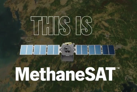
The 2024 Launch of MethaneSat
MethaneSAT, a subsidiary of the nonprofit Environmental Defense Fund, selected Blue Canyon Technologies in 2020 to supply its donor-funded satellite.
🌎
🌎
- Via Azavea 2023
Google Earth
Bing Maps Aerial
Mapbox Satellite Live
HERE WeGo - Map View / Satellite
Zoom Earth
~
Airbus
Blue Canyon Technologies
Capella
EagleView
Hexagon Geospatial
ICEYE (US)
LeoLabs
Maxxar
Nearmap
Planet | Planet API
- https://www.planet.com/
- https://developers.planet.com/docs/data/skysat/
- https://earth.esa.int/eogateway/missions/skysat
SpaceX - Rideshare
Spire
Vexcel Imaging
🌎
'New Space' | Democratization of Space
Space private sector Q2 2022 reports via @thesheetztweetz:
CNBC breaks down the most recent quarterly reports for Aerojet Rocketdyne, AST SpaceMobile, Astra, BlackSky, Iridium, Maxar, Momentus, Mynaric, Redwire, Rocket Lab, Satellogic, Spire Global, Telesat, Terran Orbital, ViaSat, Virgin Galactic and Virgin Orbit.
and Planet | https://www.cnbc.com/quotes/PL
Planet Labs PBC, formerly dMY Technology Group, Inc. IV, is a provider of global, daily satellite imagery and geospatial solutions. The Company designs, builds, and operates the Earth observation fleet of imaging satellites, capturing, and compiling data from over three million images per day. The Company’s automated, cloud-native platform processes and manages data catalogue and extracts information. The Company’s platform includes imagery, insights, and machine learning that enables companies, governments, and communities around the world to make decisions about evolving world. Its platform and analytics products include Planet Application Programming Interfaces (APIs), Planet Applications, Planet Basemaps, Planet Fusion, and Planet Analytics Feeds. The Company provides mission-critical data, advanced insights, and software solutions, across agriculture, forestry, intelligence, education and finance companies and government agencies, enabling users to derive satellite imagery.
$AJRD | $ASTS | $ASTR | $BKSY | $IRDM | $MAXR | $MNTS | $MYNA | $RDW
$RKLB | $SATL | $SPIR | $TSAT | $LLAP | $VSAT | $SPCE | $VORB
🌎
Earth Science Research from Space: Methane emissions
Extremely large emitters — releasing more than 25 tons per hour — can be seen and tracked from near-earth orbit
Earth imaging data from a sensor aboard a European satellite, Sentinel 5
Using data from 2019 and 2020, (scientists) located about 1,200 of these ultra emitters, a large portion of them from Russia, Turkmenistan, the United States, the Middle East and Algeria.
Total emissions from these sites were estimated at about 9 million tons per year. In terms of its potential to warm the planet, that much methane is equivalent to about 275 million tons of carbon dioxide, which is the total carbon footprint of 40 million people, based on the global average per capita.
Seen From Space: Huge Methane Leaks
- Methane, We're Watching
- Detecting methane from space
- "There has been quite a buzz around this unique advancement in space, and the valuable data it will provide on methane, a powerful greenhouse gas that accounts for a quarter of the warming our planet is experiencing today. Curbing anthropogenic methane emissions is one of the most efficient and economical options available to slow the rate of warming over the next few decades, while efforts continue to reduce CO2 emissions worldwide."
- ············································································································
- ·············································································································
Planet & Bioneer Leonardo DiCaprio join up with #Earth Vision
- Reefscape, Another New Way to View, Watch Over & Care for Our Common Home
··········································································································································
US environmental group wins millions to develop methane-monitoring satellite
The Environmental Defense Fund (EDF) is planning to be the first environmental group to send its own satellite into space
- “We need good solid data so that we really can support global action on climate change, and we’ve got to do it fast,” says Steven Hamburg, the EDF’s chief scientist.
- The most detailed measurements currently available of atmospheric methane concentrations come from a sensor aboard the European Space Agency’s Sentinel-5P spacecraft, which launched in October 2017. The Tropospheric Monitoring Instrument provides global coverage at a resolution of nearly 50 square kilometres, but those measurements at this time do not capture the dispersed sources of emissions from oil and gas fields.
- Commercial firms have developed high-resolution sensors that can be placed aboard 10-centimetre-sided CubeSats to measure emissions from individual wells or other facilities. Those data are proprietary, however, and the measurements currently cannot be scaled up to the level of an entire oil and gas field.
- The Environmental Defense Fund team is designing MethaneSAT to provide more-precise measurements, at a resolution of 1 square kilometre, with global coverage at least once a week.
○
As the Trump administration attempts to cut and eliminate the EPA and climate-related government programs, California sends a message...
California & Planet Labs Plan Satellite-Based Technologies to Track and Attack Climate Pollutants
- Global Climate Action / news @ https://www.greenpolicy360.net/w/Global_Climate_Action_Summit
○
SpaceX, NASA & Beginnings of 'New Space'
The first successful flight of the Falcon 1 (in 2008) served as a catalyst for the commercial space industry. The privately financed development of new rockets and spacecraft, as well as commercial businesses in space beyond telecommunications, had seen ups and downs over the years but never sustained success. SpaceX’s second successful launch of the Falcon 1 rocket in 2009, when it delivered a commercial satellite into orbit, sealed the deal.
“The impact that their first successful commercial launch had on the space industry cannot be overstated,” said Chad Anderson, who runs an investment group, Space Angels, that closely tracks public and private investment in spaceflight.
This initial success helped land a multibillion dollar contract from NASA to deliver cargo to the space station and ignited a furious decade in which SpaceX has gone from a single engine rocket, to one with nine engines, to one with 27 engines. The company has also developed two spacecraft, the Dragon 1 and 2, and landed dozens of first stages.
Before SpaceX began flying the Falcon 1 rocket, there were a few dozen privately funded companies, globally, engaged in spaceflight activities. Today (as of 2018), there are 350, and they have raised $15 billion in private capital...
○
○
Planet Labs is now just 'Planet'
Announcement - June 12, 2016
○
Will Marshall, November 2014 / Video: I'm going to show you what our satellite looks like: This is our satellite. This is not a scale model, this is the real size. It's 10 by 10 by 30 centimeters, it weighs four kilograms, and we've stuffed the latest and greatest electronics and sensor systems into this little package so that even though this is really small, this can take pictures 10 times the resolution of the big satellite here, even though it weighs one thousandth of the mass. And we call this satellite "Dove"...
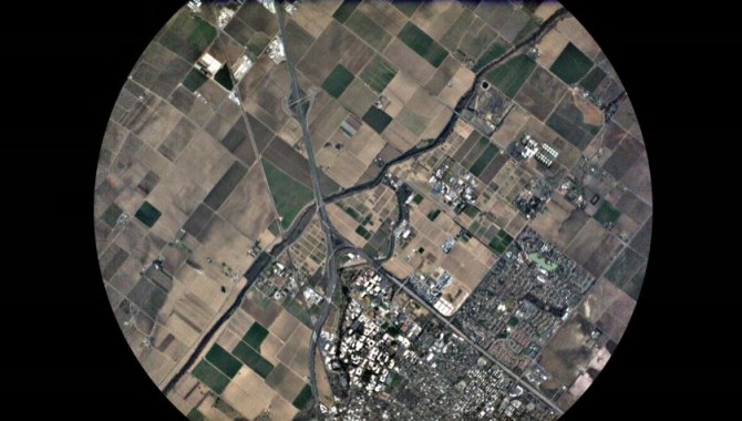
We've launched 28 [as of today]... It's the largest constellation of Earth-imaging satellites in human history, and it's going to provide a completely radical new data set about our changing planet. But that's just the beginning. You see, we're going to launch more than 100 of these satellites like these over the course of the next year. It's going to be the largest constellation of satellites in human history. And this is what it's going to do: Acting in a single-orbit plane that stays fixed with respect to the sun, the Earth rotates underneath. They're all cameras pointed down, and they slowly scan across as the Earth rotates underneath. The Earth rotates every 24 hours, so we scan every point on the planet every 24 hours. It's a line scanner for the planet. We don't take a picture of anywhere on the planet every day, we take a picture of every single place on the planet every day. Even though we launched these just a couple of weeks ago, we've already got some initial imagery from the satellites and I'm going to show it publicly for the first time right now. This is the very first picture taken by our satellite. It happened to be over UC-Davis' campus in California when we turned the camera on.
[W]e will be able to track urban growth as it happens around the whole world in all cities, every day.
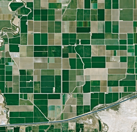
We'll be able to see the extent of all water bodies around the whole world every day and help water security. From water security to food security. We'll see crops as they grow in all the fields in every farmer's field around the planet every day. and help them to improve crop yield. This is a beautiful image that was taken just a few hours ago when the satellite was flying over Argentina. The general point is there are probably hundreds and thousands of applications of this data, I've mentioned a few, but there's others: deforestation, the ice caps melting. We can track all of these things, every tree on the planet every day. If you took the difference between today's image and yesterday's image, you'd see much of the world news — you'd see floods and fires and earthquakes. And we have decided, therefore, that the best thing that we could do with our data is to ensure universal access to it. We want to ensure everyone can see it. Thank you. (Applause) We want to empower NGOs and companies and scientists and journalists to be able to answer the questions that they have about the planet. We want to enable the developer community to run their apps on our data. In short, we want to democratize access to information about our planet.
○
Robbie Schingler, a co-founder of Planet Labs, met the director of NASA Ames, Pete Worden in Houston, TX. It was an inauspicious start to what was to become an eventful relationship that helped change the direction of the U.S. space program.
“For five hours we were yelling at each other across the table,” recalls Robbie Schingler, now 33, who was then between master’s degrees at the International Space University and the Georgetown University McDonough School of Business. “The next day he said, ‘Let’s write a paper together on the pros and cons of weaponizing space. You write the cons, I’ll write the pros.’”
The paper never materialized, but an unusual friendship and mentoring relationship did. When Worden became director of the NASA Ames Research Center in Silicon Valley four years later, he recruited the group of Houston 20-somethings, along with a handful of their friends. Included were Schingler and Chris Kemp, then 28, who would become Ames’s director of business development and later its chief technology officer.
○
How NASA led tech to the Cloud / WSJ - May 2012
NASA Oversight Hearing, Feb 25, 2015
Launched March 3, 2015, NASA #TechPort website #NASA’s latest tech development activities
○
Worden told SpaceNews that the nine years he spent at Ames were the most enjoyable of his 40 years of public service.
“In the last nine years we have launched dozens of small, low-cost satellites – and helped ignite a major new industry in this area. Ames people have revitalized space biology and begun to apply the new field of synthetic biology,” Worden said via email Feb. 26. “Ames has provided entry technology for the emerging commercial space launch sector. We have helped launch small satellites working with a number of nations. And we’ve hosted and inspired thousands of students.”
[GreenPolicy Siterunner: from early Cold War 'spin offs' of military R&D and defense spending came ARAPANET from DARPA, the genesis of today's Internet]
The future of NASA and SDI are a separate topic for others to address. Here at GreenPolicy we are tracking the utilization of technology that has moved from 'first generation' military purposes to first generation "New Space" 'open' uses. The democratization of space envisions moving from military-dependency to civilian / educational / environmental / scientific / engineering / resource monitoring and management -- a full spectrum of #EarthScience that, hopefully, brings a future of environmental-national-global security. Our position is that the application and re-purposing of initial space-borne military systems can be and should be applied to earth resource monitoring and management as legislative *technology transfer* has codified over the past two decades. The successful restructuring of the old Cold War systems is a challenge, without question, yet the example of Pete Worden and Planet Labs bring both hope and a direction that is worth pursuing in the face of rising security challenges that are global and threats to security within and across borders.
-=-=-=-=-=-=-=-=-=-=-
OpenStack strategy
OpenStack "Cloud in a Box"
A “New” model of Citizen Science
Micro-satellites, CubeSats, Nanosats / New ways to use OTS - off the shelf - components
-=-=-=-=-=-=-=-=-=-=-=-=-=-=-=-=-=-=-=-=-=-=-=-
The "New Space" field is pioneering the study of our blue planet with multiple new platforms monitoring earth systems and resources.
PlanetLabs, an early-stage new space pioneer, is out in front with its emphasis on open data sharing. Its mini satellites are called flocks of "Doves".
An API for the Planet #PlanetLabs: Open Source Conference Keynote (video)
Mission: "Democratizing Access to Information About the Changing Planet"
#PlanetLabs' API @the Open Source Conference
February 5, 2015 - Private Spending on Space Is Headed for a New Record - Space Race 2.0 #NewSpace
Planet Labs has raised more than $160 million and launched 73 global imaging satellites. The growth was hard to imagine three years ago, when co-founder Will Marshall built the first of the miniature satellites nicknamed “doves” in a Silicon Valley garage.
“A lot of people were very skeptical, and what we were trying to do seemed ludicrous,” said Marshall, a former engineer at NASA Ames Research Center in Mountain View, California. “But we have assets in orbit, and customers who are very interested in the data. Every time we take a picture, we can see how the world is changing.” -- Bloomberg
Planet Labs, flying Doves unprecedented, observing Planet Earth with 'rapid cadence' imaging opening possibilities never before offered
Connect
"Rapid cadence imagery, like Planet Labs is developing, helps us become better, more sustainable stewards of Earth."
"It is time, from a unique overview of our blue planet enabled from space, to address climate issues, sustainability challenges, and a host of existential challenges."
Citizens of the Planet -- #PlanetCitizens
It's time for an Earth point of view!
Earth Observations
National Science and Technology Council / US Group on Earth Observations Council
The Federal Government invests more than $3 billion in civil Earth observations and data annually across multiple agencies, and leverages investments made by State, local and tribal governments, academia and industry...
NOAA View Data Exploration Tool
- "New Space"
Generation 1.0, an era of Micro-satellites and #EarthImaging
○
An global community of #PlanetCitizens observing, networking, sharing information, protecting #PlanetEarth...
- Citizen Science
Citizen Science by Planet Citizens
○
Planet API | #PlanetAPI | Planet Citizen | #PlanetCitizen
GreenPolicy360 | #Earth360 | #EarthImaging | #EarthMonitoring
GP360 | #EarthObservations | #EarthScience | #NewSpace
www.planetcitizen.org | www.earthpov.com
○
- Your Mission if You Choose to Go
Democratising access to information about Planet Earth... Planet Labs brings home the data
Be one of the first ever on our voyage over time to show you're an Earth-wise #PlanetCitizen
○
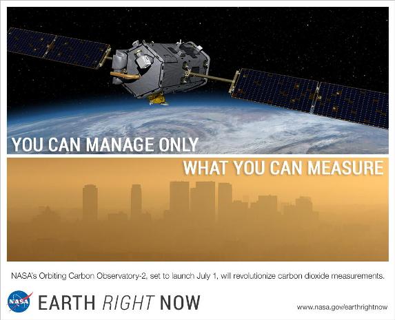
NASA’s Orbiting Carbon Observatory-2 (OCO-2): A game changer?
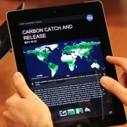
Seeing climate change from space: NASA creates image-based iPad app Ecowatch in space
Soon, each of us will be able to connect to and share earth-data as students of earth-space science and new digital networks.
With open data, links and digital apps, schools and future generations will learn new ways of seeing as citizens of the planet.
○
Geoscience: Eyes in the Sky, "New Space", Monitoring the Earth by Satellite
A New Era of Space Startups #Nanosatellites #Satdata
"Earth Imaging" -- NextGen #EarthScience in an era of #environmentalrisks and #globalsecurity threats
[1]... BlackBridge [2], Dauria [3], DigitalGlobe [4] #DigitalGlobe, highest rez commercially avail #earthimaging from space [5] [6] [7] GeoEye [8], Firefly Space Systems [9] [10], GeoOptics [11], NanoRacks [12], [13] [14], NovaWurks [15], OmniEarth [16] [17] [18] [19], OrbitLogic [20], PlanetiQ [21], Planet Labs [22] Pulse [23] [24] [25], RapidEye [26], Skybox [27] [28] [29], Teledyne [30], Tyvak Nano-Sat [31], Urthecast [32]
○
- Anthropocene
- Atmospheric Science
- Democratization of Space
- Earth Imaging
- Earth Observations
- Earth Science
- Eco-nomics
- NanoRacks
- New Space
- Planet API
- Planet Citizen
- Planet Citizens
- Planet Citizens, Planet Scientists
- PlanetLabs
- Space Science and Space Physics
- Sustainability
- Strategic Demands
- Topic
- Biogeosciences
- Climate Change
- Planetary Science
- Earth360
- EarthPOV
- Whole Earth
