File:Planet Labs, 'this is our Dove' Nov 2014.jpg
Planet_Labs,_'this_is_our_Dove'_Nov_2014.jpg (320 × 180 pixels, file size: 10 KB, MIME type: image/jpeg)
<addthis />
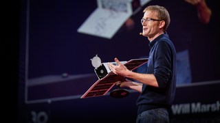
Will Marshall / Planet.com
Nov 2014
We've launched 28 [as of today]... It's the largest constellation of Earth-imaging satellites in human history, and it's going to provide a completely radical new data set about our changing planet. But that's just the beginning. You see, we're going to launch more than 100 of these satellites like these over the course of the next year. It's going to be the largest constellation of satellites in human history. And this is what it's going to do: Acting in a single-orbit plane that stays fixed with respect to the sun, the Earth rotates underneath. They're all cameras pointed down, and they slowly scan across as the Earth rotates underneath. The Earth rotates every 24 hours, so we scan every point on the planet every 24 hours. It's a line scanner for the planet.
We don't take a picture of anywhere on the planet every day, we take a picture of every single place on the planet every day. Even though we launched these just a couple of weeks ago, we've already got some initial imagery from the satellites and I'm going to show it publicly for the first time right now. This is the very first picture taken by our satellite. It happened to be over UC-Davis' campus in California when we turned the camera on. But what's even cooler is when we compare it to the previous latest image of that area, which was taken many months ago. And the image on the left is from our satellite, and we see buildings are being built. The general point is that we will be able to track urban growth as it happens around the whole world in all cities, every day.
We'll be able to see the extent of all water bodies around the whole world every day and help water security. From water security to food security. We'll see crops as they grow in all the fields in every farmer's field around the planet every day. and help them to improve crop yield. This is a beautiful image that was taken just a few hours ago when the satellite was flying over Argentina.
The general point is there are probably hundreds and thousands of applications of this data, I've mentioned a few, but there's others: deforestation, the ice caps melting. We can track all of these things, every tree on the planet every day. If you took the difference between today's image and yesterday's image, you'd see much of the world news — you'd see floods and fires and earthquakes. And we have decided, therefore, that the best thing that we could do with our data is to ensure universal access to it. We want to ensure everyone can see it. Thank you. (Applause) We want to empower NGOs and companies and scientists and journalists to be able to answer the questions that they have about the planet.
We want to enable the developer community to run their apps on our data. In short, we want to democratize access to information about our planet.
○
File history
Click on a date/time to view the file as it appeared at that time.
| Date/Time | Thumbnail | Dimensions | User | Comment | |
|---|---|---|---|---|---|
| current | 19:42, 14 June 2015 | | 320 × 180 (10 KB) | Siterunner (talk | contribs) | Category:Democratization of Space Category:Earth Observations Category:Earth Science Category:NanoRacks Category:New Space Category:Planet API Category:Planet Citizen Category:Planet Citizens, Planet Scientists [[Categor... |
You cannot overwrite this file.
File usage
There are no pages that use this file.
- Democratization of Space
- Earth Observations
- Earth Science
- Global Security
- NanoRacks
- New Space
- Planet API
- Planet Citizen
- Planet Citizens, Planet Scientists
- PlanetLabs
- Resilience
- Sustainability Policies
- Atmospheric Science
- Biogeosciences
- Climate Change
- Climate Policy
- Desertification
- Forests
- Land Use
- New Definitions of National Security
- Planetary Science
- Space Science and Space Physics
- Earth360
- EarthPOV
- Whole Earth