File:Earth Science Vital Signs, Pulse of the Planet Climate Essentials.png: Difference between revisions
Siterunner (talk | contribs) No edit summary |
Siterunner (talk | contribs) No edit summary |
||
| (3 intermediate revisions by the same user not shown) | |||
| Line 1: | Line 1: | ||
http://svs.gsfc.nasa.gov/Gallery/ClimateEssentials.html | |||
'''Earth Science ... Measuring & Monitoring Vital Signs''' | |||
: Earth and Space, Politics | |||
* http://svs.gsfc.nasa.gov/Gallery/ClimateEssentials.html | |||
* https://www.greenpolicy360.net/w/Earth_and_Space,_Politics | |||
Steve Schmidt / Founder, GreenPolicy360: | |||
Our #GreenPolicy360 network thanks Representative George E. Brown. | |||
The Congressman from California envisioned and led Earth Science initiatives in the US Congress. | |||
George Brown saw, with his physics training and engineering background, what needed to designed. | |||
The designs became planning, legislation, developing and organizing. George, quietly in his way, inspired. | |||
[[File:EarthScience Missions via the EOS - 2022.png]] | |||
:[[File:Earth Observing System - fleet of satellites.png]] | |||
<big><big>'''The Earth Observing System (EOS)'''</big></big> | |||
The mission of the Earth Observing System that became a core element of the ongoing NASA earth science programs was first envisioned in the 1970s. The constellation of satellites that now comprise a connected matrix of ongoing earth imaging programs (see the latest here) came about as the U.S. | |||
Congress realized in the years following NASA's establishment that Planet Earth was central to NASA's work. The initial NASA mission statement spoke of this study of Planet Earth as a key goal of NASA programs. A new science, space and technology Congressional Committee was created to envision and oversee these programs and one of the first realizations about the need for earth science came about through the LANDSAT program [https://www.greenpolicy360.net/w/Landsat_data_users_handbook '''(see here)''']. A historic moment brought into existence digital mapping, that is, [https://www.greenpolicy360.net/w/LANDSAT_and_Virginia_Tower_Norwood '''multi-spectral imaging of earth'''] from an orbiting satellite in space, envisioned and designed to collect and 'save' data of earth's living systems. This databank was considered to be essential by committee member George E. Brown who, as a physicist and engineer, began his three-decade + career in Congress. George eventually became known for his "big science" initiatives. What few knew back then at the beginning was how essential this data would become as climate science came into the light (in 1977 and '78 with George's work central to the drafting and passage of the first '''National Climate Act'''.) | |||
In the 1980s, the Earth Observing System (EOS) work began in earnest. | |||
NASA's Project Science Office years later described its beginning with this statement: | |||
''>Results from early missions shed light on critical components of the Earth system while prompting further, more advanced investigations. The NASA Earth Observing System (EOS) program was conceived in the 1980s and began to take shape in the early 1990s. EOS is comprised of a series of coordinated polar-orbiting satellites designed to monitor and understand key components of the climate system and their interactions through long-term global observations. The EOS missions focus on the following climate science areas: radiation, clouds, water vapor, and precipitation; the oceans; greenhouse gases; land-surface hydrology and ecosystem processes; glaciers, sea ice, and ice sheets; ozone and stratospheric chemistry; and natural and anthropogenic aerosols.'' | |||
🌎 | |||
Latest revision as of 19:50, 12 May 2024
Earth Science ... Measuring & Monitoring Vital Signs
- Earth and Space, Politics
Steve Schmidt / Founder, GreenPolicy360:
Our #GreenPolicy360 network thanks Representative George E. Brown.
The Congressman from California envisioned and led Earth Science initiatives in the US Congress.
George Brown saw, with his physics training and engineering background, what needed to designed.
The designs became planning, legislation, developing and organizing. George, quietly in his way, inspired.


The Earth Observing System (EOS)
The mission of the Earth Observing System that became a core element of the ongoing NASA earth science programs was first envisioned in the 1970s. The constellation of satellites that now comprise a connected matrix of ongoing earth imaging programs (see the latest here) came about as the U.S.
Congress realized in the years following NASA's establishment that Planet Earth was central to NASA's work. The initial NASA mission statement spoke of this study of Planet Earth as a key goal of NASA programs. A new science, space and technology Congressional Committee was created to envision and oversee these programs and one of the first realizations about the need for earth science came about through the LANDSAT program (see here). A historic moment brought into existence digital mapping, that is, multi-spectral imaging of earth from an orbiting satellite in space, envisioned and designed to collect and 'save' data of earth's living systems. This databank was considered to be essential by committee member George E. Brown who, as a physicist and engineer, began his three-decade + career in Congress. George eventually became known for his "big science" initiatives. What few knew back then at the beginning was how essential this data would become as climate science came into the light (in 1977 and '78 with George's work central to the drafting and passage of the first National Climate Act.)
In the 1980s, the Earth Observing System (EOS) work began in earnest.
NASA's Project Science Office years later described its beginning with this statement:
>Results from early missions shed light on critical components of the Earth system while prompting further, more advanced investigations. The NASA Earth Observing System (EOS) program was conceived in the 1980s and began to take shape in the early 1990s. EOS is comprised of a series of coordinated polar-orbiting satellites designed to monitor and understand key components of the climate system and their interactions through long-term global observations. The EOS missions focus on the following climate science areas: radiation, clouds, water vapor, and precipitation; the oceans; greenhouse gases; land-surface hydrology and ecosystem processes; glaciers, sea ice, and ice sheets; ozone and stratospheric chemistry; and natural and anthropogenic aerosols.
🌎
File history
Click on a date/time to view the file as it appeared at that time.
| Date/Time | Thumbnail | Dimensions | User | Comment | |
|---|---|---|---|---|---|
| current | 06:03, 20 February 2015 | 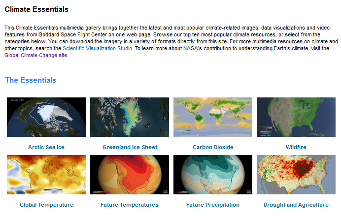 | 692 × 441 (207 KB) | Siterunner (talk | contribs) | Category:Green Graphics Category:Earth Science Category:Earth Observations Category:Green Graphics Category:Virtual Planet Category:Earth360 |
You cannot overwrite this file.
File usage
The following 8 pages use this file:
- EOS eco Operating System
- Green Graphics
- Best Practices
- Climate Change
- Climate Policy
- Green Best Practices
- Green Values
- Democratization of Space
- Digital Citizen
- Earth360
- Earth Observations
- Earth Science
- Earth Science from Space
- Environmental Security
- Global Warming
- ISS
- Micro-satellites
- NASA
- National Security
- Networking
- New Space
- Sea-Level Rise & Mitigation
- ThinBlueLayer
- United Nations Framework Convention on Climate Change
- Atmospheric Science
- Biogeosciences
- Cryosphere
- Geophysics and Geochemistry
- Mineralogy
- Geology
- Geophysics
- Hydrology
- Natural Resources
- Ocean Science
- Planetary Science
- Space Science and Space Physics
- Virtual Earth
- Virtual Planet