Category:Virtual Planet: Difference between revisions
Siterunner (talk | contribs) No edit summary |
Siterunner (talk | contribs) No edit summary |
||
| Line 11: | Line 11: | ||
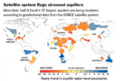
Geospatial Intelligence, or the frequently used term GEOINT, is an intelligence discipline comprising the exploitation and analysis of geospatial data and information to describe, assess, and visually depict physical features (both natural and constructed) and geographically referenced activities on the Earth. Geospatial Intelligence data sources include imagery and mapping data, whether collected by commercial satellite, government satellite, aircraft (such as Unmanned Aerial Vehicles [UAV] or reconnaissance aircraft), or by other means, such as maps and commercial databases, census information, GPS waypoints, utility schematics, or any discrete data that have locations on earth. | Geospatial Intelligence, or the frequently used term GEOINT, is an intelligence discipline comprising the exploitation and analysis of geospatial data and information to describe, assess, and visually depict physical features (both natural and constructed) and geographically referenced activities on the Earth. Geospatial Intelligence data sources include imagery and mapping data, whether collected by commercial satellite, government satellite, aircraft (such as Unmanned Aerial Vehicles [UAV] or reconnaissance aircraft), or by other means, such as maps and commercial databases, census information, GPS waypoints, utility schematics, or any discrete data that have locations on earth. | ||
Tags: Cartographic; Computational Geography; Geospatial technology; Geoscience; Geostatistics; GIS; Topographic Engineering | |||
Revision as of 16:42, 26 March 2015
Non-government virtual earth mapping
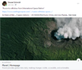
Government geospatial intelligence
Geospatial Intelligence, or the frequently used term GEOINT, is an intelligence discipline comprising the exploitation and analysis of geospatial data and information to describe, assess, and visually depict physical features (both natural and constructed) and geographically referenced activities on the Earth. Geospatial Intelligence data sources include imagery and mapping data, whether collected by commercial satellite, government satellite, aircraft (such as Unmanned Aerial Vehicles [UAV] or reconnaissance aircraft), or by other means, such as maps and commercial databases, census information, GPS waypoints, utility schematics, or any discrete data that have locations on earth.
Tags: Cartographic; Computational Geography; Geospatial technology; Geoscience; Geostatistics; GIS; Topographic Engineering
Subcategories
This category has only the following subcategory.
E
Pages in category "Virtual Planet"
The following 21 pages are in this category, out of 21 total.
A
C
U
Media in category "Virtual Planet"
The following 75 files are in this category, out of 75 total.
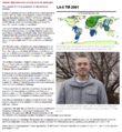
 2001 pic3.jpeg 800 × 450; 65 KB
 April 28, 2016.png 586 × 415; 159 KB
 Aquifers earthsciencefromspace Grace CA3.png 772 × 652; 559 KB
 Aquifers global earth observations by grace20150616-16 m.jpg 800 × 450; 117 KB
 Aquifers global earth observations by grace20150616-16.jpg 1,600 × 900; 317 KB
 Aquifers globalstudy 2015.png 668 × 451; 299 KB
 Aquifers June2015 past the tipping point.png 533 × 615; 195 KB
 AskNatureAvatar s.png 200 × 200; 14 KB
 Biden re Earth Day 2023.png 640 × 400; 155 KB
 California at the forefront of US environmental policies.png 600 × 450; 50 KB
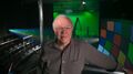
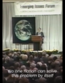 Carl Sagan at the Emerging Issues Forum - 1990.png 360 × 460; 192 KB
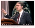 Carl Sagan at the Emerging Issues Forum.png 747 × 600; 600 KB
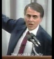 Carl Sagan, the atmosphere unifies and connects all of our world.png 360 × 390; 229 KB
 Climate-Action-Plan-World Bank-2016.png 780 × 6,050; 3.2 MB
 Desertification map.png 1,280 × 828; 588 KB
 Dove1 image.jpg 420 × 308; 26 KB
 Earth mapped.png 800 × 783; 254 KB
 Earth Science Vital Signs, Pulse of the Planet Climate Essentials.png 692 × 441; 207 KB
 Earth Science Vital Signs, Pulse of the Planet EOS NASA 2014.png 758 × 776; 366 KB
 Earth-NASA.jpg 800 × 265; 39 KB
 Earths-Future .jpg 351 × 198; 41 KB
 Earths-Future-cover.jpg 251 × 325; 48 KB
 EarthView.png 800 × 541; 1.06 MB
 EcoExplorer Maps.png 1,262 × 886; 810 KB
 EcoExploring Maps.png 957 × 830; 1.54 MB
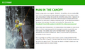 ECOTRAM - Don Perry.png 800 × 474; 390 KB
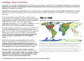
 Forests change between 2000 and 2012.jpg 676 × 932; 71 KB
 Fox on Earth Day 2023.jpg 640 × 275; 58 KB
 Global Climate Action Summit.png 640 × 400; 470 KB
 Global Forest Watch top page 2014.png 800 × 416; 350 KB
 Google Earth Hello2.png 800 × 375; 863 KB
 Google Earth invite-just in time for Earth Day.jpg 395 × 336; 69 KB
 Google Earth Outreach 2.jpg 640 × 441; 92 KB
 Google Earth VR - 2016.png 800 × 395; 477 KB
 Google Earth VR - 2017.jpg 635 × 479; 94 KB
 Haiku poems - Owl against a dusk sky - via Haiku Foundation.png 514 × 413; 144 KB
 Haikubox via RM citizen science.png 600 × 640; 466 KB
 In nature, nothing exists alone.jpg 500 × 357; 26 KB
 Landsat 50th anniv Sept 2016.jpg 800 × 456; 94 KB
 Landsat at 50.png 800 × 713; 345 KB
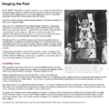 Landsat Imaging the Past-1.png 767 × 744; 242 KB
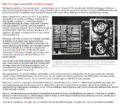 Landsat Imaging the Past-2.png 767 × 667; 329 KB
 Landsat Imaging the Past-3.png 767 × 560; 178 KB
 Landsat Imaging the Past-4.png 767 × 833; 496 KB
 Landsat Imaging the Past-5.png 767 × 870; 791 KB
 Landsat Imaging the Past-6.png 767 × 735; 385 KB
 LivingEarth2.png 800 × 503; 478 KB
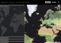
 Map of the World wiki commons m.png 679 × 314; 18 KB
 Map of the World wiki commons s.png 339 × 157; 13 KB
 Map of the World wiki commons.png 1,357 × 628; 19 KB
 NASA co2-graph-061219.jpg 800 × 500; 214 KB
 NASA test mission to protect earth from asteroid - Nov 2021.png 508 × 800; 424 KB
 Natural-capital-infograph-001.jpg 920 × 3,154; 279 KB
 New Ways of Seeing.jpg 580 × 242; 0 bytes
 OCO-2 March2015.png 811 × 663; 599 KB
 Planet and plan for an Earthdata platform.png 600 × 600; 280 KB
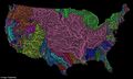
 River basins - watersheds.jpg 800 × 214; 111 KB
 Space stations - July 26 2022.png 544 × 462; 270 KB
 The Carbon Dioxide Theory of Climatic Change, by Gilbert Plass, 1956.jpg 798 × 1,202; 397 KB
 Thereisnoplanetb.com .jpg 940 × 198; 48 KB
 Timelapse.png 800 × 566; 676 KB
 Trumbull Studios.jpg 400 × 224; 45 KB
 Trumbull vfx master.jpg 575 × 323; 19 KB
 UN Mapping the World.png 740 × 477; 584 KB
 UNFCCC logo.png 336 × 96; 20 KB
 US River basins - watersheds.jpg 800 × 477; 131 KB
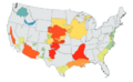 USGS Groundwater depletion map 2013.png 794 × 490; 238 KB
 Virtual Earth cover.png 800 × 479; 833 KB
 Water shortage 4B people sci report-2016.png 853 × 233; 148 KB
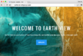
 Welcome to Earth View from Google.png 709 × 395; 395 KB
 Wind Power California US Tehachapi.png 802 × 445; 584 KB
 World Bank Group Climate Action Plan Apr2016.png 522 × 729; 244 KB
 World Bank Group Climate Change Action Plan 2016.png 512 × 256; 167 KB
 World Map - Mercator projection v Google maps.jpg 800 × 545; 101 KB


