Search results
Jump to navigation
Jump to search
Page title matches

File:LANDSAT - NASA.jpg <big><big>LANDSAT</big></big> LANDSAT's orbit -- https://www.youtube.com/watch?v=P-lbujsVa2M(622 × 415 (95 KB)) - 19:59, 23 July 2020
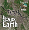
File:Landsat memories.png <big><big>'''Half Century of Earth Science: The Landsat Mission Continues'''</big></big> :: [[File:Landsat 9 about to launch.png]](535 × 473 (159 KB)) - 11:18, 3 October 2021
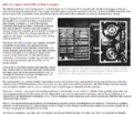
File:Landsat band imagery.png <big><big><big>'''Landsat'''</big></big></big> [[LANDSAT and Virginia Tower Norwood]](800 × 400 (907 KB)) - 01:59, 27 November 2022
File:Landsat band imagery2.png (800 × 400 (907 KB)) - 14:09, 15 February 2017
File:Landsat data site.png <big>'''[[Landsat data users handbook]]'''</big> ...ting its 50th anniversary this year, was developed at the beginning of the Landsat Earth observation satellite program as a place to store and distribute the(657 × 600 (499 KB)) - 15:22, 10 November 2023
File:Landsat Image Gallery.jpg <big><big>'''Landsat Image Gallery'''</big></big> * https://landsat.gsfc.nasa.gov/landsat-galleries(800 × 766 (187 KB)) - 20:17, 12 July 2021
File:Landsat at AT.png ''"Landsat has provided a critical reference for assessing long-term changes."'' ...he planet's surface—from farms and forests to glaciers and urban areas... "Landsat has provided a critical reference for assessing long-term changes to Earth'(762 × 598 (972 KB)) - 18:10, 11 October 2021
File:Landsat at 50.png ''https://www.doi.gov/employees/news/landsat-view-50'' <big><big><big>'''''50th Anniversary of Landsat'''''</big></big></big>(800 × 713 (345 KB)) - 23:58, 17 October 2016
File:Landsat 9 Launches - 2.jpg <big><big>'''9 Things About Landsat 9 !!!!!!!!!'''</big></big> ::Watch the Landsat Vid(600 × 737 (250 KB)) - 13:03, 28 September 2021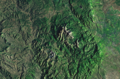
File:Colorado via Landsat-2001.png (732 × 484 (879 KB)) - 20:52, 22 February 2016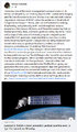
File:Landsat 9 about to launch.png ...earth science and protection mission. And he did what he promised and the Landsat program was born. George E Brown led its Congressional support for over 25 Godspeed Landsat...(420 × 721 (355 KB)) - 01:23, 3 May 2024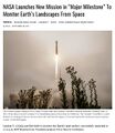
File:Landsat 9 Launches - 1.jpg <big><big>'''9 Things About Landsat 9 !!!!!!!!!'''</big></big> ::Watch the Landsat Vid(600 × 693 (128 KB)) - 11:29, 3 October 2021- ::[[File:Celebrating 50 Years of Landsat.png]] [[File:Landsat data site.png]]24 KB (3,316 words) - 14:17, 1 March 2024
File:Landsat, a 50 year legacy.png ...n Green]]''' work has made a positive difference in all of our lives!! The Landsat legacy carries on.... <big><big>'''NASA Landsat Program'''</big></big>(528 × 575 (288 KB)) - 20:32, 30 September 2023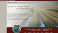
File:Landsat 50th anniv Sept 2016.jpg * ''https://www.doi.gov/employees/news/landsat-view-50'' ...of a 'Earth Observation' Program, a Vision of What Becomes a Multi-decade Landsat Mission'''''</big></big></big>(800 × 456 (94 KB)) - 23:37, 7 February 2024
File:Landsat NASA - Feb 11 2023.png <big>'''Landsat Flying for Over Fifty Years'''</big> ...n Green]]''' work has made a positive difference in all of our lives!! The Landsat legacy carries on....(763 × 600 (578 KB)) - 20:28, 30 September 2023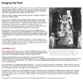
File:Landsat Imaging the Past-1.png <big>'''''Landsat'''''</big> ''http://landsat.gsfc.nasa.gov/?p=13026''(767 × 744 (242 KB)) - 00:27, 18 October 2016- [[File:Landsat band imagery.png]] <big><big>'''A Story of the Genius of Virginia Tower Norwood & Launch of Landsat's Earth Science Mission'''</big></big>35 KB (5,439 words) - 15:59, 26 December 2023
File:Landsat Imaging the Past-2.png <big>'''''Landsat'''''</big> ''http://landsat.gsfc.nasa.gov/?p=13026''(767 × 667 (329 KB)) - 00:27, 18 October 2016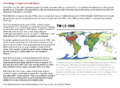
File:Landsat Imaging the Past-3.png <big>'''''Landsat'''''</big> ''http://landsat.gsfc.nasa.gov/?p=13026''(767 × 560 (178 KB)) - 00:27, 18 October 2016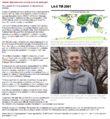
File:Landsat Imaging the Past-4.png <big>'''''Landsat'''''</big> ''http://landsat.gsfc.nasa.gov/?p=13026''(767 × 833 (496 KB)) - 00:28, 18 October 2016
File:Landsat Imaging the Past-5.png <big>'''''Landsat'''''</big> ''http://landsat.gsfc.nasa.gov/?p=13026''(767 × 870 (791 KB)) - 00:28, 18 October 2016
File:Landsat Imaging the Past-6.png <big>'''''Landsat'''''</big> ''http://landsat.gsfc.nasa.gov/?p=13026''(767 × 735 (385 KB)) - 02:07, 18 February 2019
File:Landsat launched 50 years ago today.png <big><big>'''NASA Landsat Program'''</big></big> :'''Landsat launched 50 years ago today in July 1972'''(528 × 779 (755 KB)) - 13:52, 24 July 2022
File:Landsat US collection of maps 1985-2021.png '''Landsat, a unique collection of earth science data'''(768 × 775 (1,018 KB)) - 23:53, 19 October 2022
File:NASA Launch of Landsat 9 - Sept 27, 2021.jpg <big><big>'''The Landsat Mission Continues'''</big></big>(675 × 772 (131 KB)) - 17:46, 27 September 2021
File:Landsat Issues, Oct 2014, US Congressional Research Service.pdf On February 11, 2013, NASA launched Landsat 8, a remote sensing satellite jointly operated by the U.S. Geological Survey and NASA. Landsat 8 is the latest in a series of Earth-observing(320 KB) - 17:31, 29 May 2015
File:Landsat-Google Maps Screen Shot 2016-06-17 Columbia Glacier.jpg (1,200 × 587 (312 KB)) - 13:39, 28 June 2016


Page text matches
File:LANDSAT - NASA.jpg <big><big>LANDSAT</big></big> LANDSAT's orbit -- https://www.youtube.com/watch?v=P-lbujsVa2M(622 × 415 (95 KB)) - 19:59, 23 July 2020File:Landsat 9 Launches - 1.jpg <big><big>'''9 Things About Landsat 9 !!!!!!!!!'''</big></big> ::Watch the Landsat Vid(600 × 693 (128 KB)) - 11:29, 3 October 2021
File:Virginia Norwood - 1948.jpg <big><big>'''[[LANDSAT and Virginia Tower Norwood]]'''</big></big> * https://www.science.org/content/article/meet-landsat-pioneer-who-fought-revolutionize-earth-observation(640 × 426 (74 KB)) - 20:24, 27 September 2021File:Landsat Imaging the Past-6.png <big>'''''Landsat'''''</big> ''http://landsat.gsfc.nasa.gov/?p=13026''(767 × 735 (385 KB)) - 02:07, 18 February 2019File:Landsat Imaging the Past-2.png <big>'''''Landsat'''''</big> ''http://landsat.gsfc.nasa.gov/?p=13026''(767 × 667 (329 KB)) - 00:27, 18 October 2016File:Landsat Imaging the Past-3.png <big>'''''Landsat'''''</big> ''http://landsat.gsfc.nasa.gov/?p=13026''(767 × 560 (178 KB)) - 00:27, 18 October 2016File:Landsat Imaging the Past-4.png <big>'''''Landsat'''''</big> ''http://landsat.gsfc.nasa.gov/?p=13026''(767 × 833 (496 KB)) - 00:28, 18 October 2016File:Landsat Imaging the Past-5.png <big>'''''Landsat'''''</big> ''http://landsat.gsfc.nasa.gov/?p=13026''(767 × 870 (791 KB)) - 00:28, 18 October 2016File:Landsat Imaging the Past-1.png <big>'''''Landsat'''''</big> ''http://landsat.gsfc.nasa.gov/?p=13026''(767 × 744 (242 KB)) - 00:27, 18 October 2016File:Landsat band imagery.png <big><big><big>'''Landsat'''</big></big></big> [[LANDSAT and Virginia Tower Norwood]](800 × 400 (907 KB)) - 01:59, 27 November 2022
File:Celebrating Earth's Beauty 2015.png Visit Landsat, the original earth imaging program, coming up on its 50th anniversary <big><big><big>'''June 2016: Coming Soon, 50th Anniversary of Landsat'''</big></big></big>(1,150 × 716 (1.53 MB)) - 13:45, 24 August 2016File:Landsat 9 Launches - 2.jpg <big><big>'''9 Things About Landsat 9 !!!!!!!!!'''</big></big> ::Watch the Landsat Vid(600 × 737 (250 KB)) - 13:03, 28 September 2021File:Landsat Image Gallery.jpg <big><big>'''Landsat Image Gallery'''</big></big> * https://landsat.gsfc.nasa.gov/landsat-galleries(800 × 766 (187 KB)) - 20:17, 12 July 2021File:Landsat 50th anniv Sept 2016.jpg * ''https://www.doi.gov/employees/news/landsat-view-50'' ...of a 'Earth Observation' Program, a Vision of What Becomes a Multi-decade Landsat Mission'''''</big></big></big>(800 × 456 (94 KB)) - 23:37, 7 February 2024File:Landsat at 50.png ''https://www.doi.gov/employees/news/landsat-view-50'' <big><big><big>'''''50th Anniversary of Landsat'''''</big></big></big>(800 × 713 (345 KB)) - 23:58, 17 October 2016File:Landsat NASA - Feb 11 2023.png <big>'''Landsat Flying for Over Fifty Years'''</big> ...n Green]]''' work has made a positive difference in all of our lives!! The Landsat legacy carries on....(763 × 600 (578 KB)) - 20:28, 30 September 2023File:Landsat Issues, Oct 2014, US Congressional Research Service.pdf On February 11, 2013, NASA launched Landsat 8, a remote sensing satellite jointly operated by the U.S. Geological Survey and NASA. Landsat 8 is the latest in a series of Earth-observing(320 KB) - 17:31, 29 May 2015File:Landsat at AT.png ''"Landsat has provided a critical reference for assessing long-term changes."'' ...he planet's surface—from farms and forests to glaciers and urban areas... "Landsat has provided a critical reference for assessing long-term changes to Earth'(762 × 598 (972 KB)) - 18:10, 11 October 2021- [https://svs.gsfc.nasa.gov/cgi-bin/details.cgi?aid=2095 Landsat flyover of Colorado] http://eros.usgs.gov/imagegallery/landsat-state-mosaics#http://eros.usgs.gov/sites/all/files/external/imagegallery/2491 members (0 subcategories, 7 files) - 00:03, 23 February 2016
File:Celebrating 50 Years of Landsat.png <big>'''Celebrating 50 Years of the Landsat's Earth Mapping Mission'''</big>(600 × 610 (909 KB)) - 18:01, 21 May 2023
File:Floating Forest Project.png ...on in how to hunt for giant kelp in satellite imagery. They are then given Landsat images and asked to outline any giant kelp patches that they find. Their fi ...January 11, 2015, more than 3,400 citizen scientists are reviewing 328,000 Landsat images ...(1,106 × 604 (1,020 KB)) - 20:45, 16 March 2021
File:Multispectral scanner image of Yosemite Half Dome - collection of Virginia Tower Norwood.jpg [[LANDSAT and Virginia Tower Norwood]](579 × 669 (177 KB)) - 16:52, 12 July 2021
File:Mysterious circles around the world.png ...Brown was proposing and pushing the start up of US earth science imaging w Landsat and what became over decades a constellation of earth observation satellite [[File:Landsat, a 50 year legacy.png]](733 × 600 (655 KB)) - 20:39, 30 September 2023
File:Memories of Big Science advocates in the US Congress.jpg ...(like George E Brown) who first proposed earth science satellite missions (Landsat, GPS, open data/sharing), then had to fight to protect these missions and p [[File:Landsat, a 50 year legacy.png]](583 × 279 (87 KB)) - 13:16, 24 July 2022
File:Mangroves and Coastal Wetlands tracked by Landsat.png :::<big><big>'''Landsat, 50+ years of measuring and monitoring'''</big></big> ...g and monitoring Earth's life-enabling systems was given highest priority. Landsat's program was set in motion as a decades long, first-ever digital scanning(600 × 716 (245 KB)) - 22:36, 31 August 2022File:Landsat memories.png <big><big>'''Half Century of Earth Science: The Landsat Mission Continues'''</big></big> :: [[File:Landsat 9 about to launch.png]](535 × 473 (159 KB)) - 11:18, 3 October 2021File:Landsat 9 about to launch.png ...earth science and protection mission. And he did what he promised and the Landsat program was born. George E Brown led its Congressional support for over 25 Godspeed Landsat...(420 × 721 (355 KB)) - 01:23, 3 May 2024
File:Multispectral Scanning Systen - MSS.jpg * https://landsat.gsfc.nasa.gov/</big> [[File:Celebrating 50 Years of Landsat.png]](688 × 587 (103 KB)) - 23:30, 14 April 2024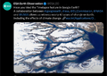
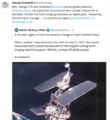
File:Timelapse.png ::George E. Brown (Landsat) and Rebecca Moore (Google Earth Outreach) [[File:Landsat data site.png]](800 × 566 (676 KB)) - 16:35, 10 November 2023File:Landsat data site.png <big>'''[[Landsat data users handbook]]'''</big> ...ting its 50th anniversary this year, was developed at the beginning of the Landsat Earth observation satellite program as a place to store and distribute the(657 × 600 (499 KB)) - 15:22, 10 November 2023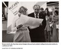
File:Virginia Tower Norwood and James Hodgson - 1972.jpg <big>'''[[LANDSAT and Virginia Tower Norwood]]'''</big>(589 × 489 (69 KB)) - 13:08, 31 July 2022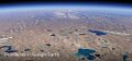
File:Timelapse in Google Earth-4.jpg ...our GreenPolicy360 hat to '''[[George E. Brown Jr]]''' who envisioned the Landsat's mission and enabled its start up as a science leader in the US Congress, ...has led many follow on initiatives, now including Timelapse, utilizing the Landsat database and its decades of images to bring us an unprecedented vision of e(525 × 244 (51 KB)) - 18:14, 17 April 2021
File:Jerry Brown AGU-Dec14,2016.png ...enomena, the [https://www.greenpolicy360.net/w/Landsat_data_users_handbook LANDSAT] and [https://www.greenpolicy360.net/w/Earth_Science_Research_from_Space al ''"Well, '''I remember back in 1978 I proposed a LANDSAT satellite for California.''' They called me 'Governor Moonbeam' because of(476 × 344 (117 KB)) - 19:42, 9 September 2022
File:Floating Forests-Kelp -- Oceanlight.jpg ''They (you) are then given Landsat images and asked to outline any giant kelp patches that they find.'' ...re than 3,400 citizen scientists had joined up to look for kelp in 328,000 Landsat images...''(720 × 480 (137 KB)) - 19:40, 27 February 2024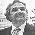
File:George E Brown.jpg ...moving toward its fifth decade with [http://landsat.gsfc.nasa.gov/?p=10391 Landsat 9.](200 × 200 (7 KB)) - 17:50, 5 December 2021
File:NASA logo1.jpg :Landsat :Landsat(304 × 166 (6 KB)) - 15:21, 7 June 2023File:Landsat US collection of maps 1985-2021.png '''Landsat, a unique collection of earth science data'''(768 × 775 (1,018 KB)) - 23:53, 19 October 2022- ...ures/FloatingForests/page1.php ''Floating Forests - Earth Observatory/NASA-Landsat''] ...istent, repeated observations,” Cavanaugh said. He devised a method to use Landsat satellite data to monitor kelp forests.243 members (4 subcategories, 195 files) - 23:56, 3 May 2019
File:NASA Launch of Landsat 9 - Sept 27, 2021.jpg <big><big>'''The Landsat Mission Continues'''</big></big>(675 × 772 (131 KB)) - 17:46, 27 September 2021File:Landsat launched 50 years ago today.png <big><big>'''NASA Landsat Program'''</big></big> :'''Landsat launched 50 years ago today in July 1972'''(528 × 779 (755 KB)) - 13:52, 24 July 2022
File:NASA test mission to protect earth from asteroid - Nov 2021.png ...g and monitoring Earth's life-enabling systems was given highest priority. Landsat's program was set in motion as a decades long, first-ever digital scanning(508 × 800 (424 KB)) - 15:12, 23 November 2021
File:Rebecca Google Outreach.jpg '''50+ Years of Landsat, the digital imaging database is unique and a rich treasure!''' [[File:Landsat launched 50 years ago today.png]](276 × 183 (9 KB)) - 23:15, 4 January 2024
File:Digital.png : '''[[Landsat data users handbook]]'''(427 × 116 (51 KB)) - 13:25, 12 March 2024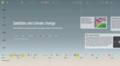
File:How satellites monitor climate change circa 2016.png [[File:Landsat launched 50 years ago today.png]] Read about the beginnings of Earth Imaging from Space with NASA / USGS / and Landsat, thru the eyes of visionary --(599 × 327 (0 bytes)) - 15:05, 11 November 2022
File:Human population map interactive.png ...s what this post is about. Before that, here are some basic data details - Landsat data from 1975, 1990, 2000 and 2014 were processed and analysed in order to(640 × 447 (106 KB)) - 20:46, 30 December 2018
File:What happens next is ... the Greenhouse Effect - explained by Carl Sagan, 1985.png [https://www.greenpolicy360.net/w/LANDSAT_and_Virginia_Tower_Norwood '''Landsat & Digital Origins of Earth Science/Imaging/Measuring & Monitoring'''](534 × 488 (110 KB)) - 21:01, 16 August 2023- * Landsat Data Users Handbook - https://www.greenpolicy360.net/w/Landsat_data_users_h713 members (14 subcategories, 630 files) - 16:02, 4 March 2024
File:Landsat, a 50 year legacy.png ...n Green]]''' work has made a positive difference in all of our lives!! The Landsat legacy carries on.... <big><big>'''NASA Landsat Program'''</big></big>(528 × 575 (288 KB)) - 20:32, 30 September 2023- ::[[File:Celebrating 50 Years of Landsat.png]] [[File:Landsat data site.png]]24 KB (3,316 words) - 14:17, 1 March 2024
- ''USGS Landsat - https://twitter.com/USGSLandsat [[File:Landsat band imagery2.png]]615 members (18 subcategories, 536 files) - 05:34, 6 May 2024
- ::George E. Brown (Landsat) and Rebecca Moore (Google Earth Outreach) ...have been possible without NASA and the United States Geological Survey’s Landsat program, the world’s first (and longest-running) civilian Earth observati12 KB (1,479 words) - 13:56, 26 March 2023

File:Act now for a livable future.png ...es (e.g., [https://www.greenpolicy360.net/w/Landsat_data_users_handbook '''Landsat's start up'''] and a [https://www.greenpolicy360.net/w/Earth_Science_Resear(501 × 275 (272 KB)) - 02:08, 7 August 2023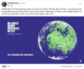
File:Gavin in Glasgow - Nov 10 2021.png <big>'''[[Landsat data users handbook]]'''</big>(728 × 600 (378 KB)) - 13:36, 10 November 2021
File:Google Earth invite-just in time for Earth Day.jpg ...have been possible without NASA and the United States Geological Survey’s Landsat program, the world’s first (and longest-running) civilian Earth observati ...our GreenPolicy360 hat to '''[[George E. Brown Jr]]''' who envisioned the Landsat's mission, the beginning of earth imaging and open access to the data and a(395 × 336 (69 KB)) - 15:04, 29 April 2021- ...magery w/ Landsat 8 -- [http://landsat.gsfc.nasa.gov/?p=10391 '''Next up, "Landsat 9"'''] ...earth science and protection mission. And he did what he promised and the Landsat program was born. George E Brown led its Congressional support for over 2520 KB (2,926 words) - 00:47, 3 May 2024
- Since 1972, when NASA launched the first Landsat satellite to track changes on the earth's surface, the agency has been incr 50 plus years of Landsat6 KB (839 words) - 19:41, 1 June 2023
- and 50+ Years of Landsat mapping our world after proposing/engineering/launching into orbit a revolu ...a platform that rolled out the beginnings of a visionary digital library. Landsat's imaging and earth observations were envisioned and designed to be used fo14 KB (2,063 words) - 12:39, 22 April 2023

File:Forests change between 2000 and 2012.jpg Landsat satellite data reveal that nearly three times more forest cover was lost th ...etation taller than 5m in height.” We produced a percentage tree cover per Landsat pixel layer for the year 2000(676 × 932 (71 KB)) - 18:17, 8 April 2017
File:EarthScience Missions via the EOS - 2022.png ...ndsat program took off and the data that began coming back from near-orbit Landsat satellites forever changed how we see, study and interact with our home pla ...Search&profile=default&search=landsat&fulltext=Search '''highlights of the Landsat and first earth observation satellites'''], the beginnings of the Earth Obs(800 × 219 (139 KB)) - 16:49, 8 May 2024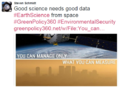
File:Good science needs good data .png ...nd monitoring Earth's life-enabling systems was given highest priority. '''Landsat's program was set in motion as a decades long, first-ever digital scanning ...oving into its fifth decade with [http://landsat.gsfc.nasa.gov/?p=10391 '''Landsat 9'''.](579 × 420 (223 KB)) - 23:31, 14 April 2024
File:Earth Observing System - fleet of satellites.png ...ndsat program took off and the data that began coming back from near-orbit Landsat satellites forever changed how we see, study and interact with our home pla <big>'''[[George E. Brown Jr]]'''</big> | <big>'''[[LANDSAT and Virginia Tower Norwood]]'''</big> | <big>'''"[[Generation Green]]"'''</(740 × 576 (557 KB)) - 19:39, 15 April 2023
File:The Original Mission Statement of NASA.png Since 1972, when NASA launched the first Landsat satellite to track changes on the earth's surface, the agency has been incr 50 plus years of Landsat(787 × 166 (14 KB)) - 15:14, 1 March 2024
File:Earth Summit 1992-s.png ...es (e.g., [https://www.greenpolicy360.net/w/Landsat_data_users_handbook '''Landsat's start up'''] and a [https://www.greenpolicy360.net/w/Earth_Science_Resear(336 × 418 (283 KB)) - 17:31, 21 August 2023
File:Earth mapped.png [[File:Landsat band imagery2.png|link=https://www.greenpolicy360.net/w/Landsat_data_users_(800 × 783 (254 KB)) - 15:01, 31 July 2022- ..., Jason-2 and DSCOVR. In 1983, NOAA assumed operational responsibility for Landsat satellite system.''652 members (7 subcategories, 585 files) - 13:28, 24 May 2022

File:Congressman george.e.brown.gif ...u now -- but what you did w the EPA, and Clean Air, and Climate Study, and Landsat Earth Science and on and on and on is alive today -- and we all have a bett [[File:Landsat 50th anniv Sept 2016.jpg]](235 × 305 (41 KB)) - 21:34, 23 April 2020- ...s to save [https://www.greenpolicy360.net/w/Landsat_data_users_handbook '''Landsat's whole earth observation as a central dynamic data resource'''.]1,221 members (18 subcategories, 1,076 files) - 15:17, 8 October 2023
- [[File:Landsat band imagery.png]] <big><big>'''A Story of the Genius of Virginia Tower Norwood & Launch of Landsat's Earth Science Mission'''</big></big>35 KB (5,439 words) - 15:59, 26 December 2023
- ...g database] of imagery of Earth that is moving on to its fifth decade with Landsat 9 (and open access) as a result of Brown's efforts. On the House science co ...w moving into its fifth decade with [http://landsat.gsfc.nasa.gov/?p=10391 Landsat 9.]816 members (8 subcategories, 739 files) - 16:14, 3 June 2023
File:Methods to enforce climate pledges-NDCs - Dec 2021.png [[File:Landsat, a 50 year legacy.png]] * https://www.greenpolicy360.net/w/File:Landsat,_a_50_year_legacy.png(539 × 480 (333 KB)) - 21:21, 28 February 2024
File:Earth Science Vital Signs, Pulse of the Planet Climate Essentials.png ...first realizations about the need for earth science came about through the LANDSAT program [https://www.greenpolicy360.net/w/Landsat_data_users_handbook '''(s(692 × 441 (207 KB)) - 19:50, 12 May 2024- ...hat has observed the Earth since the 1970s. For 2015 and 2016, we combined Landsat 8 imagery with imagery from Sentinel-2A, part of the European Commission an ...generation is building on. The economic/ecological/scientific benefits of LANDSAT, for over fifty years now in operation, are immense.36 KB (5,041 words) - 22:34, 17 May 2024
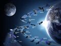
File:NASA orbiting fleet 2015.jpg ...ical Rainfall Measuring Mission (TRMM) was launched in 1997; the youngest, Landsat 8, was launched in February 2013. Together the fleet monitors a wide range(1,500 × 1,125 (866 KB)) - 00:12, 23 March 2023- Until recently, since the launch of the original ''Landsat'' program in 1972, generating images of Earth from space has been the near- ...in a profound number of extensions and uses to which the earth science of LANDSAT is being employed to benefit environmental security.943 members (19 subcategories, 839 files) - 13:03, 26 December 2023
- ...ed the first [https://www.greenpolicy360.net/w/Landsat_data_users_handbook Landsat satellite] to track changes on the earth’s surface, the agency has been i334 members (7 subcategories, 288 files) - 10:19, 21 September 2023
File:Earth Summit 1992.jpg ...es (e.g., [https://www.greenpolicy360.net/w/Landsat_data_users_handbook '''Landsat's start up'''] and a [https://www.greenpolicy360.net/w/Earth_Science_Resear(600 × 746 (171 KB)) - 21:20, 22 February 2024- '''Landsat, Earth Imaging, Digital Archiving, Atmospheric Science, Earth Observation S ...ndsat program took off and the data that began coming back from near-orbit Landsat satellites forever changed how we see, study and interact with our world.28 KB (4,066 words) - 15:24, 7 May 2024

File:On the road sjs.jpg '''Landsat, Earth Imaging, Digital Archiving, Atmospheric Science, Earth Observation S ...ndsat program took off and the data that began coming back from near-orbit Landsat satellites forever changed how we see, study and interact with our world.(293 × 249 (0 bytes)) - 21:21, 30 April 2024- ...g database] of imagery of Earth that is moving on to its fifth decade with Landsat 9 (and open access) as a result of Brown's efforts. On the House science co ...w moving into its fifth decade with [http://landsat.gsfc.nasa.gov/?p=10391 Landsat 9.]28 KB (4,045 words) - 20:38, 9 May 2024
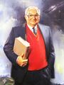
File:George E. Brown official portrait.jpg ...cy (EPA), yes the history of the EPA's formation is a story in itself; the Landsat program, the longest-running Earth Science study from space and and a const <big>'''[[Landsat data users handbook]]'''</big>(336 × 448 (75 KB)) - 14:49, 1 June 2023
File:Monitoring Greenhouse Gases from Satellite Missions 2021-2030.png ...over the earth science work of these essential missions of NASA/NOAA/USGS, Landsat and EOS and on and on. ...endlines, observing of changes over time started with George's 'baby', the Landsat mission and digital data collection instrumentation (thank you [https://www(801 × 386 (143 KB)) - 21:06, 10 November 2022- ...w moving into its fifth decade with [http://landsat.gsfc.nasa.gov/?p=10391 Landsat 9.] * https://landsat.gsfc.nasa.gov/landsat-935 KB (4,544 words) - 01:43, 13 April 2024
- ...rge believed strongly that the Earth Science of NASA, and agencies such as Landsat's USGS, and all the related educational, scientific, and business organizat15 KB (2,247 words) - 19:46, 6 May 2024

File:Global Stocktake, the first GST.jpg ...over the earth science work of these essential missions of NASA/NOAA/USGS, Landsat and EOS and on and on. ...endlines, observing of changes over time started with George's 'baby', the Landsat mission and digital data collection instrumentation (thank you [https://www(800 × 905 (513 KB)) - 02:47, 4 May 2024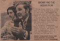
File:Rep George Brown and Steve Schmidt - Oct 15, 1969 - 448x305.png ...ing a new [https://www.greenpolicy360.net/w/Landsat_data_users_handbook '''Landsat program'''] into existence. I remember meeting, then years of learning, sha(448 × 305 (272 KB)) - 14:20, 21 April 2024- ...o propose [https://www.greenpolicy360.net/w/Landsat_data_users_handbook '''Landsat missions'''] that came to be called 'Big Science', Earth Imaging/Earth Scie ...ures/FloatingForests/page1.php ''Floating Forests - Earth Observatory/NASA-Landsat'']39 KB (5,385 words) - 22:55, 14 May 2024
- ...w moving into its fifth decade with [http://landsat.gsfc.nasa.gov/?p=10391 Landsat 9.] : Landsat and [https://www.greenpolicy360.net/w/LANDSAT_and_Virginia_Tower_Norwood Vi1,442 members (38 subcategories, 1,238 files) - 15:58, 7 April 2024
- [[File:Mangroves and Coastal Wetlands tracked by Landsat.png]] '''The Landsat program’s 50 years of Earth observations have revolutionized the study of35 KB (4,728 words) - 14:59, 27 February 2024
- ...ing a new [https://www.greenpolicy360.net/w/Landsat_data_users_handbook '''Landsat program'''] into existence. I remember years of learning, sharing and work ...ions like [https://www.greenpolicy360.net/w/Landsat_data_users_handbook '''Landsat''']. We shared plans, dreams, and stories. Many of the memories are recalle65 KB (9,719 words) - 17:57, 27 April 2024
- ...o propose [https://www.greenpolicy360.net/w/Landsat_data_users_handbook '''Landsat missions'''] that came to be called 'Big Science', Earth Imaging/Earth Scie ::George E. Brown (Landsat) and Rebecca Moore (Google Earth Outreach)29 KB (3,844 words) - 20:33, 14 May 2024
- ...in a profound number of extensions and uses to which the earth science of LANDSAT is being employed to benefit environmental security. ...hat has observed the Earth since the 1970s. For 2015 and 2016, we combined Landsat 8 imagery with imagery from Sentinel-2A, part of the European Commission an55 KB (7,656 words) - 20:23, 17 May 2024
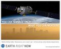
File:You can manage only what you can measure Dr David Crisp, OCO-2, June 2014 m.jpg ...ing a new [https://www.greenpolicy360.net/w/Landsat_data_users_handbook '''Landsat program'''] into existence. I remember years of learning, sharing and work <big>'''[[Landsat data users handbook]]'''</big>(573 × 465 (45 KB)) - 23:49, 12 May 2024- ...g and monitoring Earth's life-enabling systems was given highest priority. Landsat's program was set in motion as a decades long, first-ever digital scanning24 KB (3,228 words) - 20:32, 22 March 2024
- ...enomena, the [https://www.greenpolicy360.net/w/Landsat_data_users_handbook LANDSAT] and [https://www.greenpolicy360.net/w/Earth_Science_Research_from_Space al ''"Well, I remember back in 1978 I proposed a LANDSAT satellite for California. They called me 'Governor Moonbeam' because of tha30 KB (3,958 words) - 15:34, 15 April 2021
- ...g and monitoring Earth's life-enabling systems was given highest priority. Landsat's program was set in motion as a decades long, first-ever digital scanning30 KB (4,225 words) - 20:22, 2 May 2024
File:Union Oil Spill On the Calif Coast - January 1969.png ...g and monitoring Earth's life-enabling systems was given highest priority. Landsat's program was set in motion as a decades long, first-ever digital scanning(640 × 326 (196 KB)) - 23:40, 5 May 2023- ...g and monitoring Earth's life-enabling systems was given highest priority. Landsat's program was set in motion as a decades long, first-ever digital scanning21 KB (2,957 words) - 15:31, 11 July 2023
- ...g and monitoring Earth's life-enabling systems was given highest priority. Landsat's program was set in motion as a decades long, first-ever digital scanning28 KB (3,893 words) - 12:11, 5 May 2024
- ...eated, the first clean air laws led to earth observation missions, such as Landsat, to study Earth and Earth's atmosphere. I was fortunate to know George E. B ''They (you) are then given Landsat images and asked to outline any giant kelp patches that they find.''70 KB (9,551 words) - 12:46, 18 May 2024
- ...es (e.g., [https://www.greenpolicy360.net/w/Landsat_data_users_handbook '''Landsat's start up'''] and a [https://www.greenpolicy360.net/w/Earth_Science_Resear ...g and monitoring Earth's life-enabling systems was given highest priority. Landsat's program was set in motion as a decades long, first-ever digital scanning48 KB (6,642 words) - 00:34, 3 May 2024


