|
|
| Line 140: |
Line 140: |
|
| |
|
| [http://www.nnvl.noaa.gov/view/ ''NOAA View Data Exploration Tool''] | | [http://www.nnvl.noaa.gov/view/ ''NOAA View Data Exploration Tool''] |
|
| |
| ____________________________________________________________________________________________________________________________________________
| |
|
| |
|
| |
| [[File:Urthecast s.png]]
| |
|
| |
| '''Urthecast'''
| |
|
| |
| [https://www.urthecast.com/developer ''Urthecast APIs'']
| |
|
| |
| [https://www.urthecast.com/features '''''Live views of #PlanetEarth from the #ISS''''']
| |
|
| |
| ''UrtheCast -- developing the world’s first Ultra HD video feed of Earth, streamed in full color from cameras on the International Space Station.''
| |
|
| |
| [http://blog.urthecast.com/archive/ ''Archive'']
| |
|
| |
| [https://www.urthecast.com/firstlight '''''First Light'''']
| |
|
| |
|
| ____________________________________________________________________________________________________________________________________________ | | ____________________________________________________________________________________________________________________________________________ |
| Line 169: |
Line 152: |
|
| |
|
| [http://www.greenpolicy360.net/w/Category:Earth_Science_from_Space ''#EarthScience from Space''] | | [http://www.greenpolicy360.net/w/Category:Earth_Science_from_Space ''#EarthScience from Space''] |
|
| |
| ____________________________________________________________________________________________________________________________________________
| |
|
| |
| =='''''Google Earth Outreach'''''==
| |
|
| |
| [[File:Rebecca Google Outreach.jpg]]
| |
|
| |
| [http://www.google.com/earth/outreach/tools/earthengine.html '''''Google Earth Engine & Outreach''''']
| |
|
| |
| ''Google Earth Engine is an online environment monitoring platform that makes available to the entire world a dynamic digital model of our planet that is updated daily.''
| |
|
| |
| ''The Google Earth Outreach Engine stores petabytes of satellite data and allows high-performance tools to analyze and interpret this information that can then be visualized on a map...''
| |
|
| |
|
| ○ ○ ○ ○ | | ○ ○ ○ ○ |
|
| |
|
| ''Community of #PlanetCitizens observing, networking, sharing information, protecting #PlanetEarth...'' | | ''Community of #PlanetCitizens observing, networking, sharing information, protecting #PlanetEarth...'' |
|
| |
| ○ ○ ○ ○
| |
|
| |
| '''''Recent Earth Outreach network extensions include --'''''
| |
|
| |
| [http://www.greenpolicy360.net/w/File:G_Earth_Outreach.jpg '''''Global Fishing Watch and Forest Watch''''']
| |
|
| |
| '''''Join in !'''''
| |
|
| |
| ○ ○ ○ ○
| |
|
| |
| [http://www.greenpolicy360.net/w/Global_Fishing_Watch '''''Global Fishing Watch Launches''''']
| |
|
| |
| [http://globalfishingwatch.org/oceana-global-fishing-watch-report.pdf '''''Global Fishing Watch''''']
| |
|
| |
| [[File:Global Fishing Watch 2.jpg | link=http://www.greenpolicy360.net/w/Global_Fishing_Watch]]
| |
|
| |
| ○ ○ ○ ○
| |
|
| |
| '''''Global Forest Watch launches - 2014'''''
| |
|
| |
| [http://www.greenpolicy360.net/mw/images/G_Earth_Outreach.jpg '''''Google Outreach continues its impact''''']
| |
|
| |
| [[Image:GFW1a.jpeg | link=http://GlobalForestWatch.org]]
| |
|
| |
| '''''http://GlobalForestWatch.org'''''
| |
|
| |
| [http://www.wri.org/our-work/project/global-forest-watch '''''World Resources Institute Forest Watch''''']
| |
|
| |
| [http://google-latlong.blogspot.com/2014/02/monitoring-worlds-forests-with-global.html '''''Monitoring the Planet's Forests''''']
| |
|
| |
|
| |
| [http://www.greenpolicy360.net/w/File:G_Earth_Outreach.jpg '''''Earth Outreach''''']
| |
|
| |
| [https://plus.google.com/104105656721944993244/posts/gEGAkFJvXvX '''''GreenPolicy at Google+''''']
| |
|
| |
|
| |
| [https://plus.google.com/+StevenSchmidt1/posts/2ntxMkhNpf5 '''''Thank you Rebecca, #PlanetCitizen''''']
| |
|
| |
|
| |
| ○ ○ ○ ○
| |
|
| |
|
| |
| [http://www.programmableweb.com/news/google-earth-api-set-execution/2014/12/12 ''Dec 2014 News re: Google Earth API'']
| |
|
| |
| ''Google promises expansion of Google Earth to other 3D mapping products after Dec 2015. As to what, and when, we'll wait and see...''
| |
|
| |
|
| |
| ○ ○ ○ ○
| |
|
| |
| == '''''More APIs for the Planet & Connected Planet Citizens''''' ==
| |
|
| |
|
| |
| [[File:Global Biodiversity GBIF.org.png | link=http://www.gbif.org/]]
| |
|
| |
|
| |
| [http://www.gbif.org/ ''Global Biodiversity Information, free and open access to biodiversity data''] - [http://data.gbif.org/terms.htm ''Global Biodiversity / Terms'']
| |
|
| |
|
| |
| ○ ○ ○ ○
| |
|
| |
|
| |
| [[File:Floating forest of kelp.jpg | link=http://www.greenpolicy360.net/w/Planet_Citizens,_Planet_Scientists]]
| |
|
| |
|
| |
| ; <big><big> ''Floating Forests'' </big></big>
| |
|
| |
| '''''Help with the Kelp, Join in''''' -- ''be a'' '''''Be a Planet Citizen, Planet Scientist''''' -- ''http://www.floatingforests.org/''
| |
|
| |
| [http://earthobservatory.nasa.gov/Features/FloatingForests/page1.php ''Floating Forests - Earth Observatory/NASA-Landsat'']
| |
|
| |
| [http://blog.floatingforests.org/2014/08/ ''Origin of Floating Forests Project'']
| |
|
| |
| [http://www.greenpolicy360.net/w/Planet_Citizens,_Planet_Scientists ''Planet Citizen, Planet Scientist'']
| |
|
| |
| ''Kyle Cavanaugh had an idea. “These forests change so rapidly and on a variety of different time scales—months to years to decades—so we needed a long record with consistent, repeated observations,” Cavanaugh said. He devised a method to use Landsat satellite data to monitor kelp forests.
| |
|
| |
| ''A few things made Landsat an obvious resource. Since the 1970s, the satellites have had a regular collection schedule (twice monthly). Their data and images are managed by the U.S. Geological Survey and are reliably stored in an archive that dates back more than forty years. And Landsat’s images are calibrated, or standardized, across different generations of satellites, making it possible to compare data collected across several decades...
| |
|
| |
| ''Landsat measures the energy reflected and emitted from Earth at many different wavelengths. By knowing how features on Earth reflect or absorb energy at certain wavelengths, scientists can map and measure changes to the surface. The most important feature for the kelp researchers is Landsat’s near-infrared band, which measures wavelengths of light that are just outside our visual range. Healthy vegetation strongly reflects near-infrared energy, so this band is often used in plant studies. Also, water absorbs a lot of near-infrared energy and reflects little, making the band particularly good for mapping boundaries between land and water.
| |
|
| |
| ''“The near-infrared is key for identifying kelp from surrounding water,” Cavanaugh explained. “Like other types of photosynthesizing vegetation, giant kelp have high reflectance in the near infrared. This makes the kelp canopy really stand out from the surrounding water.”
| |
|
| |
| ○
| |
|
| |
| ''After a recent meeting on kelp forests and climate change, researchers Byrnes, Cavanaugh, and other colleagues set out to consolidate all of the available kelp forest data from around the world. They wanted to take a step toward understanding how climate change is affecting kelp globally, but they quickly discovered they had a sparse patchwork of information.
| |
|
| |
| ''Byrnes was struck with a thought. They had used Landsat to expand their studies across time, so why not use Landsat to expand their studies around the world? Could Landsat be used to establish global trends in kelp forest extent? The answer was yes, but the problem was eyeballs.
| |
|
| |
| ''Unlike research on terrestrial vegetation—which uses Landsat data and powerful computer processing arrays to make worldwide calculations—distinguishing kelp forests requires manual interpretation. While kelp forests pop out to the human eye in near-infrared imagery, computers looking at the data numerically can confuse kelp patches with land vegetation. Programs and coded logic that separate aquatic vegetation from land vegetation can be confounded by things like clouds, sunglint, and sea foam...
| |
|
| |
| ''"Automated classification methods just don’t produce acceptable levels of accuracy..."
| |
|
| |
| ''Byrnes and Cavanaugh put together a science team and joined with '''Zooniverse''', a group that connects professional scientists with citizen scientists in order to help analyze large amounts of data. The result was the Floating Forests project.
| |
|
| |
| ''https://www.zooniverse.org/#climate''
| |
|
| |
| ''https://www.zooniverse.org/#nature''
| |
|
| |
| ''The Floating Forest concept is all about getting more eyeballs on Landsat imagery. Citizen scientists—recruited via the Internet—are instructed in how to hunt for giant kelp in satellite imagery. They are then given Landsat images and asked to outline any giant kelp patches that they find. Their findings are crosschecked with those from other citizen scientists and then passed to the science team for verification. The size and location of these forests are catalogued and used to study global kelp trends.
| |
|
| |
| '''''Join in!'''''
| |
|
| |
|
| |
|
| ○ ○ ○ ○ | | ○ ○ ○ ○ |
- Democratizing "New Space"
Planet Labs @ Planet.com
Planet Labs / GreenPolicy360
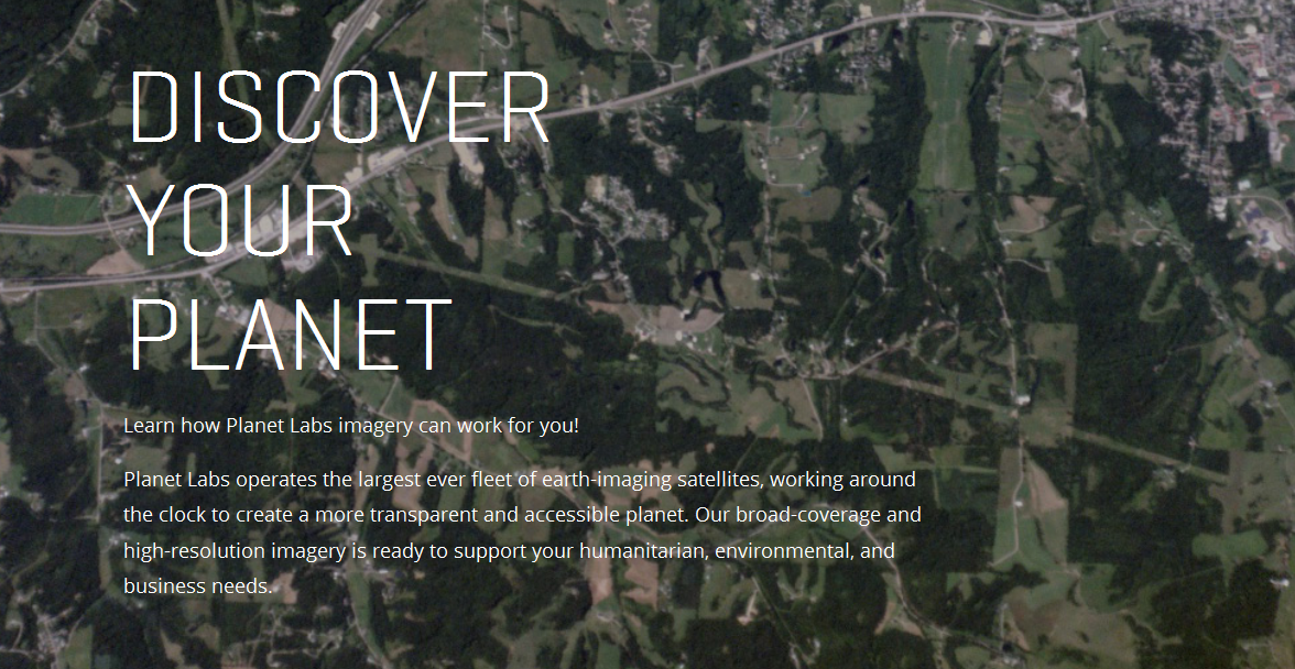
To image the entire Earth every day, Planet Labs has worked out that it needs 150 satellites in orbit concurrently...
Planet Labs democratizing space / Forbes - April 2014
Re/Code
How NASA led tech to the Cloud / WSJ - May 2012
Robbie Schingler, a co-founder of Planet Labs, met Worden in Houston, TX.
“For five hours we were yelling at each other across the table,” recalls Robbie Schingler, now 33, who was then between master’s degrees at the International Space University and the Georgetown University McDonough School of Business. “The next day he said, ‘Let’s write a paper together on the pros and cons of weaponizing space. You write the cons, I’ll write the pros.’”
The paper never materialized, but an unusual friendship and mentoring relationship did. When Worden became director of the NASA Ames Research Center in Silicon Valley four years later, he recruited the group of Houston 20-somethings, along with a handful of their friends. Included were Schingler and Chris Kemp, then 28, who would become Ames’s director of business development and later its chief technology officer.
○ ○ ○ ○
NASA review
NASA Oversight Hearing, Feb 25, 2015
Launched March 3, 2015, NASA #TechPort website #NASA’s latest tech development activities
The Technology Portfolio System, TechPort, is NASA’s first comprehensive resource for locating information about NASA-funded technology development activities. This beta system enables the public to explore NASA’s technology portfolio...
○ ○ ○ ○
Pete Worden - NASA Ames departure - SpaceNews - Feb 2015 / It would be a profound shift to see the Strategic Defense Initiative-SDI guy, who helped launch 'new space' (and Planet Labs) continue his move from maverick military to earth/biology... so to speak
Worden told SpaceNews that the nine years he spent at Ames were the most enjoyable of his 40 years of public service.
“In the last nine years we have launched dozens of small, low-cost satellites – and helped ignite a major new industry in this area. Ames people have revitalized space biology and begun to apply the new field of synthetic biology,” Worden said via email Feb. 26. “Ames has provided entry technology for the emerging commercial space launch sector. We have helped launch small satellites working with a number of nations. And we’ve hosted and inspired thousands of students.”
[Ed: from early Cold War 'spin offs' of military R&D and defense spending came ARAPANET from DARPA, the genesis of today's Internet]
The future of NASA and SDI are a separate topic for others to address. Here at GreenPolicy we are tracking the utilization of technology that has moved from 'first generation' military purposes to first generation "New Space" 'open' uses. The democratization of space envisions moving from military-dependency to civilian/educational/environmental/scientific/engineering/resource monitoring and management -- a full spectrum of #EarthScience that, hopefully, brings a future of environmental-national-global security. Our position is that the application and re-purposing of initial space-borne military systems can be and should be applied to earth resource monitoring and management as legislative *technology transfer* has codified over the past two decades. The successful restructuring of the old Cold War systems is a challenge, without question, yet the example of Pete Worden and Planet Labs bring both hope and a direction that is worth pursuing in the face of rising security challenges that are global and threats to security within and across borders.
_ _ _ _ _ _ _ _ _ _ _ _ _ _ _ _
• OpenStack strategy
OpenStack "Cloud in a Box"
https://www.nebula.com/
• “New” model of Citizen Science
Micro-satellites, Nanosats
OTS components
_ _ _ _ _ _ _ _ _ _ _ _ _ _ _ _
The "New Space" field is pioneering the study of our blue planet with multiple new platforms monitoring earth systems and resources. PlanetLabs is a recently founded company that is out in front with its emphasis on open data sharing. Its mini satellites are called "Doves" and they "flock] for #earthmonitoring and rapid sequence imaging.
An API for the Planet #PlanetLabs Open Source Conference keynote
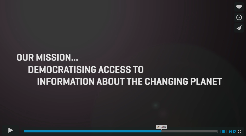
Mission: "Democratizing Access to Information About the Changing Planet"

About Planet Labs Documentation Intro
February 5, 2015 - Private Spending on Space Is Headed for a New Record - Space Race 2.0 #NewSpace
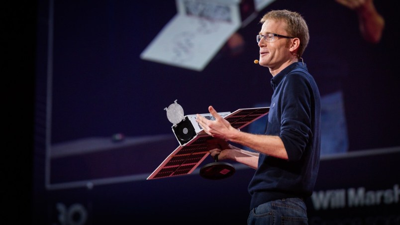
Planet Labs has raised more than $160 million and launched 73 global imaging satellites. The growth was hard to imagine three years ago, when co-founder Will Marshall built the first of the miniature satellites nicknamed “doves” in a Silicon Valley garage.
“A lot of people were very skeptical, and what we were trying to do seemed ludicrous,” said Marshall, a former engineer at NASA Ames Research Center in Mountain View, California. “But we have assets in orbit, and customers who are very interested in the data. Every time we take a picture, we can see how the world is changing.” -- Bloomberg
Planet Labs, flying Doves unprecedented, observing Planet Earth with 'rapid cadence' imaging opening possibilities never before offered
Connect
Planet Labs/NYT Planet Labs, newly #ISS deployed Doves Smartphones in space!
Launch of new Flock of Dove Satellites to Image Earth
Doves fly Doves flock
Planet Labs 'Dove' micro-satellites
New York Times / "Rapid cadence imagery, like Planet Labs is developing, helps us become better, more sustainable stewards of Earth."
Planet Labs Pulse [1] [2] [3]
Citizens of the Planet -- #PlanetCitizens
____________________________________________________________________________________________________________________________________________
Geo, Group on Earth Observations
Earth Observation Data [4]
Data Sharing [5]
Geoss portal
____________________________________________________________________________________________________________________________________________
National Science and Technology Council / US Group on Earth Observations Council
Value of Earth Observations
The Federal Government invests more than $3 billion in civil Earth observations and data annually across multiple agencies, and leverages investments made by State, local and tribal governments, academia and industry...
The NASA OpenNEX Challenge to the Public -- Join In, Our Data is Yours
Ground Truth
NASA/JPL focus on #PlanetEarth
Earth Observing System (ECHO) - Earth Science Data Information Systems API
National Oceanic and Atmospheric Administration - National Environmental Satellite, Data, and Information Service (NESDIS)
NOAA Data Centers
- http://www.ncdc.noaa.gov/
- http://www.nodc.noaa.gov/
- http://www.ngdc.noaa.gov/
NOAA View Data Exploration Tool
____________________________________________________________________________________________________________________________________________
- "New Space"
Generation 1.0, an era of Micro-satellites and #EarthImaging
#EarthScience from Space
○ ○ ○ ○
Community of #PlanetCitizens observing, networking, sharing information, protecting #PlanetEarth...
○ ○ ○ ○
- Citizen Science
Citizen Science by Planet Citizens
○ ○ ○ ○
Planet API | #PlanetAPI | Planet Citizen | #PlanetCitizen
GreenPolicy360 | #Earth360 | #EarthImaging | #EarthMonitoring
GP360 | #EarthObservations | #EarthScience | #NewSpace
www.planetcitizen.org | www.earthpov.com
○ ○ ○ ○
- Your Mission if You Choose to Go
Democratising access to information about Planet Earth... Planet Labs brings home the data
Be one of the first ever on our voyage over time to show you're an Earth-wise #PlanetCitizen

![[1]](https://www.greenpolicy360.net/mw/images/Doves_close-up-of-cubesats-leaving-nanoracks-deployer-2014-02-11_m.jpg)
![[2]](https://www.greenpolicy360.net/mw/images/Doves_launched_from_ISS_float_against_Earth_horizon_m.jpg)
