File:Arable land percent world.png
Original file (1,357 × 628 pixels, file size: 40 KB, MIME type: image/png)
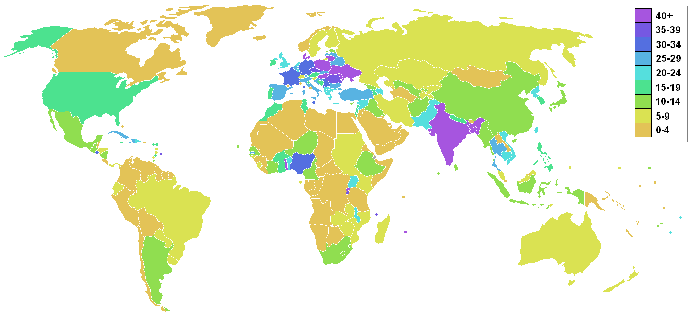
Arable land v Non-Arable (Infertile) land
Check the change over years in the arable land in your country -- http://data.trendeconomy.com/industries/Arable_Land/
○
https://en.wikipedia.org/wiki/Arable_land
https://en.wikipedia.org/wiki/Soil_fertilitys
○
Arable land per person is shrinking. It decreased from 0.38 ha in 1970 to 0.23 ha in 2000, with a projected decline to 0.15 ha per person by 2050 [1]
Arable land, hectares per person, by country -- http://data.worldbank.org/indicator/AG.LND.ARBL.HA.PC
Loss of Arable land / via Peakwater.org -- http://peakwater.org/?tag=loss-of-arable-land
File history
Click on a date/time to view the file as it appeared at that time.
| Date/Time | Thumbnail | Dimensions | User | Comment | |
|---|---|---|---|---|---|
| current | 21:00, 8 October 2015 | | 1,357 × 628 (40 KB) | Siterunner (talk | contribs) | https://en.wikipedia.org/wiki/Arable_land Category:Agriculture Category:Alternative Agriculture Category:Biodiversity Category:Biosphere Category:Climate Change Category:Ecology Studies [[Category:Environmental Full-cost Accou... |
You cannot overwrite this file.
File usage
There are no pages that use this file.
- Agriculture
- Alternative Agriculture
- Aquifers
- Biodiversity
- Biosphere
- Climate Change
- Countries
- Ecology Studies
- Environmental Full-cost Accounting
- Environmental Security
- Extinction
- Farm-Related Policies
- Food-Related Policies
- Genetic Engineering
- Green Graphics
- Land Ethic
- Permaculture
- Pesticides
- Soil
- Sustainability
- Sustainability Policies