File:EarthScience Missions via the EOS - 2022.png
EarthScience_Missions_via_the_EOS_-_2022.png (800 × 219 pixels, file size: 139 KB, MIME type: image/png)
Steven Schmidt, GreenPolicy360 Siterunner: News from NOAA today. This is type of work I've been focusing on... #EarthScience ... since the launch of #EarthDay in 1970. I'm remembering George Brown explaining to Gaylord Nelson in a planning mtg how we needed data, climate info w a baseline and access to the data sets for scientists, educators, and public. Rep Brown told the Senator that he'd get the job going in his com't oversight role. He did -- for three decades George shepherded NASA/NOAA/USGS/JPL, a flock of Earth Science missions, programs and their funding. George was referred to over the years as the 'Big Science' man ...
Read the latest on these 'Vital Signs' data gathering missions...
🌎
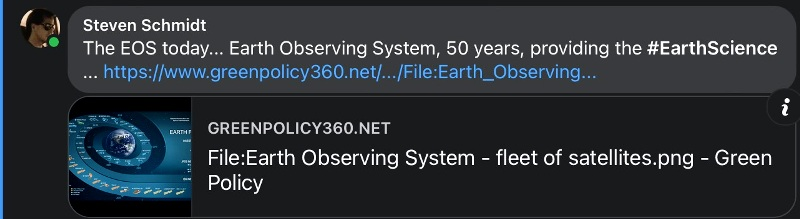
Earth Observing System (EOS)
Green360's Eco Operating System (eOS)

EOS
Earth Observing System
Originating with a NASA 'Mission Statement' and visionary Earth Science leaders in the U.S. Congress, a whole earth research mission, environmental protection movement is launched...
GreenPolicy360 siterunner, Steven Schmidt, recalls the origins of earth science missions and visionary leaders:
The Original Mission Statement of NASA (1958) provided Congressional intent and guidance to the first generation of space programs. US Congressman George Brown, if he were here, would've done I am certain everything within his power to continue the original 'our' part of the mission statement... 'to understand and protect our home planet'...
“To understand and protect our home planet; to explore the universe and search for life; to inspire the next generation of explorers ... as only NASA can.”
The NASA programs to understand and protect can be traced to the 1960s when a monumental new technology was invented and, with a fortuitous shift in U.S. remote imaging capabilities from to digital, 'multispectral' scanning, the Landsat program took off and the data that began coming back from near-orbit Landsat satellites forever changed how we see, study and interact with our home planet.
GreenPolicy360's archive of the 1960s/70s earth science, an environmental era start up that your siterunner experienced personally, includes memories that reveal rarely discussed highlights of the Landsat and first earth observation satellites, the beginnings of the Earth Observing System (EOS), Earth Science missions now in their fifth decade.
🌎
NOAA Updates its Global Surface Temperature Dataset
- Adds complete global coverage
February 10, 2023
Providing reliable and quality climate information allows government agencies, researchers, and others to make informed decisions that can save lives and improve quality of life. Since the late 1990s, NCEI has provided a suite of climate services, including the monthly Global Climate Report, to support this mission. One of its most highly visible and widely used products is NOAA’s global surface temperature dataset (also known as NOAAGlobalTemp), which is an authoritative dataset used to assess observed global climate change.
NOAAGlobalTemp has been used by multiple science organizations such as the World Meteorological Organization and in assessments, such as the Intergovernmental Panel on Climate Change and the Bulletin of the American Meteorological Society (BAMS) State of the Climate reports. It is also usually compared to other respected global surface temperature datasets such as those produced by NASA and the UK Met Office, among others.
Through the years, the main data sources for the NOAAGlobalTemp dataset have been the Global Historical Climatology Network - Monthly (GHCNm), which uses weather stations across the land surfaces, as well as the Extended Reconstructed Sea Surface Temperature (ERSST), which uses ships, buoys, surface drifters, profiling floats, and recently other uncrewed automatic systems, over the ocean surfaces.
As technology improves and additional data sources become available, it is essential to update these datasets in order to provide the most accurate depiction of the Earth’s environmental conditions—updated datasets support informed decision-making on climate change....
🌎
Global Climate Report
(Monthly)
(Annual)
NoAA GlobalTemp
Sea Surface Temperature
International Comprehensive Ocean-Atmosphere Data Set
🌎
Bookmark Climate Policy @GreenPolicy360
🌎
File history
Click on a date/time to view the file as it appeared at that time.
| Date/Time | Thumbnail | Dimensions | User | Comment | |
|---|---|---|---|---|---|
| current | 17:18, 10 February 2023 | 800 × 219 (139 KB) | Siterunner (talk | contribs) |
You cannot overwrite this file.
File usage
- About Us
- Air Quality
- Air Pollution
- Agriculture
- Alternative Agriculture
- Antarctica
- Anthropocene
- Arctic
- Atmospheric Science
- Biodiversity
- California
- Citizen Science
- City Governments
- Clean Air
- Clean Water
- Climate Change
- Climate Migration
- Climate Policy
- Countries
- County Governments
- Democracy
- Desertification
- Digital Citizen
- Earth Imaging
- Earth Observations
- Earth360
- Earth Science
- Earth Science from Space
- Earth System Science
- Ecology Studies
- Eco-nomics
- Economic Justice
- Education
- Energy
- Environmental Full-cost Accounting
- Environmental Laws
- Environmental Protection
- Environmental Security
- Environmental Security, National Security
- ESA
- Estuary
- European Union
- Externalities
- Extinction
- Fisheries
- Florida
- Food
- Forests
- Fossil Fuels
- Germany
- Greenland
- Global Security
- Global Warming
- Green Best Practices
- Green Graphics
- Green Networking
- Green Politics
- Health
- INDC
- Maps
- Media
- Money in Politics
- NASA
- NOAA
- Natural Resources
- Networking
- New Definitions of National Security
- New Economy
- New Space
- Oceans
- Ocean Science
- Online Education
- Planet Citizen
- Planet Citizens
- Planet Citizens, Planet Scientists
- Pollution
- Rainforest
- Renewable Energy
- Resilience
- Russian Federation
- Sea-level Rise
- Sea-Level Rise & Mitigation
- Seventh Generation Sustainability
- Social Justice
- Soil
- Solar Energy
- Strategic Demands
- Sustainability Policies
- Threat Multiplier
- Transportation
- Ukraine
- United Nations
- US
- US Environmental Protection Agency
- Water
- Water Quality
- Water Saving
- Wetlands
- Whole Earth
- Wildlife
- Wind Energy
- World Bank
- World Wide Web
- Youth