File:New Climate Maps for US.jpg
New_Climate_Maps_for_US.jpg (677 × 405 pixels, file size: 47 KB, MIME type: image/jpeg)

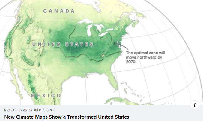
In the U.S.... according to new data from the Rhodium Group analyzed by ProPublica and The New York Times Magazine, warming temperatures and changing rainfall will drive agriculture and temperate climates northward, while sea level rise will consume coastlines and dangerous levels of humidity will swamp the Mississippi River valley.
'Taken with other recent research showing that the most habitable climate in North America will shift northward and the incidence of large fires will increase across the country, this suggests that the climate crisis will profoundly interrupt the way we live and farm in the United States. See how the North American places where humans have lived for thousands of years will shift and what changes are in store for your local county.
Check out your local area -- and consider, with care, the coming consequences of climate change...
~
File history
Click on a date/time to view the file as it appeared at that time.
| Date/Time | Thumbnail | Dimensions | User | Comment | |
|---|---|---|---|---|---|
| current | 22:58, 27 February 2021 | | 677 × 405 (47 KB) | Siterunner (talk | contribs) |
You cannot overwrite this file.
File usage
There are no pages that use this file.