Category:NOAA
<addthis />

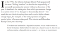
Via Wikipedia (citation as of 2021) | The National Oceanic and Atmospheric Administration (NOAA) is an American scientific and regulatory agency within the United States Department of Commerce that forecasts weather, monitors oceanic and atmospheric conditions, charts the seas, conducts deep sea exploration, and manages fishing and protection of marine mammals and endangered species in the U.S. exclusive economic zone.
The National Environmental Satellite, Data, and Information Service (NESDIS) was created by NOAA to operate and manage the US environmental satellite programs, and manage NWS data and those of other government agencies and departments.[citation needed] NESDIS's National Centers for Environmental Information (NCEI) archives data collected by the NOAA, U.S. Navy, U.S. Air Force, the Federal Aviation Administration, and meteorological services around the world and comprises the Center for Weather and Climate (previously NOAA's National Climatic Data Center), National Coastal Data Development Center (NCDDC), National Oceanographic Data Center (NODC), and the National Geophysical Data Center (NGDC)).
In 1960, TIROS-1, NASA's first owned and operated geostationary satellite, was launched. Since 1966, NESDIS has managed polar orbiting satellites (POES) and since 1974 it has operated geosynchronous satellites (GOES). In 1979, NOAA's first polar-orbiting environmental satellite was launched. Current operational satellites include NOAA-15, NOAA-18, NOAA-19, GOES 13, GOES 14, GOES 15, Jason-2 and DSCOVR. In 1983, NOAA assumed operational responsibility for Landsat satellite system.
Since May 1998, NESDIS has operated the Defense Meteorological Satellite Program (DMSP) satellites on behalf of the Air Force Weather Agency.
New generations of satellites are developed to succeed the current polar orbiting and geosynchronous satellites, the Joint Polar Satellite System) and GOES-R, which is scheduled for launch in March 2017.
NESDIS runs the Office of Projects, Planning, and Analysis (OPPA) formerly the Office of Systems Development,[42] the Office of Satellite Ground Systems (formerly the Office of Satellite Operations)[43] the Office of Satellite and Project Operations,[44] the Center for Satellite Applications and Research (STAR)],[45] the Joint Polar Satellite System Program Office[46] the GOES-R Program Office, the International & Interagency Affairs Office, the Office of Space Commerce[47] and the Office of System Architecture and Advanced Planning.
Federation of Earth Science Information Partners
🌎
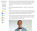
Case Study of Data Mapping on NOAA's Science of Climate Change and Weather Impacts

- NOAA Climate.Gov
- Global Climate Dashboard
🌎
Subcategories
This category has the following 7 subcategories, out of 7 total.
A
E
P
S
T
Pages in category "NOAA"
The following 57 pages are in this category, out of 57 total.
C
E
- Each of us can make a positive difference
- Earth
- Earth and Space, Politics
- Earth Day Summit - April 22 2021
- Earth Right Now
- Earth Science Research from Space
- EarthPOV
- EarthTime
- Environmental Rules Rolled Back
- ESA Living Planet Announcement - May 2022
- Ethics and Climate Change
- European Union Green Deal - Fit for 55
G
- George E. Brown Jr
- Glasgow Climate Summit - Pledges, Promises, Declarations - What's Next Up
- Global Climate Action Summit
- GOES-16
- Green Best Practices
- Green Stories of the Day
- Green Stories of the Day - GreenPolicy360 Archive
- Greening Our Blue Planet
- GreenPolicy360 Archive Highlights 2013
- GreenPolicy360 Archive Highlights 2014
- GreenPolicy360 Archive Highlights 2015
- GreenPolicy360 Archive Highlights 2016
- GreenPolicy360 Archive Highlights 2017
- GreenPolicy360 Archive Highlights 2018
- GreenPolicy360 Archive Highlights 2019
- GreenPolicy360 Archive Highlights 2020
- GreenPolicy360 Archive Highlights 2023
L
T
Media in category "NOAA"
The following 200 files are in this category, out of 577 total.
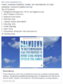
(previous page) (next page)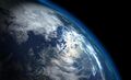 'Thin Blue Layer' of Earth's Atmosphere 2.jpg 800 × 486; 46 KB
 'Thin Blue Layer' of Earth's Atmosphere m.jpg 426 × 240; 15 KB
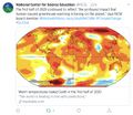
 2020 record temperatures.png 800 × 502; 358 KB
 7-20-2020 GreenPolicy360 RT No.2.jpg 591 × 510; 125 KB
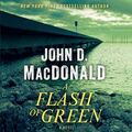 A Flash of Green by John D. MacDonald.jpg 400 × 400; 55 KB
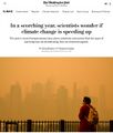 A scorching year, what about the 360 warming data.jpg 600 × 706; 106 KB
 About Baselines and Change.png 592 × 312; 33 KB
 About website of The Invading Sea.png 800 × 343; 126 KB
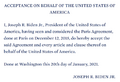 Acceptance on behalf of the United States of America.png 448 × 306; 62 KB
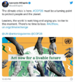
 Act now for a livable future.png 501 × 275; 272 KB
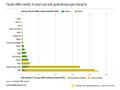 Ag production and GHG emissions.jpg 680 × 510; 33 KB
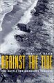 Against the Tide - Cover - by Cornelia Dean.jpg 308 × 475; 57 KB
 Alaska Willow - March 12 2023.png 576 × 230; 99 KB
 Alaska Willow News-March 12 2023.png 576 × 625; 235 KB
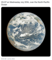
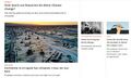
 Amazon fires burn across the rainforest.jpg 800 × 504; 76 KB
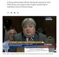
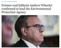 Andrew Wheeler confirmed to head EPA.jpg 753 × 600; 85 KB
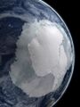 Antarctica-2018.jpg 768 × 1,024; 82 KB
 Anti science, anti open data - EPA April 2017.png 429 × 616; 198 KB
 AOC re climate task force - july 8 2020.jpg 585 × 203; 38 KB
 Arctic - Antarctic - Breaking.png 639 × 600; 903 KB
 Arctic - Kolbert - 2023.png 553 × 476; 274 KB
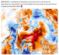
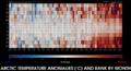
 Arctic 30.1 C at 62.5 N.jpg 800 × 432; 80 KB
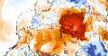 Arctic heat in Russia-Siberia 2020.gif 784 × 408; 3.6 MB
 Arctic mdl 1990-2010.jpg 720 × 667; 149 KB
 Arctic Melt - 1950-2020.png 640 × 349; 287 KB
 Arctic Sea Ice Area graphic thru 2016.png 640 × 355; 382 KB
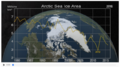
 Arctic Sea Ice News.png 800 × 439; 458 KB
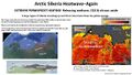 Arctic Siberia Heatwave - Again - June 2021.jpg 640 × 360; 83 KB
 Arctic-asia mdl 1990-2010.jpg 720 × 667; 158 KB
 Arctic-March30,2019.jpg 797 × 600; 126 KB
 Arctic-Siberia-6-20-2020.jpg 478 × 644; 148 KB
 As Earth Warms, NASA Targets 'Other Half' of Carbon, Climate Equation.jpg 1,504 × 846; 242 KB
 Astronaut Photography of Earth ISS Cupola 2014.png 1,598 × 628; 1.13 MB
 Atmosphere Science.jpg 800 × 600; 45 KB
 Atmospheric Experiment of Humanity.jpg 519 × 574; 201 KB
 Banking - finance - climate - Mann-1.jpg 452 × 640; 162 KB
 Banking - finance - climate - Mann-2.jpg 452 × 640; 164 KB
 Barrier island hubris 6-29-2021.jpg 490 × 635; 111 KB
 Battle for Democracy.jpg 640 × 123; 24 KB
 Ben Santer to Pruitt March 2017.png 506 × 420; 0 bytes
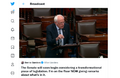 Bernie Sanders, Senate 2.PNG 800 × 517; 379 KB
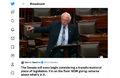 Bernie Sanders, Senate Aug 3.PNG 800 × 518; 388 KB
 Biden - clean energy ambitions.JPG 640 × 334; 31 KB
 Biden introduces leadership team - Nov 24 2020.jpg 800 × 644; 173 KB
 Biden selects Kerry as special climate envoy.jpg 592 × 505; 87 KB
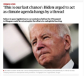 Biden urged to act - Oct 18 2021 - The Guardian.png 663 × 600; 497 KB
 Biden's assembled an all-star climate team 4-21-2021.jpg 682 × 732; 309 KB
 Biden-January 27 2021-Environment Day 1-News headlines.jpg 800 × 673; 122 KB
 Biden-January 27 2021-Environment Day 1.jpg 800 × 500; 80 KB
 Biden-Sanders Unity Task Force on Climate.jpg 701 × 780; 139 KB
 Big Oil Rocked by News May 27 2021.jpg 639 × 600; 84 KB
 Bill Nelson on Global Temp Rise and Climate Change.png 640 × 353; 100 KB
 Bill Nye The Planet's on Fire.jpg 800 × 675; 106 KB
 Bloomberg Carbon Clock 10-26-2021 8-47-05 AM EST.png 800 × 195; 356 KB
 Bloomberg Live Climate Data Dashboard.jpg 640 × 756; 156 KB
 Breakpoint - Reckoning with America's Environmental Crisis.jpg 329 × 500; 49 KB
 Bridenstine talks.png 1,485 × 911; 223 KB
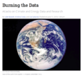 Burning the Data.png 640 × 597; 434 KB
 Burst of climate denial as Trump presidency ends.jpg 632 × 604; 92 KB
 California's kelp forests and coastal biodiversity diminished.png 532 × 754; 307 KB
 Car heating and cooling.png 465 × 635; 261 KB
 Carbon Brief - Greenhouse gas levels 2021.png 640 × 436; 292 KB
 CFSV2 world temp July 3, 2023.png 600 × 800; 513 KB
 CH4 graph - 1980-2020.JPG 640 × 446; 22 KB
 Changes in carbon dioxide per 1000 years - via Climate Central.jpg 682 × 424; 34 KB
 China Record Heat - August 2022.png 800 × 1,343; 812 KB
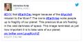 Christina Korp Earth Day and Apollo 8.jpg 519 × 264; 80 KB
 Citizens Climate Lobby - Save Our Future Act 2021.jpg 518 × 262; 77 KB
 Citizens Climate Lobby - Tampa Bay.jpg 586 × 515; 125 KB
 Climate Action 25th conf in Madrid.jpg 680 × 510; 22 KB
 Climate activist - Steven Schmidt - 1978 on.png 600 × 480; 174 KB
 Climate and National Security.jpg 603 × 533; 157 KB
 Climate Books - 2020.jpg 800 × 450; 69 KB
 Climate Change Conf Nov 6-17.png 464 × 488; 107 KB
 Climate Change COP27 - Nov 11 2022 US Representatives.jpg 712 × 444; 54 KB
 Climate Change COP27 - Nov 11 Kathy Castor.jpg 712 × 710; 77 KB
 Climate Change from Space - Climate Kit via ESA - 2022.png 800 × 421; 651 KB
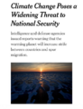 Climate Change Poses a Widening Threat to National Security.png 600 × 781; 310 KB
 Climate change unique threat to national security.png 800 × 42; 20 KB
 Climate Change US EPA.jpg 600 × 703; 95 KB
 Climate Conferences 1979-2020.jpg 768 × 768; 121 KB
 Climate Crisis - Emily Atkin Heated No. 1.jpg 537 × 453; 61 KB
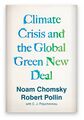 Climate Crisis and the Global Green New Deal.jpg 293 × 418; 33 KB
 Climate debate.jpg 493 × 580; 129 KB
 Climate Desk.jpg 390 × 226; 21 KB
 Climate diplomacy is failing - June 2020.jpg 592 × 440; 71 KB
 Climate Emergency Institute - Oct 2022.png 610 × 600; 274 KB
 Climate Emergency Institute -- 2021.jpg 800 × 450; 55 KB
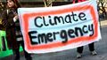 Climate emergency.jpg 800 × 450; 69 KB
 Climate Headline News around the World - July 2023.jpg 600 × 704; 151 KB
 Climate Lawsuit-Our Childrens Trust-Florida.png 462 × 760; 289 KB
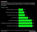 Climate Models.png 639 × 558; 123 KB
 Climate News - Oct 28 2022.jpg 626 × 600; 88 KB
 Climate News - United Nations Report - Feb 2022.png 768 × 878; 539 KB
 Climate News Dec 4 2023 in Dubai.png 800 × 1,037; 649 KB
 Climate Plans Enforcement - Resources - GreenPolicy.png 768 × 897; 686 KB
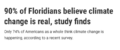 Climate poll - Florida.png 640 × 267; 36 KB
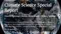 Climate Science Special Report - US - November 2017.jpg 800 × 445; 122 KB
 Climate strike - Week 171.png 739 × 600; 834 KB
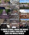 Climate Strike Around the World - Sep20,2019.jpg 700 × 830; 119 KB
 Climate Summit - Leonardo DiCaprio.png 600 × 663; 521 KB
 Climate Summit live updates - Nov 2 2021.png 751 × 600; 420 KB
 Climate Summit planned-1.jpg 800 × 301; 53 KB
 Climate Summit planned-2.jpg 800 × 187; 31 KB
 Climate Summit planned-3.jpg 800 × 278; 44 KB
 Climate Summit planned-4.jpg 800 × 241; 41 KB
 Climate usa 60 years on.jpg 800 × 480; 34 KB
 Climate365 NASA and science orgs measure and monitor.png 798 × 633; 165 KB
 ClimateNews 360.jpg 172 × 172; 9 KB
 ClimateNewsFlorida.jpg 448 × 191; 36 KB
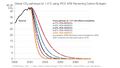
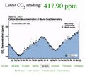 CO2 at Mauna Loa data - June 02, 2020 - 417.90 ppm.jpg 640 × 566; 66 KB
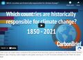 CO2 cumulative emissions 1850 - 2021 - countries.jpg 640 × 462; 211 KB
 CO2 Emissions per Capita by Country 1960-2014.png 800 × 451; 424 KB
 CO2 emissions-around-the-world.png 800 × 595; 123 KB
 CO2 global pathways via IPCC AR6 - how will we respond.jpg 800 × 450; 57 KB
 CO2 higher than in the past 5 million yrs.jpg 514 × 285; 62 KB
 Coastal Connecticut sea level rise.png 480 × 549; 396 KB
 COP26 Climate Summit concludes.jpg 600 × 800; 160 KB
 COP26 concludes - 2.png 648 × 467; 177 KB
 COP26 concludes - 3.png 648 × 713; 416 KB
 COP26 concludes.png 648 × 528; 329 KB
 COP26 in GLASGOW - 31 OCT-12 NOV 2021.jpg 800 × 264; 51 KB
 COP27 'opening speech'.png 640 × 460; 160 KB
 COP28 News - Dec 13 2023.png 800 × 898; 410 KB
 CopernicusEU - Sentinel5P Atmosphere Monitoring Mission - 2.jpg 795 × 1,477; 654 KB
 CopernicusEU - Sentinel5P Atmosphere Monitoring Mission.png 583 × 465; 222 KB
 Coral bleaching - August 2023.png 488 × 430; 261 KB
 Coral bleaching - NOAA - August 2023.png 488 × 338; 201 KB
 Costs of War US Post 9-11 War Spending.jpg 800 × 305; 60 KB
 Covering Climate Now.jpg 493 × 498; 67 KB
 Cradle of Civilization - and climate change.jpg 640 × 360; 70 KB
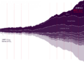
 Cumulative CO2 Emissions by Country Since 1850.png 800 × 445; 445 KB
 Dated record of Earths climate - Science Report Sept 10 2020.jpg 735 × 669; 192 KB
 Death Valley ... the heat, what its like.jpg 640 × 381; 62 KB
 Defend Our Future 6-1-2020.jpg 585 × 458; 103 KB
 Democratic Climate Plan-Introduced June 2020.jpg 528 × 561; 117 KB
 Democratic National Convention-62 climate speakers.jpg 443 × 407; 57 KB
 Democratic Party Climate Bill - Aug 2022.png 640 × 269; 70 KB
 Democratic Party pres candidates debate in Miami-June 2019.jpg 800 × 534; 124 KB
 Democratic presidential candidates on the Green New Deal.jpg 800 × 359; 57 KB
 Denying human-caused climate change.jpg 639 × 620; 129 KB
 Diane Walder in Miami Beach.jpg 775 × 787; 147 KB
 Don't Look Up ....jpg 430 × 543; 172 KB
 Don't Look Up.jpg 800 × 450; 104 KB
 Donald Trump-Jair Bolsonaro-March 2019.jpg 640 × 455; 57 KB
 Dove1 image.jpg 420 × 308; 26 KB
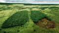
 Drawdown top ten solutions - 2017.png 498 × 654; 179 KB
 DSCOVR EPIC - July 20 2022.png 532 × 612; 315 KB
 Earth AI - Feb 2022.png 482 × 480; 192 KB
 Earth and Space, Politics.png 796 × 765; 349 KB
 Earth Breathing.jpg 800 × 450; 117 KB
 Earth Day 2021 - Climate Summit News-1.jpg 491 × 270; 127 KB
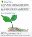 Earth Day 50 years on.jpg 480 × 548; 107 KB
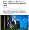 Earth Day and Climate at the Center.jpg 595 × 604; 131 KB
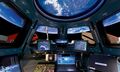
 Earth Information Center - 2022 Graphic NASA.png 800 × 981; 868 KB
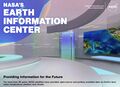 Earth Information Center from NASA.jpg 800 × 577; 94 KB
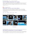
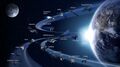
 Earth Observing System - fleet of satellites.png 740 × 576; 557 KB
 Earth POV from the ISS Cupola-m.jpg 800 × 480; 71 KB
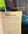 Earth Summit 1992-s.png 336 × 418; 283 KB
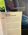 Earth Summit 1992.jpg 600 × 746; 171 KB
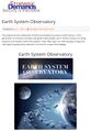 Earth System Observatory-1.jpg 580 × 833; 129 KB
 Earth System Observatory-2.jpg 580 × 831; 69 KB
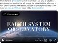 Earth System Observatory.jpg 457 × 338; 47 KB
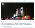 Earth trapping unprecedented amount of heat - NASA.jpg 468 × 373; 56 KB
 Earth via GOES 17 Weather Satellite - first full image May 2018.png 800 × 451; 834 KB
 Earth-upper-atmosphere-NASA.jpg 800 × 781; 327 KB
 EarthNow our planet is changing.jpg 585 × 368; 0 bytes
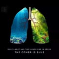 Earths two lungs.png 336 × 336; 130 KB
 EarthScience Missions via the EOS - 2022.png 800 × 219; 139 KB
 Economist.com global capital snapshot as of July 2020.jpg 800 × 477; 119 KB
 EDF satellite - methane tracking.png 600 × 674; 388 KB
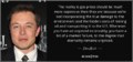 Elon Musk quote - gas externality price.png 680 × 320; 199 KB
 Emissions graph - gleick tw 2018.jpg 640 × 364; 37 KB
 Energy Charter Treaty.jpg 512 × 480; 74 KB
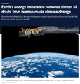 Energy Imbalance, Climate Change - Aug 1 2021.png 640 × 672; 394 KB
 Environmental laws in US - Supreme Court votes soon.png 800 × 414; 334 KB
 Environmental Protection Agency logo.png 380 × 414; 39 KB
 EOS EarthSats s.jpg 743 × 417; 64 KB
 EOSDIS EarthData Jan2015a.png 1,594 × 844; 701 KB
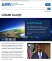
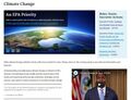 EPA website - Climate Change priority - March 2021.jpg 786 × 600; 140 KB
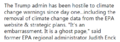 EPA website a 'ghost page' now.png 667 × 233; 45 KB
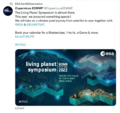 ESA Living Planet Symposium - Announcement.png 637 × 600; 508 KB
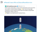 ESA Living Planet Symposium - May 2022.png 700 × 600; 258 KB
 ESG Fight - Feb 2023.png 396 × 194; 88 KB
 Estates at Acqualina - Sunny Isles Miami.jpg 746 × 600; 117 KB
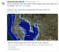
 Estuary in Clearwater on Tampa Bay.jpg 3,584 × 2,016; 1.5 MB
 EU agrees to cut emissions 55 percent by 2030.jpg 800 × 558; 96 KB
 EU unveils new climate change policy - July 14 2021 - 1.jpg 800 × 234; 33 KB


.png)


