Category:Maps
<addthis />

Earth Mapping
- Planet Citizens Mapping Planet Earth
- https://www.greenpolicy360.net/w/Virtual_Earth
- https://www.greenpolicy360.net/w/Planet_Citizens,_Planet_Scientists

····················································································
Digital maps are making quantum leaps in quality and utility ...
Type NAVD into Google
NOAA provides a baseline reference tool, 'Datums and Reference Frames', Monitor sea-level change with dynamic mapping.
A geodetic datum or reference frame is an abstract coordinate system with a reference surface (such as sea level) that serves to provide known locations to begin surveys and create maps.
NOAA and NASA Begin Sea Level Rise Project
🌎
How Facebook, Apple and Microsoft are contributing to an openly licensed map of the world
Collaborating in the open to build an openly licensed map of the world: OpenStreetMap
OpenStreetMap has grown into one of the most successful collaboratively maintained open datasets in the world. Today, contributors to the maps include not just local mappers, but also a diverse mix of commercial organisations, non-governmental organisations, humanitarian organisations and also large commercial organisations.
The Microsoft Open Maps team has recently released open data on building footprints in the US. Microsoft was among the first to release satellite imagery for use by OpenStreetMap and the images are now integrated into the default editor. It also has a community of mappers directly contributing to OpenStreetMap in Australia.
Apple has an internal volunteer programme that has around 5,000 staff contributing to Missing Maps, they’ve released building data for France and Denmark, and are engaged with data improvement projects around the world.
Facebook is exploring how artificial intelligence-assisted tracing can help to improve the quality of OpenStreetMap data in Thailand.
DigitalGlobe has made its satellite imagery available under a licence that will allow it to be used by the OpenStreetMap community to improve their mapping efforts.
Telenav launched OpenStreetCam to help collect openly-licensed street imagery and has now released open data and code to explore how machine learning can enable the images to be used to improve OpenStreetMap with stop signs and turn directions.
Visit StateoftheMap
·······························
Follow some of our GreenPolicy 'cartography' favorites on Twitter
Data Viz Today - https://twitter.com/DataVizToday
David Garcia - https://twitter.com/mapmakerdavid
David M - https://twitter.com/mapbliss
Earth Lab CU-Boulder - https://twitter.com/EarthLabCU
Jim Eynard - https://twitter.com/jimeynard
Google Earth - https://twitter.com/googleearth
Katie-sky - https://twitter.com/KatieKowalsky
Joe Mascaro - https://twitter.com/joe_mascaro
Nathaniel Douglass - https://twitter.com/AlexndrTheNate
NOAA Satellites - https://twitter.com/NOAASatellites
Vanessa Schneider - https://twitter.com/vanessagene
Joshua Stevens - https://twitter.com/jscarto
USGS Landsat - https://twitter.com/USGSLandsat
·······················································
Explore Mapping / Geographic Earth Science at GreenPolicy's 'Virtual Earth


Visit Your Country and 200 Other Countries/Territories
🌎
Maps to Guide You
🌎
🌎

Available Satellite Imagery - Planet Citizen Navigation (circa 2022)
~
Google Earth
Bing Maps Aerial
Mapbox Satellite Live
HERE WeGo - Map View / Satellite
Zoom Earth
~
Maxxar
Airbus
Hexagon Geospatial
Vexcel Imaging
EagleView
Nearmap
Planet | Planet API
- https://www.planet.com/
- https://developers.planet.com/docs/data/skysat/
- https://earth.esa.int/eogateway/missions/skysat
🌎
GIS | Geographic Information System Mapping Technology - Esri
GIS connects data to a map, integrating location data (where things are) with all types of descriptive information (what things are like there). This provides a foundation for mapping and analysis that is used in science and almost every industry. GIS helps users understand patterns, relationships, and geographic context.
Hundreds of thousands of organizations in virtually every field are using GIS to make maps that communicate, perform analysis, share information, and solve complex problems around the world. This is changing the way the world works.
○
GPS: The Global Positioning System
A global public service of the U.S. government
The first GPS satellite, Navstar 1, was launched in 1978.
Watch the story of GPS origins, open-use changes to enable global applications, and ongoing funding and operations ...
More re: GPS:
○
Carto
○
Global Ecological Land Units
🌎
Where Are You?
Where Are You? Pictures of Us from the International Space Station
- What Are Your 'Coordinates', the Space Station Will Send You a Photo -- Pictures from ISS
🌎


🌎

○

🌎
Subcategories
This category has the following 18 subcategories, out of 18 total.
A
E
F
G
L
N
O
P
S
T
U
V
Pages in category "Maps"
The following 57 pages are in this category, out of 57 total.
C
E
G
- George E. Brown Jr
- Glasgow Climate Summit - Pledges, Promises, Declarations - What's Next Up
- Global Climate Action Summit
- Global Fishing Watch
- Going Green
- Google Earth
- Google Earth Timelapse
- Green New Deal
- Green Quotes
- Green Stories of the Day
- Green Stories of the Day - GreenPolicy360 Archive
- GreenLinks
- GreenPolicy360 Archive Highlights 2013
- GreenPolicy360 Archive Highlights 2014
- GreenPolicy360 Archive Highlights 2015
- GreenPolicy360 Archive Highlights 2016
- GreenPolicy360 Archive Highlights 2017
- GreenPolicy360 Archive Highlights 2018
- GreenPolicy360 Archive Highlights 2019
- GreenPolicy360 Archive Highlights 2020
- GreenPolicy360 Archive Highlights 2023
P
T
Media in category "Maps"
The following 49 files are in this category, out of 529 total.
(previous page) (next page)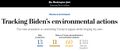 Tracking Biden's Environmental Record - WaPo - Feb 2021.jpg 766 × 326; 64 KB
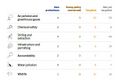 Tracking Biden's Environmental Record - WaPo listing - Feb 2021.jpg 588 × 397; 35 KB
 Travelling via Google Street View beyond agoraphobia.png 800 × 763; 634 KB
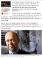
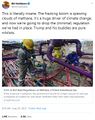
 Trump digs coal-2.jpg 800 × 533; 46 KB
 UN - Tipping Point for Climate Action.png 690 × 600; 601 KB
 UN Climate Summit News (1).pdf ; 1.85 MB
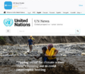
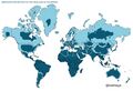
 UN Mapping the World.png 740 × 477; 584 KB
 UN NDC Registry - website database.png 798 × 392; 575 KB
 Unprecedented report - IPCC Aug-9-2021.jpg 800 × 666; 165 KB
 Update - James Hansen July 2023 'We are fools'.png 595 × 800; 610 KB
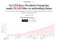
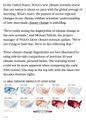
 Updated Nov 5 2020 - 29,508 false or misleading statements.jpg 640 × 444; 48 KB
 Updated Oct 22 2020 - 26,548 false or misleading statements.jpg 640 × 444; 47 KB
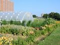 Urban-agriculture-garden-columbus-ohio.jpg 800 × 600; 121 KB
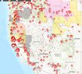
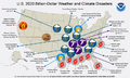 US 2020-billion-dollar-disasters-map.png 800 × 480; 259 KB
 US Annual Temperatures 1901-2020 Average Comparison.jpg 604 × 843; 242 KB
 US EPA to reverse methane rules.jpg 592 × 745; 175 KB
 US interstate system.png 640 × 402; 90 KB
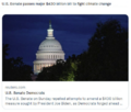
 US Quits Climate Accord.jpg 795 × 233; 40 KB
- US Role George E Brown 2.pdf ; 151 KB
- US Role George E Brown 3.pdf ; 157 KB
 US Senate passes 430 billion climate bill.png 468 × 396; 213 KB
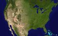 USA-satellitemap.jpg 794 × 496; 232 KB
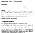 Usable climate science is adaptation science-Adam Sobel May 2021.jpg 702 × 664; 155 KB
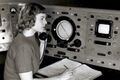 Virginia Norwood - 1948.jpg 640 × 426; 74 KB
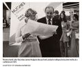 Virginia Tower Norwood and James Hodgson - 1972.jpg 589 × 489; 69 KB
 Virtual Earth cover.png 800 × 479; 833 KB
 Wavy Jet Stream by Patrick Mazza.jpg 515 × 362; 64 KB
 We are all in this together-IPCC report-August 2021.jpg 513 × 768; 183 KB
 We must flatten the curve, yes ... August 2020.jpg 800 × 421; 99 KB
 What happens when.png 585 × 215; 20 KB
 Wheeler-Mulvaney-repeal of Clean Power Plan-June19,2019.jpg 800 × 640; 145 KB
 When your house is on fire.jpg 589 × 473; 77 KB
 Which countries pollute the most ~2017.jpg 800 × 422; 69 KB
 Who really invented the climate stripes - Climate Change Education.png 600 × 600; 234 KB
 Why is the Amazon burning - Katharine Hayhoe explains.jpg 498 × 763; 149 KB
 Wildfires 2021 - August.jpg 519 × 220; 54 KB
 Wildfires-US-ESRI online-Sept2020.jpg 552 × 499; 128 KB
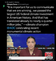 Winning on the climate legis - AOC.png 480 × 519; 249 KB
 World GDP Graph.jpg 700 × 600; 83 KB
 World Map - Mercator projection v Google maps.jpg 800 × 545; 101 KB
 World's top economies - GDP - 2018.jpg 700 × 630; 133 KB
 WV v EPA SCOTUS poll - June 27 2022 before court decision.png 623 × 480; 126 KB
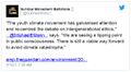 Youth Climate Movement.jpg 516 × 284; 79 KB
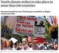 Youth Climate Strikes-March15,2019.jpg 707 × 639; 159 KB


