Planet API

GreenPolicy360: We have tracked the 'eco-evo' of Planet, the New Space Earth Imaging company from its initial start up after spinning off from NASA engineering key learnings. In fact, we are fortunate to be one of the few who, in the early 1970s were listening in when a first generation of Earth Science visionaries responsible for NASA Earth Science programs and a host of related US government and educational/private sector companies designed, developed, launched and began managing Earth Science Research from Space.
Here's to this generation's 'Young Ones', the visionaries today who are taking Earth Imaging/Science/Research to places we began to hope to go back in the early 1960s/70s days of eco-venturing.
Here's to Planet! Here's to Planet Earth!
Here's to planet citizens, planet scientists...
2024
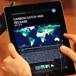
Big Data Sets and New Powerful AI Tools to Utilize the Collected Earth Data
- We're reminded of the original NASA mission statement and those who proposed, funded, launched and managed the first decades of Earth Science satellites
We, at GreenPolicy360, have a special interest in the work of Planet, as we were 'in at the beginning' as it were. We were there, in person, close up, when the original NASA mission statement, including these words -- “To understand and protect our home planet..." -- were being spoken of by a US representative serving on the Space and Technology committee responsible for policy and oversight. Congressman George Brown from California showed your GreenPolicy360 Founder/Siterunner words that were motivating him to propose Landsat missions that came to be called 'Big Science', Earth Imaging/Earth Science and Atmospheric-Climate Science. For 30+ years Representative George E. Brown led the charge, as it were, to gather the data needed to make informed and wise decisions about our home Planet.
A decade after George's passing away in 1999, youthful engineers from NASA 'spun off' from the 'home ship' to launch Planet Labs and their mission resonated with a mission we share. Our environmental work goes back to this mission and, as we have attempted to bring it into the light, it is again time to highlight Planet.
Look at their most recent add-ons to what we call a Planet API. It's AI time, artificial intelligence applied to analyzing the Earth imaging data that has been gathered over a decade by Planet and is being queried and utilized in ways that Rep. Brown used to explain was his dream, as he, also an engineer, explained how the public-private partnerships, with universities and educators, using fleets of satellite with new digital imaging and data banks, would enable a new vision for citizens across the Earth.
And now, here we are! Planet.com and GreenPolicy360.com, we're on mission ....
- https://www.greenpolicy360.net/w/Environmental_movement
- https://www.greenpolicy360.net/w/Earth_Day_Memories_on_the_50th_Anniversary
Understanding AI’s Impact on Space Data with Planet’s Head of Product
Planet Citizen
- Planet Citizens
Earth Imaging, "New Space"

The Founders of Planet (previously Planet Labs) Speak of the 360 Global Mapping Plan and #Earthdata Platform (2023)
Watch the video, envision the future capabilities and continuing reach of #EarthScience
As of 2023, Planet has three distinct constellations of satellites: Doves, SkySats, and RapidEye.
The high resolution SkySats in orbit are described here - https://www.planet.com/products/hi-res-monitoring/
The RapidEye constellation was retired in March 2020.
🌎

About Planet
Planet Labs PBC
Satellite imagery and geospatial solutions... Planet is driven by a mission to image the world every day, and make change visible, accessible and actionable. Founded in 2010 by three NASA scientists, Planet designs, builds, and operates the largest Earth observation fleet of imaging satellites. Planet provides mission-critical data, advanced insights, and software solutions to over 900 customers, comprising the world’s leading agriculture, forestry, intelligence, education and finance companies and government agencies, enabling users to simply and effectively derive unique value from satellite imagery. Planet is a public benefit corporation listed on the New York Stock Exchange as PL.
As of 2023, Planet has three distinct constellations of satellites: Doves, SkySats, and RapidEye.
What problems would you solve, what exploration would you do?
In the years since, Planet has found its work inspired by customers and partners who use Planet's array of products to solve big, important problems. Agricultural companies are increasing crop yields across millions of farmers’ fields daily. Governments track security risks, climate change, and respond to disasters like floods and wildfires. Google keeps the online maps that you use up to date and time-sequenced. Journalists shed light on critical world events (and won a Pulitzer prize). Over 60 countries in the tropics use Planet with its partners to curb deforestation in the world’s tropical forests – the lungs of Earth. These examples are just a small subset of myriad uses people have found by interfacing with Planet's imagery data and research tools.
Planet's API is opening eyes to new potential and crucial insights, providing solutions in a fast-changing, dynamic world.
New Ways to See & Experience Planet Earth
Visit GreenPolicy360's story of Earth Science research from our decades of research, eco-activism and #PlanetCitizens education.
Our #PlanetCitizensPlanetScientists eco operating system (eOS) includes:
ThinBlueLayer.com - Look at how thin our atmosphere is
New Definitions of National Security
Earth Science Research from Space
Planet Citizens, Planet Scientists
- What happens when young NASA scientists 'grow up and up' and launch their own ventures...
GreenPolicy360 is an original Planet Labs / Planet.com follower !
- The Youthful Leadership at Planet Is on a Mission !!
- Go Chris Boshuizen, Will Marshall, Robbie Schingler !!!
From the NASA Scientists Who 'Spun Off' from the Home Ship and Launched a New Visionary Venture: PlanetLabs.com


The Mission Continues
2023
November, a Systems Upgrade
Will Marshall: Incredible to see Pelican-1 & 36 SuperDoves successfully reach orbit today!! Pelican is an entirely new system for @planet, built in-house by our team. I’m so proud of their efforts to get this tech demo launched so that we can collect learnings & feedback. Thanks @SpaceX! | pic.twitter.com/zdF0gJiI1f | Nov 11, 2023
Doves to SuperDoves, to the Pelican Earth Observation Platform
Following years of Doves and SuperDoves, flying as Constellations, now comes the Pelican era!!
- Pelican-1, along with 36 SuperDoves, Flock 4Q... launched on SpaceX’s Transporter-9 mission ...Saturday, November 11, 2023
Tip of our green hat to Earth Imaging and accumulating data and knowledge envisioned by "eco-pioneers" of the early years...
- GreenPolicy360 salutes George E. Brown and those striving to benefit all of us Planet Earth Voyagers... #PlanetCitizens #PlanetScientists
- Carry on, Planet -- Carry on the mission
The images gathered by Doves can be accessed online, some of which is available under an open data access policy, providing up-to-date information and illustrating patterns of dynamic change relevant to climate monitoring, crop yield prediction, urban planning, disaster response and much more as planet citizens monitor and manage earth systems.
In 2017, Planet launched 87 Dove and 5 RapidEye satellites and then an additional 88 Dove satellites, as Google sold its subsidiary Terra Bella and its SkySat satellite constellation to Planet Labs.
By September 2018 the company had launched nearly 300 satellites, 150 of which are active. In 2020, Planet Labs launched six additional high-resolution SkySats, and 35 Dove satellites.

Will Marshall
Planet (Planet Labs)
A short stroll from the downtown San Francisco headquarters of Yelp and LinkedIn, Planet operates the largest and least expensive fleet of satellites in history — the first to take pictures of the entire landmass of the globe, once a day, and sell them to the public. The company is part of a fast-growing commercial satellite industry that is democratizing insights once available mainly to people with Top Secret government security clearances. -- Via NBC
Planet Labs and a Planet API
Planet Labs's launch of the PlanetScope DOVEs is organised around the main idea to image Earth every day.
Planet designs, builds and operates ultra-compact, inexpensive cubesats which can be manufactured in bulk.
Over 130 DOVES from PlanetScope have been launched into very similar orbit planes, circling Earth every 90 minutes:
- 12 satellites on 22 June 2016
- 88 satellites on 15 February 2017
- 48 satellites on 14 July 2017
- 4 satellites on 31 October 2017
- 4 satellites on 12 January 2018
- 16 satellites on 29 November 2018
- 3 satellites on 3 December 2018
- 12 satellites on 27 December 2018
- 20 satellites on 1 April 2019
- 12 satellites on 27 November 2019
- 26 satellites on 3 September 2020
- 9 satellites on 28 October 2020
- 48 satellites on 24 January 2021
- 44 satellites on 13 January 2022
🌎
SkySat
(as of May 2023)
SkySat, operated by Planet, is a high resolution constellation of 21 satellites, able to image revisit any location on Earth up to 10x daily (a daily collection capacity of 400 thousand km²/day). SkySat images are approximately 50 centimeters per pixel resolution.
Constellation & Sensor Overview
The SkySat satellite constellation consists of multiple launches of our SkySat-C generation satellites, first launched in 2016.
Each satellite is 3-axis stabilized and agile enough to slew between different targets of interest. Each satellite has four thrusters for orbital control, along with four reaction wheels and three magnetic torquers for attitude control.
All SkySats contain Cassegrain telescopes with a focal length of 3.6m, with three 5.5 megapixel CMOS imaging detectors making up the focal plane.
SkySat Imagery Products
SkySat Products are available for search and download via Planet’s APIs, User Interfaces, and Integrations, in the form of Scene, Collect, and Video products, which are encoded in our platform as a set of Item Types and Asset Types.
A SkySat Scene Product is an individual framed scene within a strip, captured by the satellite in its line-scan of the Earth. SkySat Satellites have three cameras per satellite, which capture three overlapping strips. Each of these strips contain overlapping scenes, not organized to any particular tiling grid system.
SkySat Scene products are approximately 1 x 2.5 square kilometers in size. They are represented in the Planet Platform as the SkySatScene item type.
A SkySat Collect Product is created by composing roughly 60 SkySat Scenes along an imaging strip into an orthorectified segment, approximately 20 x 5.9 square kilometers in size. They are represented in the Planet Platform as the SkySatCollect item type. This product may be easier to handle, if you're looking at larger areas of interest with SkySat imagery. Due to the image rectification process involved in creating this product, Collect is generally recommended over the Scene product when the AOI spans multiple scenes, particularly if a mosaic or composite image of the individual scenes is required. Collect performs necessary rectification steps automatically. This is especially useful for users who don't feel comfortable doing orthorectification manually.
2022: Planet turns 10+
At the start of our first decade, Planet set a very clear mission: to image the whole world every day, making change visible, accessible and actionable. Broadly, our goal was to use space to help life on earth. We had a simple theory of change: you can’t manage what you don’t measure, and the Earth was not being measured nearly fast enough to address a wide array of global challenges...
Planet operates 200 satellites taking >4m images per day, building >$100M/yr rev. business...


Planet.com
- Monitoring the pulse of our planet
- Pioneering projects with earth science, mapping, environmental activism, resilience & sustainability
2019
Planet's launched Dove numbers reach 150+ satellites across three 'constellations' – Dove, SkySat, and RapidEye...


2018
Partnerships with public interest groups grow globally... Google Earth Outreach and more...

Planet Citizen, Bioneers and environmental activist Leonardo DiCaprio joins w/ Planet to launch an amazing ocean imaging, earth science project. Join in the action!
Visit Bioneers.org for many more planet citizen eco-ideas and -apps for resiliwnce and sustainability. #GreenBestPractices
- Reefscape
The Reefscape project aims to improve our understanding of the condition of coral reefs worldwide, while simultaneously developing spectral libraries needed to advance the development of a new satellite mission.
To gather a more comprehensive understanding of the condition of global reef ecosystems, we need a way to assess and monitor them on a large geographic scale. New satellites, such as those from Planet (formerly Planet Labs), are, as of 2017, able to capture near-daily imagery of coral reefs worldwide. Planet’s high-resolution imagery of reef location provides us with an at-your-fingertips understanding of the extent of shallow, horizontally oriented reefs.
To lay the groundwork for a new satellite mission, it is important to develop a baseline understanding of current reef extent, and to pair that information with field-based assessments of reef condition. In addition, improved spectral libraries of corals are required to drive the new satellite design and approach for global monitoring. GreenBestPractices
Join in the API work. Make a positive difference.
··································································
2017

2016
- Planet Labs is now Planet @planet.com -- https://www.planet.com/
2015
- "New Space" / Your Earth Science from Above
Generation 1.0, an era of Micro-satellites and #EarthImaging
2014
- Planet Labs, Will Marshall... "These are our Doves"
- In short, we want to democratize access to information about our planet.
Planet Labs' API @the Open Source Conference

About Planet Labs Documentation Intro Planet Labs at GitHub
- July 2015 - 'Planet Labs Acquires Blackbridge/RapidEye
- February 2015 - Private Spending on Space Is Headed for a New Record - Space Race 2.0
- #NewSpace - Planet Labs has raised more than $160 million and launched 73 global imaging satellites... Three years ago co-founder Will Marshall built the first of the miniature satellites nicknamed “doves” in a Silicon Valley garage.
- “A lot of people were very skeptical, and what we were trying to do seemed ludicrous,” says Marshall, a former engineer at NASA Ames Research Center in Mountain View, California. “But we have assets in orbit, and customers who are very interested in the data. Every time we take a picture, we can see how the world is changing.”
Connect
Planet Labs/NYT Planet Labs, newly #ISS deployed Doves 'Smartphone' components in space
Launch of Flock of Dove Satellites to Continuously Image and Study Earth
Planet Labs 'Dove' micro-satellites
- New York Times / "Rapid cadence imagery, like Planet Labs is developing, helps us become better, more sustainable stewards of Earth."
- Planet Lab Doves "Planet Earth imaging possibilities never before offered"
Citizens of the Planet -- #PlanetCitizens
PlanetCitizen | PlanetCitizen.org
Planet Citizens | PlanetCitizens.org
Planet Citizens, Planet Scientists

Google Earth Outreach

Google Earth Engine & Outreach
Under the forward-looking initiative and leadership of Planet Citizen and Bioneers Rebecca Moore who set in motion Google Earth Outreach, Google Earth Engine is an online environment monitoring platform that makes available to the entire world a dynamic digital model of our planet that is updated daily.
The Google Earth Outreach Engine stores petabytes of satellite data and allows high-performance tools to analyze and interpret this information that can then be visualized on a map...
Communities of #PlanetCitizens observing, networking, sharing information, protecting #PlanetEarth...
- ·················································································
Join in ! Become a Planet Citizen and Make a Difference in Y/Our World
Recent Earth Outreach green networking include --
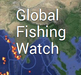
Global Fishing Watch and Forest Watch
Planet Citizens, Use the Earth Science Data to Join In & Get with the Action
○
Global Forest Watch launches - 2014
Google Outreach continues its impact
World Resources Institute Forest Watch
Monitoring the Planet's Forests
Thank you Rebecca, #PlanetCitizen
····································································
Upping the Game with Planet API
February 2017 / News re: Google & Planet
December 2014 / News re: Google Earth's API
Google promises expansion of Google Earth to other 3D mapping products after Dec 2015. As to what, and when, we'll wait and see...

Visit Virtual Earth for More on Mapping Earth
Earth Mapping Developments & Updates
····································································
More APIs for the Planet & Connected Planet Citizens
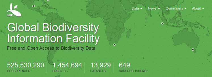
Global Biodiversity Information, free and open access to biodiversity data - Global Biodiversity / Terms
○ ○ ○ ○
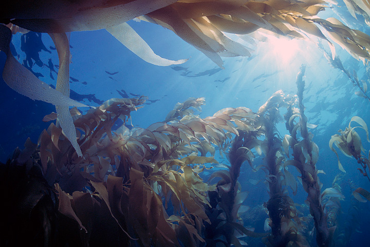

- Floating Forests
Help with the Kelp, Join in -- be a Be a Planet Citizen, Planet Scientist -- http://www.floatingforests.org/
Floating Forests - Earth Observatory/NASA-Landsat
Origin of Floating Forests Project
Planet Citizen, Planet Scientist
Kyle Cavanaugh had an idea. “These forests change so rapidly and on a variety of different time scales—months to years to decades—so we needed a long record with consistent, repeated observations,” Cavanaugh said. He devised a method to use Landsat satellite data to monitor kelp forests.
A few things made Landsat an obvious resource. Since the 1970s, the satellites have had a regular collection schedule (twice monthly). Their data and images are managed by the U.S. Geological Survey and are reliably stored in an archive that dates back more than forty years. And Landsat’s images are calibrated, or standardized, across different generations of satellites, making it possible to compare data collected across several decades...
Landsat measures the energy reflected and emitted from Earth at many different wavelengths. By knowing how features on Earth reflect or absorb energy at certain wavelengths, scientists can map and measure changes to the surface. The most important feature for the kelp researchers is Landsat’s near-infrared band, which measures wavelengths of light that are just outside our visual range. Healthy vegetation strongly reflects near-infrared energy, so this band is often used in plant studies. Also, water absorbs a lot of near-infrared energy and reflects little, making the band particularly good for mapping boundaries between land and water.
“The near-infrared is key for identifying kelp from surrounding water,” Cavanaugh explained. “Like other types of photosynthesizing vegetation, giant kelp have high reflectance in the near infrared. This makes the kelp canopy really stand out from the surrounding water.”
○
After a recent meeting on kelp forests and climate change, researchers Byrnes, Cavanaugh, and other colleagues set out to consolidate all of the available kelp forest data from around the world. They wanted to take a step toward understanding how climate change is affecting kelp globally, but they quickly discovered they had a sparse patchwork of information.
Byrnes was struck with a thought. They had used Landsat to expand their studies across time, so why not use Landsat to expand their studies around the world? Could Landsat be used to establish global trends in kelp forest extent? The answer was yes, but the problem was eyeballs.
Unlike research on terrestrial vegetation — which uses Landsat data and powerful computer processing arrays to make worldwide calculations — distinguishing kelp forests requires manual interpretation. While kelp forests pop out to the human eye in near-infrared imagery, computers looking at the data numerically can confuse kelp patches with land vegetation. Programs and coded logic that separate aquatic vegetation from land vegetation can be confounded by things like clouds, sunglint, and sea foam...
"Automated classification methods just don’t produce acceptable levels of accuracy..."
Byrnes and Cavanaugh put together a science team and joined with Zooniverse, a group that connects professional scientists with citizen scientists in order to help analyze large amounts of data. The result was the Floating Forests project.
The Floating Forest concept is all about getting more eyeballs on Landsat imagery. Citizen scientists—recruited via the Internet—are instructed in how to hunt for giant kelp in satellite imagery. They are then given Landsat images and asked to outline any giant kelp patches that they find. Their findings are crosschecked with those from other citizen scientists and then passed to the science team for verification. The size and location of these forests are catalogued and used to study global kelp trends.
Join Up Planet Citizens, Get with the Action
○ ○ ○ ○ ○ ○ ○ ○
- Citizen Science
🌎
NASA Builds Your Own Private Satellite -- With Google Android (2012)
What would you do with your own private satellite? If you haven't decided, you should. PhoneSat -- a project overseen by NASA's Ames Research Center in Silicon Valley -- wants to lower the cost of building space satellites to the point where anyone with space ambitions could launch one. Yes, it's a satellite made from a phone. The not-so-secret ingredient is Google's Android mobile operating system.
NASA Democratizing Space Research With Android
PlanetLabs Launches ...
Planet Labs PBC is an American public Earth imaging company based in San Francisco, California. Their goal is to image the entirety of the Earth daily to monitor changes and pinpoint trends. The company designs and manufactures Triple-CubeSat miniature satellites called Doves that are then delivered into orbit as secondary payloads on other rocket launch missions. -- Via Wikipedia
In 2013, a first generation of Planet Labs 'Dove' micro-satellites were launched into space to remotely image and provide Earth Science data available to all Planet Citizens...
Planet Labs filed its founding paperwork and officially launched in 2010, before becoming operationally recognized widely with its first products in 2012.
History is being created, new chapters in visionary Earth Science that started with the original NASA mission statement words: “To understand and protect our home planet..."
Eco-visioning, eco-science, eco-data and -navigating, #PlanetCitizens @work
A tip of our green hat to those who pushed forward the first generation of Earth Science from space, as they could see the possibilities and need for environmental protection and the knowledge we needed to have in order to manage our home planet as planet citizens.
Steven Schmidt / GreenPolicy360 Siterunner In memory of George E Brown..."My friend, mentor, and colleague", a man who led big science and put in place a foundation of environmental activism in Congress over three decades.
As a high school student, I met George Brown in the mid-1960s and we began to work, purposefully and closely, to make environmental protection a political reality. He changed the direction of my life and was integral to the founding of Earth Day in 1971 as he helped to set in motion my lifetime of environmental activism. George was looking forward to the 21st century, and especially to the challenges of environmental and earth science programs that he led in Congress for decades, until suddenly he passed away in 1999. George was an amazing man, a visionary who was a mover in the U.S. Congress for four decades, beginning in the 1960s when we began our friendship and work together on a political journey. Let me dedicate this GreenPolicy360 page to George E. Brown as both a biography and memorial. George will always be an influencer for me and his work and legacy is key to understanding my generation...
I can see back to the beginning of an Earth Observation "Inventory". I remember meeting, then years of learning, sharing and work alongside a congressman who set in motion and for decades shepherded U.S. earth science research programs. George E. Brown was a special person who brought a physics and engineering background to Congress. George saw what others didn't really understand and when he showed me the original Mission Statement of NASA, I began to understand.
🌎
Planet API | #PlanetAPI | Planet Citizen | #PlanetCitizen
GreenPolicy360 | #Earth360 | #EarthImaging | #EarthMonitoring
GP360 | #EarthObservations | #EarthScience | #NewSpace
www.planetcitizen.org | www.earthpov.com
🌎
- Your Mission if You Choose to Go
Democratising access to information about Planet Earth... Planet Labs brings home the data
Be one of the first ever on our voyage over time to show you're an Earth-wise #PlanetCitizen
🌎
Earth Sciences / EcoExploring / EcoMapping

- Country
- Maps
- About Us
- Additional Website Resources - Linked Data - Green Best Practices
- Agriculture
- Air Quality
- Air Pollution
- Aquifers
- Anthropocene
- Atmospheric Science
- Biodiversity
- Bioneers
- Citizen Science
- Clean Air
- Climate Change
- Climate Policy
- Democratization of Space
- Desertification
- Digital Citizen
- Earth
- Earth360
- EarthPOV
- Earth Imaging
- Earth Observations
- Earth Law
- Earth Science
- Earth Science from Space
- Earth System Science
- Ecology Studies
- Eco-nomics
- Education
- Environmental Full-cost Accounting
- Environmental Protection
- Environmental Security
- Environmental Security, National Security
- EOS eco Operating System
- ESA
- Externalities
- Fisheries
- Forest
- Forests
- Global Warming
- Green Best Practices
- GreenPolicy360
- Green Networking
- Green Politics
- Health
- Internet
- Land Ethic
- Media
- NASA
- Natural Resources
- Networking
- New Definitions of National Security
- New Space
- NOAA
- Oceans
- Online Education
- Peace
- Permaculture
- Planet API
- Planet Citizens
- Planet Scientist
- Planet Citizens, Planet Scientists
- PlanetLabs
- Planetary Science
- Pollution
- Population
- Rainforest
- Resilience
- Strategic Demands
- Sustainability
- Sustainability Policies
- ThinBlueLayer
- Virtual Earth
- Virtual Planet
- Water
- Whole Earth
- World Wide Web
- Youth
- Biogeosciences
- Cryosphere
- Geology
- Geophysics
- Geophysics and Geochemistry
- Hydrology
- Mineralogy
- Ocean Science
- Space Science and Space Physics